Roßleben elevation
Roßleben (Thuringia), Germany elevation is 131 meters and Roßleben elevation in feet is 430 ft above sea level [src 1]. Roßleben is a populated place (feature code) with elevation that is 127 meters (417 ft) smaller than average city elevation in Germany.
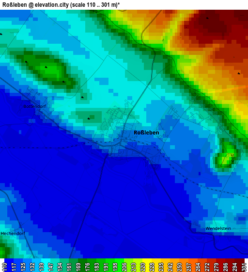
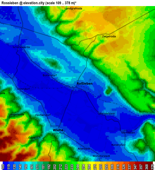
Below is the Elevation map of Roßleben, which displays elevation range with different colors. Scale of the first map is from 110 to 301 m (361 to 988 ft) with average elevation of 148.4 meters (=487 ft) [note 1]
These maps also provides idea of topography and contour of this city, they are displayed at different zoom levels. More info about maps, scale and edge coordinates you can find below images.
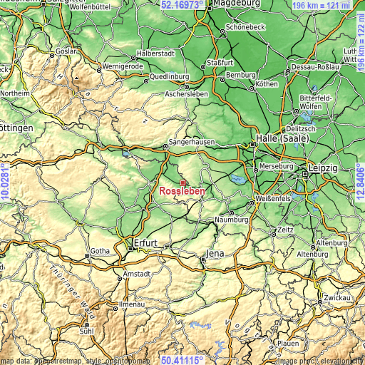
| \ | Map #1 | Map #2 | Topo.Map |
| Scale [m] | 110..301 m | 109..378 m | × |
| Scale [ft] | 361..988 ft | 358..1240 ft | × |
| Average | 148.4 m = 487 ft | 187.1 m = 614 ft | × |
| Width | 6.11 km = 3.8 mi | 12.22 km = 7.6 mi | 195.5 km = 121.5 mi |
| Height | 6.11 km = 3.8 mi | 12.22 km = 7.6 mi | 195.5 km = 121.5 mi |
| ↑Max Latitude | 51.326329° | 51.353781° | 52.16973° |
| Latitude at center | 51.29886° | 51.29886° | 51.29886° |
| ↓Min Latitude | 51.271375° | 51.243873° | 50.41115° |
| ← Min Longitude | 11.390405° | 11.346459° | 10.0281° |
| Longitude center | 11.43435° | 11.43435° | 11.43435° |
| →Max Longitude | 11.478295° | 11.522241° | 12.8406° |
Nearby cities:
Cities around Roßleben sort by population:
• Querfurt elevation 167 m
14.7 km,  51°
51°
• Artern 127 m
12.3 km,  306°
306°
• Allstedt 135 m
12.1 km,  344°
344°
• Rastenberg 200 m
13.8 km,  184°
184°
• Nebra 142 m
10 km,  96°
96°
• Heldrungen 129 m
15 km,  271°
271°
• Wiehe 139 m
4 km,  202°
202°
• Bad Bibra 154 m
14.6 km,  133°
133°
• Karsdorf 122 m
15.8 km, 101°
• Barnstädt 205 m
15 km,  70°
70°
• Voigtstedt 128 m
13.5 km,  319°
319°
• Großmonra 186 m
13.6 km,  225°
225°
Multilingual:
 En español:
Roßleben elevación 131 m.
 En France:
Roßleben élévation 131 m.
 Auf Deutsch:
Roßleben höhe über dem Meeresspiegel ist 131 m.

Sources and notes:
- [note 1] Map square and city borders are not equal. Map elevation data is calculated only from area inside that square.
- [src 1] Elevation data from geonames database provided with same terms of usage.
- [src 2] The elevation map of Roßleben is generated using elevation data from NASA's 3 arcsec (90m) resolution SRTM data.
- [src 3] Base (background) map © OpenStreetMap contributors tiles are generated by Geofabrik and OpenTopoMap.
Copyright & License:
This Roßleben Elevation Map is licensed under CC BY-SA. You may reuse any part from this page, if you give a proper credit by linking to this URL:
 More info on terms of use page.