Querfurt elevation
Querfurt (Saxony-Anhalt), Germany elevation is 167 meters and Querfurt elevation in feet is 548 ft above sea level [src 1]. Querfurt is a populated place (feature code) with elevation that is 91 meters (299 ft) smaller than average city elevation in Germany.
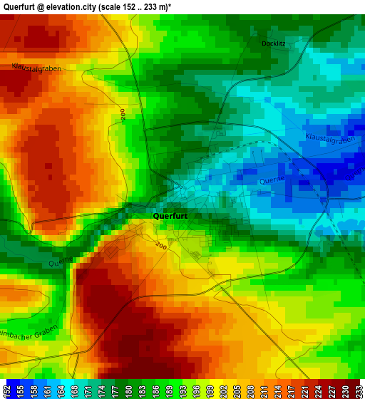
Below is the Elevation map of Querfurt, which displays elevation range with different colors. Scale of the first map is from 152 to 233 m (499 to 764 ft) with average elevation of 193 meters (=633 ft) [note 1]
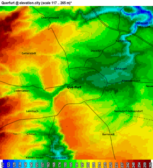
These maps also provides idea of topography and contour of this city, they are displayed at different zoom levels. More info about maps, scale and edge coordinates you can find below images.
| \ | Map #1 | Map #2 | Topo.Map |
| Scale [m] | 152..233 m | 117..265 m | × |
| Scale [ft] | 499..764 ft | 384..869 ft | × |
| Average | 193 m = 633 ft | 197.4 m = 648 ft | × |
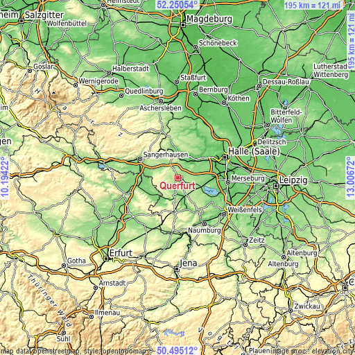
| Width | 6.1 km = 3.8 mi | 12.2 km = 7.6 mi | 195.2 km = 121.3 mi |
| Height | 6.1 km = 3.8 mi | 12.2 km = 7.6 mi | 195.2 km = 121.3 mi |
| ↑Max Latitude | 51.40866° | 51.436063° | 52.25054° |
| Latitude at center | 51.38124° | 51.38124° | 51.38124° |
| ↓Min Latitude | 51.353804° | 51.326351° | 50.49512° |
| ← Min Longitude | 11.556525° | 11.512579° | 10.19422° |
| Longitude center | 11.60047° | 11.60047° | 11.60047° |
| →Max Longitude | 11.644415° | 11.688361° | 13.00672° |
Nearby cities:
Cities around Querfurt sort by population:
• Röblingen am See elevation 94 m
10.4 km,  33°
33°
• Nebra 142 m
10.5 km,  188°
188°
• Schafstädt 147 m
12 km,  89°
89°
• Karsdorf 122 m
12.9 km,  161°
161°
• Obhausen 153 m
3.8 km,  72°
72°
• Langeneichstädt 169 m
10.7 km,  111°
111°
• Schraplau 121 m
7.8 km,  36°
36°
• Farnstädt 185 m
6.2 km,  337°
337°
• Barnstädt 205 m
4.9 km,  148°
148°
• Erdeborn 104 m
10.8 km,  12°
12°
• Stedten 111 m
9.4 km, 42°
• Osterhausen 165 m
10.5 km,  320°
320°
Multilingual:
 En español:
Querfurt elevación 167 m.
 En France:
Querfurt élévation 167 m.
 Auf Deutsch:
Querfurt höhe über dem Meeresspiegel ist 167 m.

Sources and notes:
- [note 1] Map square and city borders are not equal. Map elevation data is calculated only from area inside that square.
- [src 1] Elevation data from geonames database provided with same terms of usage.
- [src 2] The elevation map of Querfurt is generated using elevation data from NASA's 3 arcsec (90m) resolution SRTM data.
- [src 3] Base (background) map © OpenStreetMap contributors tiles are generated by Geofabrik and OpenTopoMap.
Copyright & License:
This Querfurt Elevation Map is licensed under CC BY-SA. You may reuse any part from this page, if you give a proper credit by linking to this URL:
 More info on terms of use page.