Runding elevation
Runding (Bavaria, Upper Palatinate), Germany elevation is 478 meters and Runding elevation in feet is 1568 ft above sea level [src 1]. Runding is a seat of a fourth-order administrative division (feature code) with elevation that is 220 meters (722 ft) bigger than average city elevation in Germany.
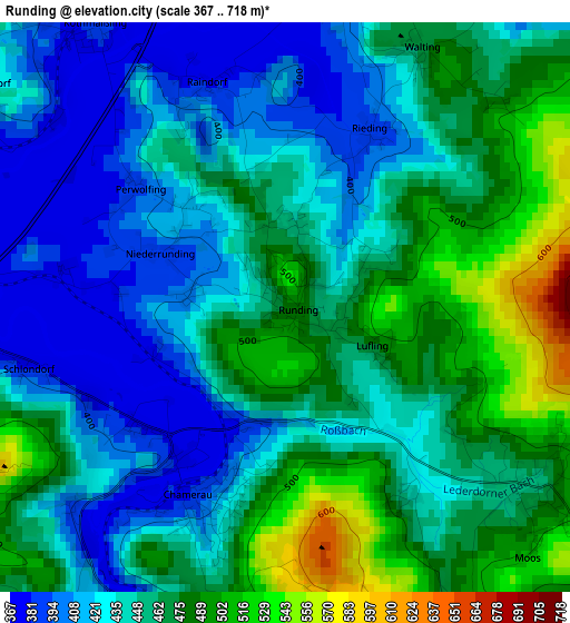
Below is the Elevation map of Runding, which displays elevation range with different colors. Scale of the first map is from 367 to 718 m (1204 to 2356 ft) with average elevation of 450 meters (=1476 ft) [note 1]
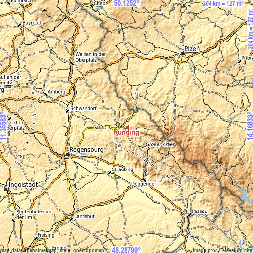
These maps also provides idea of topography and contour of this city, they are displayed at different zoom levels. More info about maps, scale and edge coordinates you can find below images.
| \ | Map #1 | Topo.Map |
| Scale [m] | 367..718 m | × |
| Scale [ft] | 1204..2356 ft | × |
| Average | 450 m = 1476 ft | × |
| Width | 6.38 km = 4 mi | 204.3 km = 126.9 mi |
| Height | 6.38 km = 4 mi | 204.3 km = 126.9 mi |
| ↑Max Latitude | 49.243828° | 50.1252° |
| Latitude at center | 49.21513° | 49.21513° |
| ↓Min Latitude | 49.186416° | 48.28799° |
| ← Min Longitude | 12.718135° | 11.35583° |
| Longitude center | 12.76208° | 12.76208° |
| →Max Longitude | 12.806025° | 14.16833° |
Nearby cities:
Cities around Runding sort by population:
• Cham elevation 396 m
7.9 km,  278°
278°
• Kötzting 424 m
8 km,  122°
122°
• Chamerau 373 m
1.9 km,  207°
207°
• Weiding 380 m
5.3 km,  0°
0°
• Miltach 381 m
5.9 km,  175°
175°
• Willmering 392 m
7.9 km,  299°
299°
• Blaibach 420 m
6.7 km,  143°
143°
• Arnschwang 399 m
7.9 km,  29°
29°
• Rimbach 587 m
9 km,  77°
77°
• Waffenbrunn 421 m
9 km,  309°
309°
• Zandt 456 m
7.5 km,  196°
196°
• Grafenwiesen 443 m
9 km,  100°
100°
Multilingual:
 En español:
Runding elevación 478 m.
 En France:
Runding élévation 478 m.


Sources and notes:
- [note 1] Map square and city borders are not equal. Map elevation data is calculated only from area inside that square.
- [src 1] Elevation data from geonames database provided with same terms of usage.
- [src 2] The elevation map of Runding is generated using elevation data from NASA's 3 arcsec (90m) resolution SRTM data.
- [src 3] Base (background) map © OpenStreetMap contributors tiles are generated by Geofabrik and OpenTopoMap.
Copyright & License:
This Runding Elevation Map is licensed under CC BY-SA. You may reuse any part from this page, if you give a proper credit by linking to this URL:
 More info on terms of use page.