Kötzting elevation
Kötzting (Bavaria, Upper Palatinate), Germany elevation is 424 meters and Kötzting elevation in feet is 1391 ft above sea level [src 1]. Kötzting is a populated place (feature code) with elevation that is 166 meters (545 ft) bigger than average city elevation in Germany.
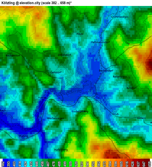
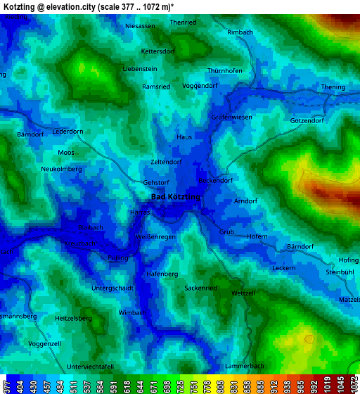
Below is the Elevation map of Kötzting, which displays elevation range with different colors. Scale of the first map is from 382 to 658 m (1253 to 2159 ft) with average elevation of 468 meters (=1535 ft) [note 1]
These maps also provides idea of topography and contour of this city, they are displayed at different zoom levels. More info about maps, scale and edge coordinates you can find below images.
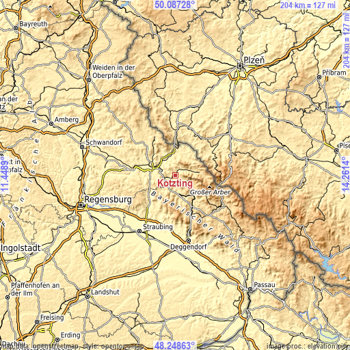
| \ | Map #1 | Map #2 | Topo.Map |
| Scale [m] | 382..658 m | 377..1072 m | × |
| Scale [ft] | 1253..2159 ft | 1237..3517 ft | × |
| Average | 468 m = 1535 ft | 526.1 m = 1726 ft | × |
| Width | 6.39 km = 4 mi | 12.78 km = 7.9 mi | 204.4 km = 127 mi |
| Height | 6.39 km = 4 mi | 12.78 km = 7.9 mi | 204.4 km = 127 mi |
| ↑Max Latitude | 49.20521° | 49.233913° | 50.08728° |
| Latitude at center | 49.17649° | 49.17649° | 49.17649° |
| ↓Min Latitude | 49.147753° | 49.119° | 48.24863° |
| ← Min Longitude | 12.811205° | 12.767259° | 11.4489° |
| Longitude center | 12.85515° | 12.85515° | 12.85515° |
| →Max Longitude | 12.899095° | 12.943041° | 14.2614° |
Nearby cities:
Cities around Kötzting sort by population:
• Viechtach elevation 438 m
11 km,  168°
168°
• Arrach 534 m
10.2 km,  80°
80°
• Prackenbach 498 m
9.3 km,  193°
193°
• Chamerau 373 m
8.1 km,  288°
288°
• Miltach 381 m
6.5 km,  255°
255°
• Runding 478 m
8 km,  302°
302°
• Hohenwarth 532 m
6.3 km,  65°
65°
• Blaibach 420 m
3 km,  248°
248°
• Arnschwang 399 m
11.5 km,  345°
345°
• Rimbach 587 m
6.6 km,  17°
17°
• Zandt 456 m
9.3 km, 251°
• Grafenwiesen 443 m
3.3 km,  38°
38°
Multilingual:
 En español:
Kötzting elevación 424 m.
 En France:
Kötzting élévation 424 m.
 Auf Deutsch:
Kötzting höhe über dem Meeresspiegel ist 424 m.

Sources and notes:
- [note 1] Map square and city borders are not equal. Map elevation data is calculated only from area inside that square.
- [src 1] Elevation data from geonames database provided with same terms of usage.
- [src 2] The elevation map of Kötzting is generated using elevation data from NASA's 3 arcsec (90m) resolution SRTM data.
- [src 3] Base (background) map © OpenStreetMap contributors tiles are generated by Geofabrik and OpenTopoMap.
Copyright & License:
This Kötzting Elevation Map is licensed under CC BY-SA. You may reuse any part from this page, if you give a proper credit by linking to this URL:
 More info on terms of use page.