Scherstetten elevation
Scherstetten (Bavaria, Swabia), Germany elevation is 565 meters and Scherstetten elevation in feet is 1854 ft above sea level [src 1]. Scherstetten is a seat of a fourth-order administrative division (feature code) with elevation that is 307 meters (1007 ft) bigger than average city elevation in Germany.
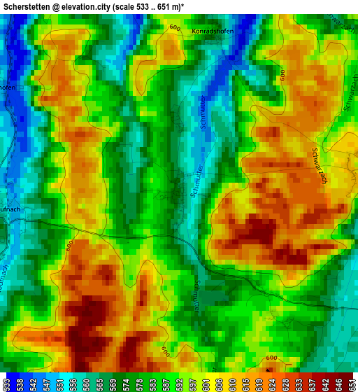
Below is the Elevation map of Scherstetten, which displays elevation range with different colors. Scale of the first map is from 533 to 651 m (1749 to 2136 ft) with average elevation of 590 meters (=1936 ft) [note 1]
These maps also provides idea of topography and contour of this city, they are displayed at different zoom levels. More info about maps, scale and edge coordinates you can find below images.
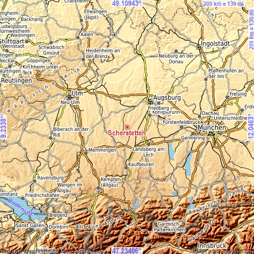
| \ | Map #1 | Topo.Map |
| Scale [m] | 533..651 m | × |
| Scale [ft] | 1749..2136 ft | × |
| Average | 590 m = 1936 ft | × |
| Width | 6.52 km = 4.1 mi | 208.5 km = 129.6 mi |
| Height | 6.52 km = 4.1 mi | 208.5 km = 129.6 mi |
| ↑Max Latitude | 48.209614° | 49.10943° |
| Latitude at center | 48.18032° | 48.18032° |
| ↓Min Latitude | 48.151009° | 47.23406° |
| ← Min Longitude | 10.596105° | 9.2338° |
| Longitude center | 10.64005° | 10.64005° |
| →Max Longitude | 10.683995° | 12.0463° |
Nearby cities:
Cities around Scherstetten sort by population:
• Schwabmünchen elevation 554 m
8.7 km,  90°
90°
• Langerringen 574 m
9.6 km,  113°
113°
• Ettringen 583 m
9 km,  175°
175°
• Markt Wald 636 m
6.5 km,  221°
221°
• Eppishausen 553 m
9.3 km,  260°
260°
• Langenneufnach 540 m
10 km,  342°
342°
• Hiltenfingen 558 m
6.1 km, 110°
• Mickhausen 524 m
6.8 km,  0°
0°
• Aichen 509 m
9.2 km,  305°
305°
• Walkertshofen 531 m
6.4 km,  323°
323°
• Münster 532 m
5.4 km,  357°
357°
• Mittelneufnach 554 m
3.2 km, 262°
Multilingual:
 En español:
Scherstetten elevación 565 m.
 En France:
Scherstetten élévation 565 m.
 Auf Deutsch:
Scherstetten höhe über dem Meeresspiegel ist 565 m.

Sources and notes:
- [note 1] Map square and city borders are not equal. Map elevation data is calculated only from area inside that square.
- [src 1] Elevation data from geonames database provided with same terms of usage.
- [src 2] The elevation map of Scherstetten is generated using elevation data from NASA's 3 arcsec (90m) resolution SRTM data.
- [src 3] Base (background) map © OpenStreetMap contributors tiles are generated by Geofabrik and OpenTopoMap.
Copyright & License:
This Scherstetten Elevation Map is licensed under CC BY-SA. You may reuse any part from this page, if you give a proper credit by linking to this URL:
 More info on terms of use page.