Schwabmünchen elevation
Schwabmünchen (Bavaria, Swabia), Germany elevation is 554 meters and Schwabmünchen elevation in feet is 1818 ft above sea level [src 1]. Schwabmünchen is a populated place (feature code) with elevation that is 296 meters (971 ft) bigger than average city elevation in Germany.
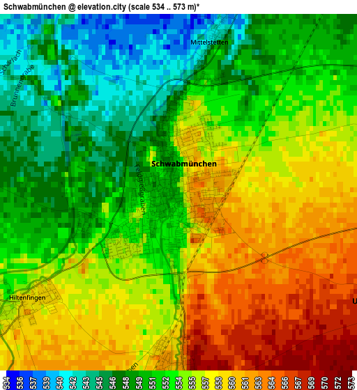
Below is the Elevation map of Schwabmünchen, which displays elevation range with different colors. Scale of the first map is from 534 to 573 m (1752 to 1880 ft) with average elevation of 553.5 meters (=1816 ft) [note 1]
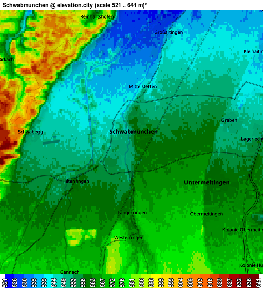
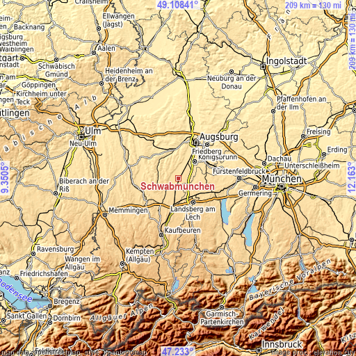
These maps also provides idea of topography and contour of this city, they are displayed at different zoom levels. More info about maps, scale and edge coordinates you can find below images.
| \ | Map #1 | Map #2 | Topo.Map |
| Scale [m] | 534..573 m | 521..641 m | × |
| Scale [ft] | 1752..1880 ft | 1709..2103 ft | × |
| Average | 553.5 m = 1816 ft | 560.9 m = 1840 ft | × |
| Width | 6.52 km = 4.1 mi | 13.03 km = 8.1 mi | 208.5 km = 129.6 mi |
| Height | 6.52 km = 4.1 mi | 13.03 km = 8.1 mi | 208.5 km = 129.6 mi |
| ↑Max Latitude | 48.208574° | 48.237852° | 49.10841° |
| Latitude at center | 48.17928° | 48.17928° | 48.17928° |
| ↓Min Latitude | 48.149969° | 48.120641° | 47.233° |
| ← Min Longitude | 10.712805° | 10.668859° | 9.3505° |
| Longitude center | 10.75675° | 10.75675° | 10.75675° |
| →Max Longitude | 10.800695° | 10.844641° | 12.163° |
Nearby cities:
Cities around Schwabmünchen sort by population:
• Untermeitingen elevation 563 m
4.3 km,  118°
118°
• Großaitingen 529 m
5.6 km,  17°
17°
• Langerringen 574 m
3.7 km,  177°
177°
• Graben 552 m
4.9 km,  79°
79°
• Wehringen 522 m
8.5 km, 22°
• Klosterlechfeld 561 m
6 km, 115°
• Lamerdingen 597 m
9.8 km,  187°
187°
• Obermeitingen 568 m
5.1 km,  134°
134°
• Hurlach 580 m
7.9 km,  149°
149°
• Hiltenfingen 558 m
3.6 km,  234°
234°
• Kleinaitingen 537 m
9.4 km,  62°
62°
• Scherstetten 565 m
8.7 km,  270°
270°
Multilingual:
 En español:
Schwabmünchen elevación 554 m.
 En France:
Schwabmünchen élévation 554 m.
 Auf Deutsch:
Schwabmünchen höhe über dem Meeresspiegel ist 554 m.

Sources and notes:
- [note 1] Map square and city borders are not equal. Map elevation data is calculated only from area inside that square.
- [src 1] Elevation data from geonames database provided with same terms of usage.
- [src 2] The elevation map of Schwabmünchen is generated using elevation data from NASA's 3 arcsec (90m) resolution SRTM data.
- [src 3] Base (background) map © OpenStreetMap contributors tiles are generated by Geofabrik and OpenTopoMap.
Copyright & License:
This Schwabmünchen Elevation Map is licensed under CC BY-SA. You may reuse any part from this page, if you give a proper credit by linking to this URL:
 More info on terms of use page.