Mickhausen elevation
Mickhausen (Bavaria, Swabia), Germany elevation is 524 meters and Mickhausen elevation in feet is 1719 ft above sea level [src 1]. Mickhausen is a seat of a fourth-order administrative division (feature code) with elevation that is 266 meters (873 ft) bigger than average city elevation in Germany.
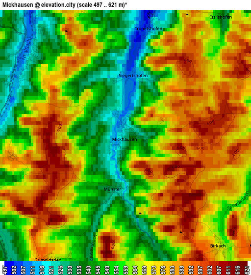
Below is the Elevation map of Mickhausen, which displays elevation range with different colors. Scale of the first map is from 497 to 621 m (1631 to 2037 ft) with average elevation of 564.7 meters (=1853 ft) [note 1]
These maps also provides idea of topography and contour of this city, they are displayed at different zoom levels. More info about maps, scale and edge coordinates you can find below images.
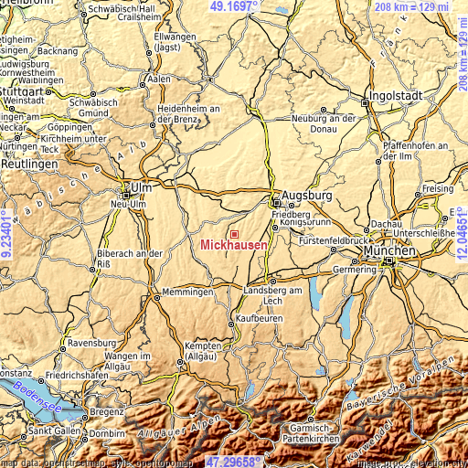
| \ | Map #1 | Topo.Map |
| Scale [m] | 497..621 m | × |
| Scale [ft] | 1631..2037 ft | × |
| Average | 564.7 m = 1853 ft | × |
| Width | 6.51 km = 4 mi | 208.3 km = 129.4 mi |
| Height | 6.51 km = 4 mi | 208.3 km = 129.4 mi |
| ↑Max Latitude | 48.270969° | 49.1697° |
| Latitude at center | 48.24171° | 48.24171° |
| ↓Min Latitude | 48.212435° | 47.29658° |
| ← Min Longitude | 10.596315° | 9.23401° |
| Longitude center | 10.64026° | 10.64026° |
| →Max Longitude | 10.684205° | 12.04651° |
Nearby cities:
Cities around Mickhausen sort by population:
• Großaitingen elevation 529 m
10.4 km,  98°
98°
• Fischach 497 m
5.5 km,  12°
12°
• Ziemetshausen 482 m
9.6 km,  305°
305°
• Langenneufnach 540 m
4.1 km, 312°
• Hiltenfingen 558 m
10.7 km,  147°
147°
• Balzhausen 521 m
10.9 km,  270°
270°
• Ustersbach 487 m
8.4 km,  4°
4°
• Aichen 509 m
7.6 km,  259°
259°
• Walkertshofen 531 m
4.2 km,  245°
245°
• Münster 532 m
1.4 km,  191°
191°
• Mittelneufnach 554 m
7.9 km,  203°
203°
• Scherstetten 565 m
6.8 km,  180°
180°
Multilingual:
 En español:
Mickhausen elevación 524 m.
 En France:
Mickhausen élévation 524 m.
 Auf Deutsch:
Mickhausen höhe über dem Meeresspiegel ist 524 m.

Sources and notes:
- [note 1] Map square and city borders are not equal. Map elevation data is calculated only from area inside that square.
- [src 1] Elevation data from geonames database provided with same terms of usage.
- [src 2] The elevation map of Mickhausen is generated using elevation data from NASA's 3 arcsec (90m) resolution SRTM data.
- [src 3] Base (background) map © OpenStreetMap contributors tiles are generated by Geofabrik and OpenTopoMap.
Copyright & License:
This Mickhausen Elevation Map is licensed under CC BY-SA. You may reuse any part from this page, if you give a proper credit by linking to this URL:
 More info on terms of use page.