Schrobenhausen elevation
Schrobenhausen (Bavaria, Upper Bavaria), Germany elevation is 414 meters and Schrobenhausen elevation in feet is 1358 ft above sea level [src 1]. Schrobenhausen is a populated place (feature code) with elevation that is 156 meters (512 ft) bigger than average city elevation in Germany.
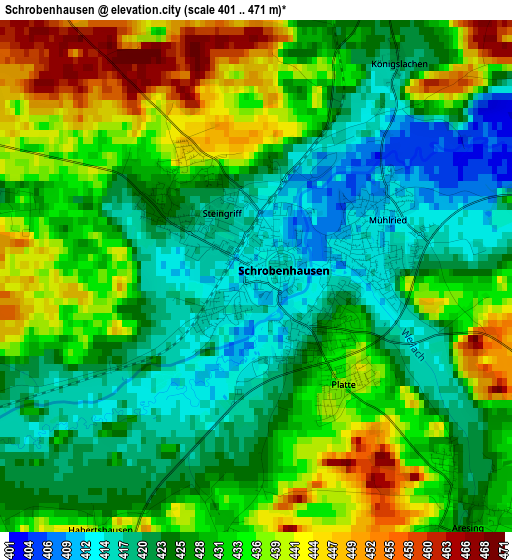
Below is the Elevation map of Schrobenhausen, which displays elevation range with different colors. Scale of the first map is from 401 to 471 m (1316 to 1545 ft) with average elevation of 429.2 meters (=1408 ft) [note 1]
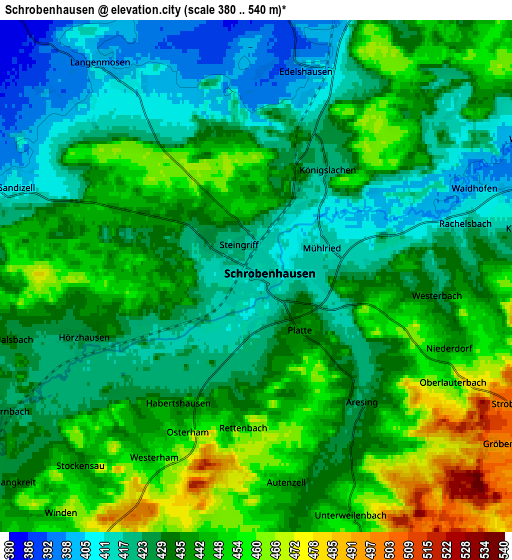
These maps also provides idea of topography and contour of this city, they are displayed at different zoom levels. More info about maps, scale and edge coordinates you can find below images.
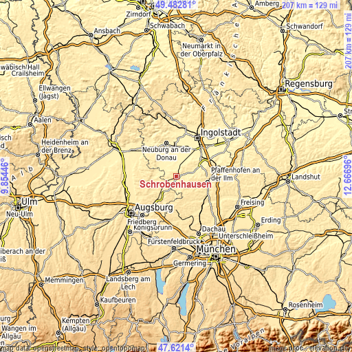
| \ | Map #1 | Map #2 | Topo.Map |
| Scale [m] | 401..471 m | 380..540 m | × |
| Scale [ft] | 1316..1545 ft | 1247..1772 ft | × |
| Average | 429.2 m = 1408 ft | 435.2 m = 1428 ft | × |
| Width | 6.47 km = 4 mi | 12.94 km = 8 mi | 207 km = 128.6 mi |
| Height | 6.47 km = 4 mi | 12.94 km = 8 mi | 207 km = 128.6 mi |
| ↑Max Latitude | 48.589746° | 48.618805° | 49.48281° |
| Latitude at center | 48.56067° | 48.56067° | 48.56067° |
| ↓Min Latitude | 48.531577° | 48.502468° | 47.6214° |
| ← Min Longitude | 11.216765° | 11.172819° | 9.85446° |
| Longitude center | 11.26071° | 11.26071° | 11.26071° |
| →Max Longitude | 11.304655° | 11.348601° | 12.66696° |
Nearby cities:
Cities around Schrobenhausen sort by population:
• Pöttmes elevation 408 m
13 km,  281°
281°
• Karlshuld 377 m
13.6 km,  7°
7°
• Kühbach 457 m
9.5 km,  215°
215°
• Ehekirchen 417 m
14.3 km,  304°
304°
• Gerolsbach 462 m
10.6 km,  135°
135°
• Ried 450 m
9.3 km,  180°
180°
• Inchenhofen 461 m
12 km,  243°
243°
• Gachenbach 458 m
7 km,  196°
196°
• Waidhofen 407 m
5.8 km,  71°
71°
• Schiltberg 454 m
10.9 km, 184°
• Langenmosen 403 m
6.2 km,  325°
325°
• Berg im Gau 394 m
8.1 km,  354°
354°
Multilingual:
 En español:
Schrobenhausen elevación 414 m.
 En France:
Schrobenhausen élévation 414 m.
 Auf Deutsch:
Schrobenhausen höhe über dem Meeresspiegel ist 414 m.

Sources and notes:
- [note 1] Map square and city borders are not equal. Map elevation data is calculated only from area inside that square.
- [src 1] Elevation data from geonames database provided with same terms of usage.
- [src 2] The elevation map of Schrobenhausen is generated using elevation data from NASA's 3 arcsec (90m) resolution SRTM data.
- [src 3] Base (background) map © OpenStreetMap contributors tiles are generated by Geofabrik and OpenTopoMap.
Copyright & License:
This Schrobenhausen Elevation Map is licensed under CC BY-SA. You may reuse any part from this page, if you give a proper credit by linking to this URL:
 More info on terms of use page.