Kühbach elevation
Kühbach (Bavaria, Swabia), Germany elevation is 457 meters and Kühbach elevation in feet is 1499 ft above sea level [src 1]. Kühbach is a populated place (feature code) with elevation that is 199 meters (653 ft) bigger than average city elevation in Germany.
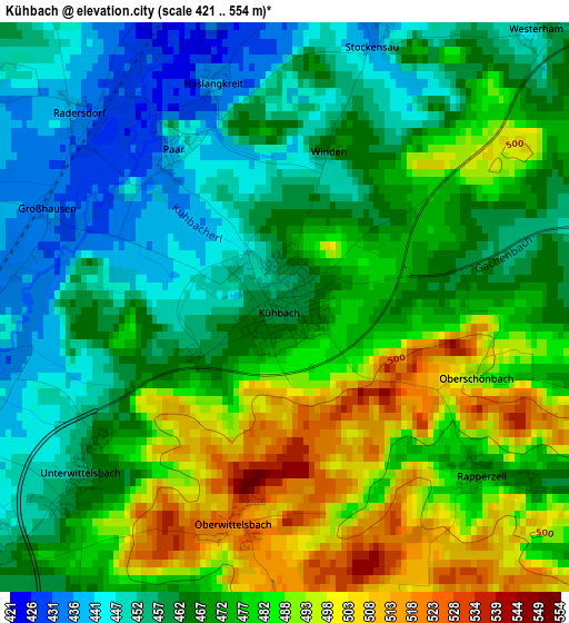
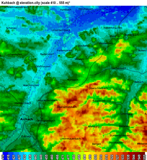
Below is the Elevation map of Kühbach, which displays elevation range with different colors. Scale of the first map is from 421 to 554 m (1381 to 1818 ft) with average elevation of 471 meters (=1545 ft) [note 1]
These maps also provides idea of topography and contour of this city, they are displayed at different zoom levels. More info about maps, scale and edge coordinates you can find below images.
| \ | Map #1 | Map #2 | Topo.Map |
| Scale [m] | 421..554 m | 410..555 m | × |
| Scale [ft] | 1381..1818 ft | 1345..1821 ft | × |
| Average | 471 m = 1545 ft | 462.9 m = 1519 ft | × |
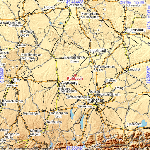
| Width | 6.48 km = 4 mi | 12.95 km = 8 mi | 207.3 km = 128.8 mi |
| Height | 6.48 km = 4 mi | 12.95 km = 8 mi | 207.2 km = 128.7 mi |
| ↑Max Latitude | 48.520126° | 48.549225° | 49.41443° |
| Latitude at center | 48.49101° | 48.49101° | 48.49101° |
| ↓Min Latitude | 48.461877° | 48.432728° | 47.55046° |
| ← Min Longitude | 11.142965° | 11.099019° | 9.78066° |
| Longitude center | 11.18691° | 11.18691° | 11.18691° |
| →Max Longitude | 11.230855° | 11.274801° | 12.59316° |
Nearby cities:
Cities around Kühbach sort by population:
• Aichach elevation 453 m
5.4 km,  226°
226°
• Schrobenhausen 414 m
9.5 km,  35°
35°
• Altomünster 510 m
12.6 km,  155°
155°
• Ried 450 m
5.7 km,  106°
106°
• Inchenhofen 461 m
5.9 km,  294°
294°
• Hollenbach 454 m
8.9 km,  264°
264°
• Gachenbach 458 m
3.6 km,  73°
73°
• Obergriesbach 481 m
11.5 km, 229°
• Schiltberg 454 m
5.5 km,  124°
124°
• Petersdorf 485 m
11.7 km,  284°
284°
• Pfaffenhofen 534 m
10.9 km,  172°
172°
• Sielenbach 474 m
10.2 km,  188°
188°
Multilingual:
 En español:
Kühbach elevación 457 m.
 En France:
Kühbach élévation 457 m.


Sources and notes:
- [note 1] Map square and city borders are not equal. Map elevation data is calculated only from area inside that square.
- [src 1] Elevation data from geonames database provided with same terms of usage.
- [src 2] The elevation map of Kühbach is generated using elevation data from NASA's 3 arcsec (90m) resolution SRTM data.
- [src 3] Base (background) map © OpenStreetMap contributors tiles are generated by Geofabrik and OpenTopoMap.
Copyright & License:
This Kühbach Elevation Map is licensed under CC BY-SA. You may reuse any part from this page, if you give a proper credit by linking to this URL:
 More info on terms of use page.