Sinn elevation
Sinn (Hesse, Regierungsbezirk Gießen), Germany elevation is 213 meters and Sinn elevation in feet is 699 ft above sea level [src 1]. Sinn is a seat of a fourth-order administrative division (feature code) with elevation that is 45 meters (148 ft) smaller than average city elevation in Germany.
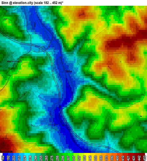
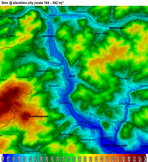
Below is the Elevation map of Sinn, which displays elevation range with different colors. Scale of the first map is from 182 to 452 m (597 to 1483 ft) with average elevation of 288.9 meters (=948 ft) [note 1]
These maps also provides idea of topography and contour of this city, they are displayed at different zoom levels. More info about maps, scale and edge coordinates you can find below images.
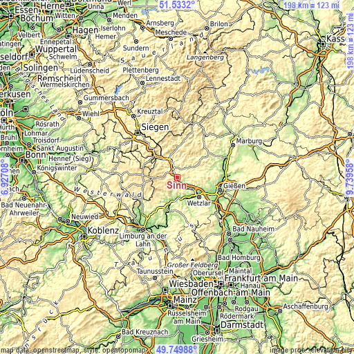
| \ | Map #1 | Map #2 | Topo.Map |
| Scale [m] | 182..452 m | 164..542 m | × |
| Scale [ft] | 597..1483 ft | 538..1778 ft | × |
| Average | 288.9 m = 948 ft | 305.8 m = 1003 ft | × |
| Width | 6.2 km = 3.9 mi | 12.39 km = 7.7 mi | 198.3 km = 123.2 mi |
| Height | 6.2 km = 3.9 mi | 12.39 km = 7.7 mi | 198.3 km = 123.2 mi |
| ↑Max Latitude | 50.677856° | 50.705695° | 51.5332° |
| Latitude at center | 50.65° | 50.65° | 50.65° |
| ↓Min Latitude | 50.622128° | 50.594239° | 49.74988° |
| ← Min Longitude | 8.289385° | 8.245439° | 6.92708° |
| Longitude center | 8.33333° | 8.33333° | 8.33333° |
| →Max Longitude | 8.377275° | 8.421221° | 9.73958° |
Nearby cities:
Cities around Sinn sort by population:
• Dillenburg elevation 232 m
10.6 km,  342°
342°
• Herborn 205 m
4.1 km,  329°
329°
• Aßlar 166 m
11.2 km,  125°
125°
• Ehringshausen 175 m
6.6 km,  147°
147°
• Greifenstein 351 m
4.4 km,  212°
212°
• Leun 159 m
11.1 km,  170°
170°
• Driedorf 485 m
10.7 km,  260°
260°
• Mittenaar 324 m
6.6 km,  32°
32°
• Breitscheid 454 m
10.7 km,  291°
291°
• Bischoffen 282 m
9.9 km,  55°
55°
• Niederbiel 166 m
11.5 km,  156°
156°
• Merkenbach 252 m
2.8 km,  284°
284°
Multilingual:
 En español:
Sinn elevación 213 m.
 En France:
Sinn élévation 213 m.


Sources and notes:
- [note 1] Map square and city borders are not equal. Map elevation data is calculated only from area inside that square.
- [src 1] Elevation data from geonames database provided with same terms of usage.
- [src 2] The elevation map of Sinn is generated using elevation data from NASA's 3 arcsec (90m) resolution SRTM data.
- [src 3] Base (background) map © OpenStreetMap contributors tiles are generated by Geofabrik and OpenTopoMap.
Copyright & License:
This Sinn Elevation Map is licensed under CC BY-SA. You may reuse any part from this page, if you give a proper credit by linking to this URL:
 More info on terms of use page.