Leun elevation
Leun (Hesse, Regierungsbezirk Gießen), Germany elevation is 159 meters and Leun elevation in feet is 522 ft above sea level [src 1]. Leun is a populated place (feature code) with elevation that is 99 meters (325 ft) smaller than average city elevation in Germany.
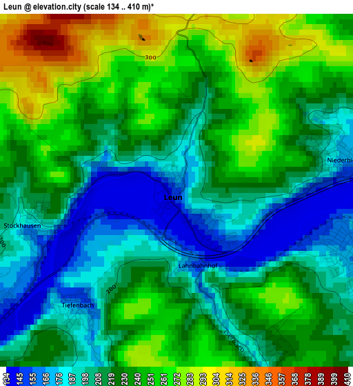
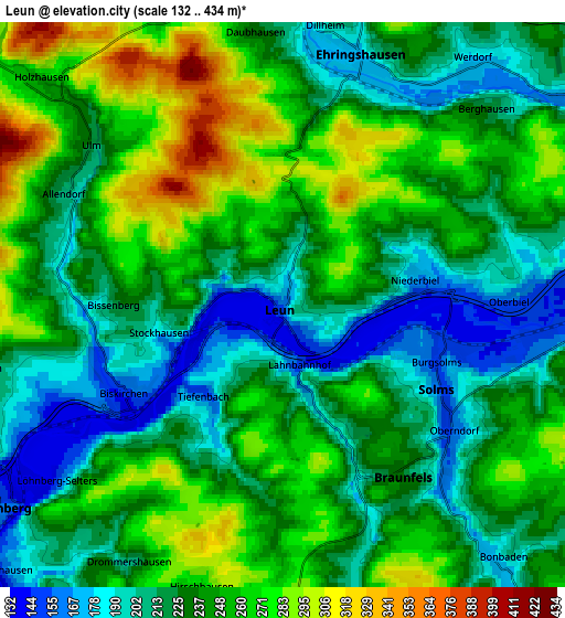
Below is the Elevation map of Leun, which displays elevation range with different colors. Scale of the first map is from 134 to 410 m (440 to 1345 ft) with average elevation of 225.5 meters (=740 ft) [note 1]
These maps also provides idea of topography and contour of this city, they are displayed at different zoom levels. More info about maps, scale and edge coordinates you can find below images.
| \ | Map #1 | Map #2 | Topo.Map |
| Scale [m] | 134..410 m | 132..434 m | × |
| Scale [ft] | 440..1345 ft | 433..1424 ft | × |
| Average | 225.5 m = 740 ft | 236.2 m = 775 ft | × |
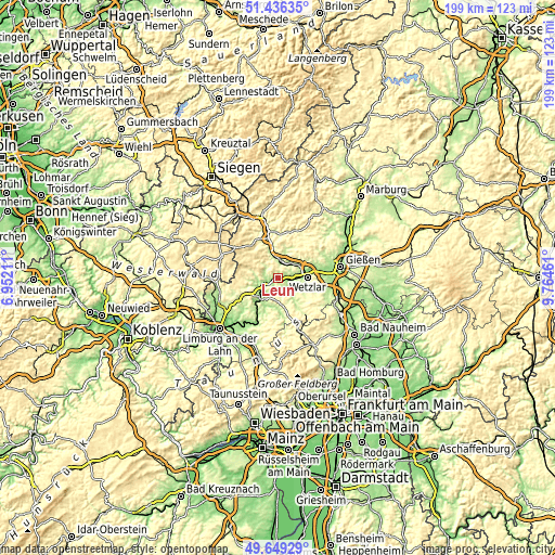
| Width | 6.21 km = 3.9 mi | 12.42 km = 7.7 mi | 198.7 km = 123.5 mi |
| Height | 6.21 km = 3.9 mi | 12.42 km = 7.7 mi | 198.7 km = 123.5 mi |
| ↑Max Latitude | 50.579204° | 50.607102° | 51.43635° |
| Latitude at center | 50.55129° | 50.55129° | 50.55129° |
| ↓Min Latitude | 50.523359° | 50.495412° | 49.64929° |
| ← Min Longitude | 8.314415° | 8.270469° | 6.95211° |
| Longitude center | 8.35836° | 8.35836° | 8.35836° |
| →Max Longitude | 8.402305° | 8.446251° | 9.76461° |
Nearby cities:
Cities around Leun sort by population:
• Aßlar elevation 166 m
8.6 km,  58°
58°
• Solms 156 m
3.8 km,  116°
116°
• Braunfels 235 m
4.5 km,  151°
151°
• Ehringshausen 175 m
5.7 km,  18°
18°
• Selters 157 m
6.2 km,  231°
231°
• Greifenstein 351 m
8.4 km,  330°
330°
• Burgsolms 156 m
3.4 km,  107°
107°
• Löhnberg 147 m
7.4 km,  235°
235°
• Oberbiel 161 m
4.9 km,  87°
87°
• Niederbiel 166 m
2.9 km,  81°
81°
• Albshausen 155 m
5.7 km,  97°
97°
• Laufdorf 237 m
8.2 km, 118°
Multilingual:
 En español:
Leun elevación 159 m.
 En France:
Leun élévation 159 m.


Sources and notes:
- [note 1] Map square and city borders are not equal. Map elevation data is calculated only from area inside that square.
- [src 1] Elevation data from geonames database provided with same terms of usage.
- [src 2] The elevation map of Leun is generated using elevation data from NASA's 3 arcsec (90m) resolution SRTM data.
- [src 3] Base (background) map © OpenStreetMap contributors tiles are generated by Geofabrik and OpenTopoMap.
Copyright & License:
This Leun Elevation Map is licensed under CC BY-SA. You may reuse any part from this page, if you give a proper credit by linking to this URL:
 More info on terms of use page.