Sontheim an der Brenz elevation
Sontheim an der Brenz (Baden-Württemberg, Regierungsbezirk Stuttgart), Germany elevation is 443 meters and Sontheim an der Brenz elevation in feet is 1453 ft above sea level [src 1]. Sontheim an der Brenz is a seat of a fourth-order administrative division (feature code) with elevation that is 185 meters (607 ft) bigger than average city elevation in Germany.
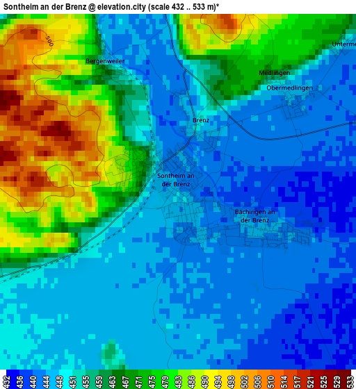
Below is the Elevation map of Sontheim an der Brenz, which displays elevation range with different colors. Scale of the first map is from 432 to 533 m (1417 to 1749 ft) with average elevation of 457.5 meters (=1501 ft) [note 1]
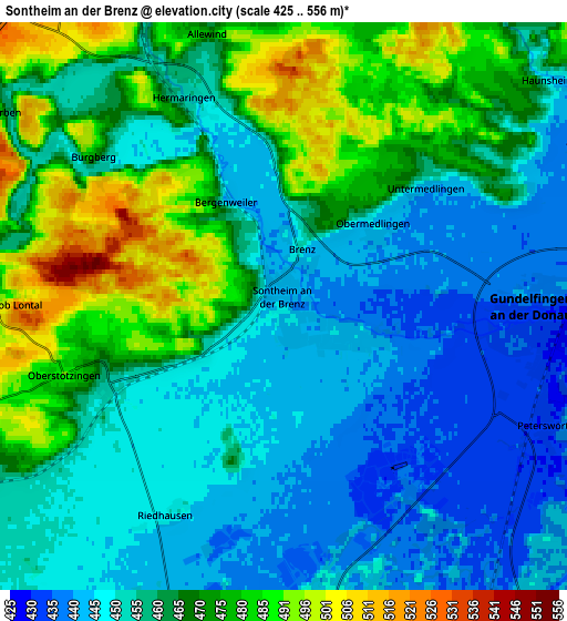
These maps also provides idea of topography and contour of this city, they are displayed at different zoom levels. More info about maps, scale and edge coordinates you can find below images.
| \ | Map #1 | Map #2 | Topo.Map |
| Scale [m] | 432..533 m | 425..556 m | × |
| Scale [ft] | 1417..1749 ft | 1394..1824 ft | × |
| Average | 457.5 m = 1501 ft | 461.3 m = 1513 ft | × |
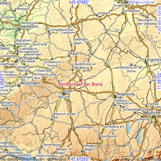
| Width | 6.47 km = 4 mi | 12.94 km = 8 mi | 207 km = 128.6 mi |
| Height | 6.47 km = 4 mi | 12.94 km = 8 mi | 207 km = 128.6 mi |
| ↑Max Latitude | 48.581431° | 48.610494° | 49.47465° |
| Latitude at center | 48.55235° | 48.55235° | 48.55235° |
| ↓Min Latitude | 48.523253° | 48.494139° | 47.61293° |
| ← Min Longitude | 10.247025° | 10.203079° | 8.88472° |
| Longitude center | 10.29097° | 10.29097° | 10.29097° |
| →Max Longitude | 10.334915° | 10.378861° | 11.69722° |
Nearby cities:
Cities around Sontheim an der Brenz sort by population:
• Giengen an der Brenz elevation 473 m
8.5 km,  335°
335°
• Gundelfingen 439 m
6 km,  88°
88°
• Niederstotzingen 466 m
4.3 km,  253°
253°
• Offingen 448 m
9.4 km,  145°
145°
• Bachhagel 470 m
9.1 km,  13°
13°
• Hermaringen 452 m
5.3 km, 335°
• Haunsheim 448 m
8.1 km,  49°
49°
• Gundremmingen 435 m
9.9 km,  125°
125°
• Bächingen an der Brenz 443 m
1.7 km,  112°
112°
• Rammingen 509 m
9.6 km, 246°
• Asselfingen 497 m
7.7 km, 250°
• Medlingen 448 m
2.7 km,  42°
42°
Multilingual:
 En español:
Sontheim an der Brenz elevación 443 m.
 En France:
Sontheim an der Brenz élévation 443 m.
 Auf Deutsch:
Sontheim an der Brenz höhe über dem Meeresspiegel ist 443 m.
 На русском:
Sontheim an der Brenz высота над уровнем моря 443 м
Sources and notes:
- [note 1] Map square and city borders are not equal. Map elevation data is calculated only from area inside that square.
- [src 1] Elevation data from geonames database provided with same terms of usage.
- [src 2] The elevation map of Sontheim an der Brenz is generated using elevation data from NASA's 3 arcsec (90m) resolution SRTM data.
- [src 3] Base (background) map © OpenStreetMap contributors tiles are generated by Geofabrik and OpenTopoMap.
Copyright & License:
This Sontheim an der Brenz Elevation Map is licensed under CC BY-SA. You may reuse any part from this page, if you give a proper credit by linking to this URL:
 More info on terms of use page.