Rammingen elevation
Rammingen (Baden-Württemberg, Tübingen Region), Germany elevation is 509 meters and Rammingen elevation in feet is 1670 ft above sea level [src 1]. Rammingen is a seat of a fourth-order administrative division (feature code) with elevation that is 251 meters (823 ft) bigger than average city elevation in Germany.
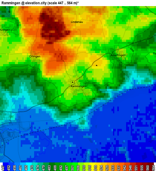
Below is the Elevation map of Rammingen, which displays elevation range with different colors. Scale of the first map is from 447 to 564 m (1467 to 1850 ft) with average elevation of 487.1 meters (=1598 ft) [note 1]
These maps also provides idea of topography and contour of this city, they are displayed at different zoom levels. More info about maps, scale and edge coordinates you can find below images.
| \ | Map #1 | Topo.Map |
| Scale [m] | 447..564 m | × |
| Scale [ft] | 1467..1850 ft | × |
| Average | 487.1 m = 1598 ft | × |
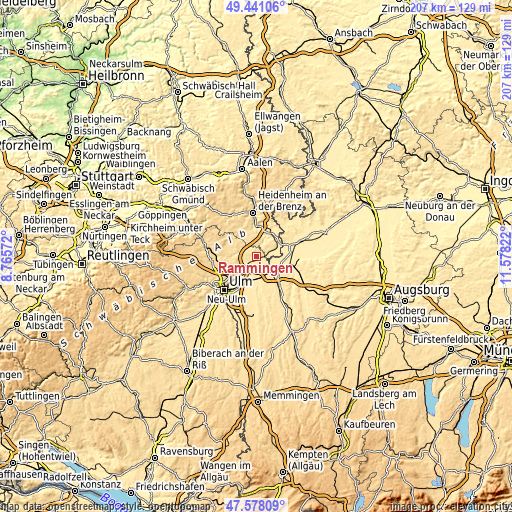
| Width | 6.47 km = 4 mi | 207.1 km = 128.7 mi |
| Height | 6.47 km = 4 mi | 207.1 km = 128.7 mi |
| ↑Max Latitude | 48.54724° | 49.44106° |
| Latitude at center | 48.51814° | 48.51814° |
| ↓Min Latitude | 48.489023° | 47.57809° |
| ← Min Longitude | 10.128025° | 8.76572° |
| Longitude center | 10.17197° | 10.17197° |
| →Max Longitude | 10.215915° | 11.57822° |
Nearby cities:
Cities around Rammingen sort by population:
• Günzburg elevation 470 m
10.4 km,  131°
131°
• Langenau 461 m
4.6 km,  238°
238°
• Nersingen 462 m
10.6 km,  199°
199°
• Leipheim 471 m
8.4 km,  153°
153°
• Sontheim an der Brenz 443 m
9.6 km,  66°
66°
• Niederstotzingen 466 m
5.3 km,  61°
61°
• Wasserburg 454 m
11.2 km,  140°
140°
• Hermaringen 452 m
10.8 km,  37°
37°
• Bernstadt 561 m
11 km,  259°
259°
• Bubesheim 467 m
11 km, 148°
• Bächingen an der Brenz 443 m
10.8 km, 73°
• Asselfingen 497 m
1.9 km,  48°
48°
Multilingual:
 En español:
Rammingen elevación 509 m.
 En France:
Rammingen élévation 509 m.
 Auf Deutsch:
Rammingen höhe über dem Meeresspiegel ist 509 m.

Sources and notes:
- [note 1] Map square and city borders are not equal. Map elevation data is calculated only from area inside that square.
- [src 1] Elevation data from geonames database provided with same terms of usage.
- [src 2] The elevation map of Rammingen is generated using elevation data from NASA's 3 arcsec (90m) resolution SRTM data.
- [src 3] Base (background) map © OpenStreetMap contributors tiles are generated by Geofabrik and OpenTopoMap.
Copyright & License:
This Rammingen Elevation Map is licensed under CC BY-SA. You may reuse any part from this page, if you give a proper credit by linking to this URL:
 More info on terms of use page.