Südlohn elevation
Südlohn (North Rhine-Westphalia, Regierungsbezirk Münster), Germany elevation is 51 meters and Südlohn elevation in feet is 167 ft above sea level [src 1]. Südlohn is a seat of a fourth-order administrative division (feature code) with elevation that is 207 meters (679 ft) smaller than average city elevation in Germany.
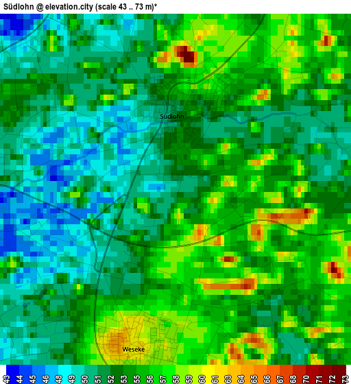
Below is the Elevation map of Südlohn, which displays elevation range with different colors. Scale of the first map is from 43 to 73 m (141 to 240 ft) with average elevation of 53.4 meters (=175 ft) [note 1]
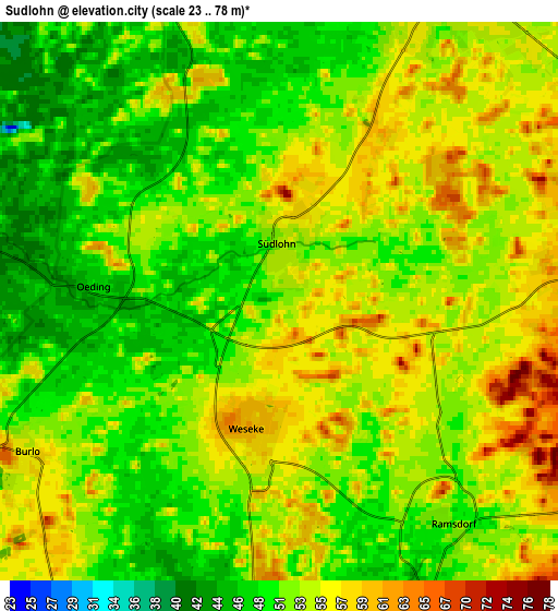
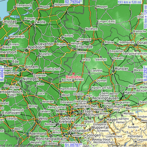
These maps also provides idea of topography and contour of this city, they are displayed at different zoom levels. More info about maps, scale and edge coordinates you can find below images.
| \ | Map #1 | Map #2 | Topo.Map |
| Scale [m] | 43..73 m | 23..78 m | × |
| Scale [ft] | 141..240 ft | 75..256 ft | × |
| Average | 53.4 m = 175 ft | 52.4 m = 172 ft | × |
| Width | 6.03 km = 3.7 mi | 12.05 km = 7.5 mi | 192.8 km = 119.8 mi |
| Height | 6.03 km = 3.7 mi | 12.05 km = 7.5 mi | 192.8 km = 119.8 mi |
| ↑Max Latitude | 51.960418° | 51.987489° | 52.79204° |
| Latitude at center | 51.93333° | 51.93333° | 51.93333° |
| ↓Min Latitude | 51.906226° | 51.879106° | 51.05787° |
| ← Min Longitude | 6.822725° | 6.778779° | 5.46042° |
| Longitude center | 6.86667° | 6.86667° | 6.86667° |
| →Max Longitude | 6.910615° | 6.954561° | 8.27292° |
Nearby cities:
Cities around Südlohn sort by population:
• Bocholt elevation 31 m
20.2 km,  238°
238°
• Borken 48 m
10 km,  183°
183°
• Ahaus 50 m
19.1 km,  31°
31°
• Vreden 41 m
11.9 km,  347°
347°
• Stadtlohn 49 m
7.6 km, 28°
• Rhede 31 m
16 km,  227°
227°
• Gescher 62 m
9.7 km,  76°
76°
• Klein Reken 74 m
20.3 km,  143°
143°
• Velen 60 m
9.4 km,  117°
117°
• Raesfeld 62 m
18.6 km, 183°
• Heiden 70 m
12 km,  157°
157°
• Legden 70 m
19.5 km,  55°
55°
Multilingual:
 En español:
Südlohn elevación 51 m.
 En France:
Südlohn élévation 51 m.


Sources and notes:
- [note 1] Map square and city borders are not equal. Map elevation data is calculated only from area inside that square.
- [src 1] Elevation data from geonames database provided with same terms of usage.
- [src 2] The elevation map of Südlohn is generated using elevation data from NASA's 3 arcsec (90m) resolution SRTM data.
- [src 3] Base (background) map © OpenStreetMap contributors tiles are generated by Geofabrik and OpenTopoMap.
Copyright & License:
This Südlohn Elevation Map is licensed under CC BY-SA. You may reuse any part from this page, if you give a proper credit by linking to this URL:
 More info on terms of use page.