Telgte elevation
Telgte (North Rhine-Westphalia, Regierungsbezirk Münster), Germany elevation is 55 meters and Telgte elevation in feet is 180 ft above sea level [src 1]. Telgte is a populated place (feature code) with elevation that is 203 meters (666 ft) smaller than average city elevation in Germany.
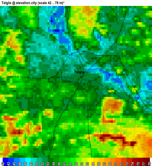
Below is the Elevation map of Telgte, which displays elevation range with different colors. Scale of the first map is from 42 to 78 m (138 to 256 ft) with average elevation of 56.3 meters (=185 ft) [note 1]
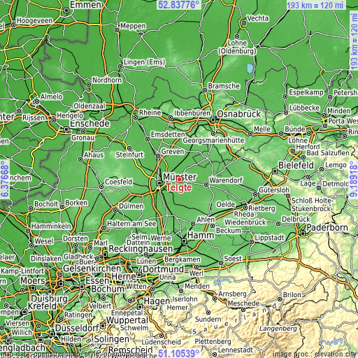
These maps also provides idea of topography and contour of this city, they are displayed at different zoom levels. More info about maps, scale and edge coordinates you can find below images.

| \ | Map #1 | Map #2 | Topo.Map |
| Scale [m] | 42..78 m | 39..83 m | × |
| Scale [ft] | 138..256 ft | 128..272 ft | × |
| Average | 56.3 m = 185 ft | 55.7 m = 183 ft | × |
| Width | 6.02 km = 3.7 mi | 12.04 km = 7.5 mi | 192.6 km = 119.7 mi |
| Height | 6.02 km = 3.7 mi | 12.04 km = 7.5 mi | 192.6 km = 119.7 mi |
| ↑Max Latitude | 52.007009° | 52.034052° | 52.83776° |
| Latitude at center | 51.97995° | 51.97995° | 51.97995° |
| ↓Min Latitude | 51.952874° | 51.925782° | 51.10539° |
| ← Min Longitude | 7.738985° | 7.695039° | 6.37668° |
| Longitude center | 7.78293° | 7.78293° | 7.78293° |
| →Max Longitude | 7.826875° | 7.870821° | 9.18918° |
Nearby cities:
Cities around Telgte sort by population:
• Münster elevation 64 m
10.9 km,  259°
259°
• Warendorf 58 m
14.4 km,  102°
102°
• Greven 45 m
18.1 km,  314°
314°
• Drensteinfurt 64 m
20.8 km,  188°
188°
• Sassenberg 61 m
17.7 km,  85°
85°
• Sendenhorst 69 m
15.6 km,  168°
168°
• Ostbevern 54 m
7.8 km,  31°
31°
• Altenberge 108 m
23 km,  289°
289°
• Everswinkel 72 m
7.4 km,  143°
143°
• Glandorf 72 m
18.8 km,  51°
51°
• Ladbergen 53 m
17.2 km,  352°
352°
• Beelen 60 m
23.2 km, 104°
Multilingual:
 En español:
Telgte elevación 55 m.
 En France:
Telgte élévation 55 m.


Sources and notes:
- [note 1] Map square and city borders are not equal. Map elevation data is calculated only from area inside that square.
- [src 1] Elevation data from geonames database provided with same terms of usage.
- [src 2] The elevation map of Telgte is generated using elevation data from NASA's 3 arcsec (90m) resolution SRTM data.
- [src 3] Base (background) map © OpenStreetMap contributors tiles are generated by Geofabrik and OpenTopoMap.
Copyright & License:
This Telgte Elevation Map is licensed under CC BY-SA. You may reuse any part from this page, if you give a proper credit by linking to this URL:
 More info on terms of use page.