Titz elevation
Titz (North Rhine-Westphalia, Regierungsbezirk Köln), Germany elevation is 102 meters and Titz elevation in feet is 335 ft above sea level [src 1]. Titz is a seat of a fourth-order administrative division (feature code) with elevation that is 156 meters (512 ft) smaller than average city elevation in Germany.
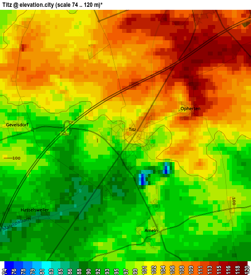
Below is the Elevation map of Titz, which displays elevation range with different colors. Scale of the first map is from 74 to 120 m (243 to 394 ft) with average elevation of 100.6 meters (=330 ft) [note 1]
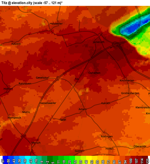
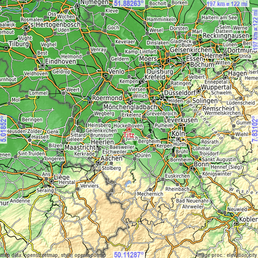
These maps also provides idea of topography and contour of this city, they are displayed at different zoom levels. More info about maps, scale and edge coordinates you can find below images.
| \ | Map #1 | Map #2 | Topo.Map |
| Scale [m] | 74..120 m | -57..121 m | × |
| Scale [ft] | 243..394 ft | -187..397 ft | × |
| Average | 100.6 m = 330 ft | 91.9 m = 302 ft | × |
| Width | 6.15 km = 3.8 mi | 12.3 km = 7.6 mi | 196.8 km = 122.3 mi |
| Height | 6.15 km = 3.8 mi | 12.3 km = 7.6 mi | 196.8 km = 122.3 mi |
| ↑Max Latitude | 51.033834° | 51.061461° | 51.88263° |
| Latitude at center | 51.00619° | 51.00619° | 51.00619° |
| ↓Min Latitude | 50.97853° | 50.950853° | 50.11287° |
| ← Min Longitude | 6.380825° | 6.336879° | 5.01852° |
| Longitude center | 6.42477° | 6.42477° | 6.42477° |
| →Max Longitude | 6.468715° | 6.512661° | 7.83102° |
Nearby cities:
Cities around Titz sort by population:
• Grevenbroich elevation 52 m
14.5 km,  49°
49°
• Bergheim 67 m
16.1 km,  110°
110°
• Erkelenz 99 m
11.2 km,  316°
316°
• Hückelhoven 64 m
14.9 km,  291°
291°
• Jülich 85 m
10.4 km,  204°
204°
• Bedburg 62 m
10.4 km,  98°
98°
• Jüchen 75 m
11.7 km,  26°
26°
• Elsdorf 78 m
12.6 km,  127°
127°
• Niederzier 105 m
14 km,  167°
167°
• Linnich 64 m
11.2 km,  254°
254°
• Aldenhoven 111 m
15.4 km,  219°
219°
• Neu-Pattern 120 m
16.7 km, 218°
Multilingual:
 En español:
Titz elevación 102 m.
 En France:
Titz élévation 102 m.


Sources and notes:
- [note 1] Map square and city borders are not equal. Map elevation data is calculated only from area inside that square.
- [src 1] Elevation data from geonames database provided with same terms of usage.
- [src 2] The elevation map of Titz is generated using elevation data from NASA's 3 arcsec (90m) resolution SRTM data.
- [src 3] Base (background) map © OpenStreetMap contributors tiles are generated by Geofabrik and OpenTopoMap.
Copyright & License:
This Titz Elevation Map is licensed under CC BY-SA. You may reuse any part from this page, if you give a proper credit by linking to this URL:
 More info on terms of use page.