Hückelhoven elevation
Hückelhoven (North Rhine-Westphalia, Regierungsbezirk Köln), Germany elevation is 64 meters and Hückelhoven elevation in feet is 210 ft above sea level [src 1]. Hückelhoven is a populated place (feature code) with elevation that is 194 meters (636 ft) smaller than average city elevation in Germany.
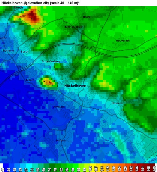
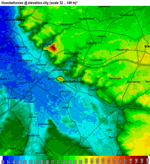
Below is the Elevation map of Hückelhoven, which displays elevation range with different colors. Scale of the first map is from 40 to 149 m (131 to 489 ft) with average elevation of 66.9 meters (=219 ft) [note 1]
These maps also provides idea of topography and contour of this city, they are displayed at different zoom levels. More info about maps, scale and edge coordinates you can find below images.
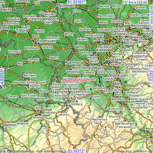
| \ | Map #1 | Map #2 | Topo.Map |
| Scale [m] | 40..149 m | 32..149 m | × |
| Scale [ft] | 131..489 ft | 105..489 ft | × |
| Average | 66.9 m = 219 ft | 70.5 m = 231 ft | × |
| Width | 6.14 km = 3.8 mi | 12.29 km = 7.6 mi | 196.6 km = 122.2 mi |
| Height | 6.14 km = 3.8 mi | 12.29 km = 7.6 mi | 196.6 km = 122.2 mi |
| ↑Max Latitude | 51.083114° | 51.110712° | 51.93101° |
| Latitude at center | 51.0555° | 51.0555° | 51.0555° |
| ↓Min Latitude | 51.027869° | 51.000222° | 50.16312° |
| ← Min Longitude | 6.182635° | 6.138689° | 4.82033° |
| Longitude center | 6.22658° | 6.22658° | 6.22658° |
| →Max Longitude | 6.270525° | 6.314471° | 7.63283° |
Nearby cities:
Cities around Hückelhoven sort by population:
• Erkelenz elevation 99 m
6.7 km,  66°
66°
• Heinsberg 39 m
8.9 km,  275°
275°
• Wegberg 67 m
10.5 km,  22°
22°
• Geilenkirchen 96 m
12.4 km,  217°
217°
• Baesweiler 117 m
16.4 km,  189°
189°
• Übach-Palenberg 121 m
16.9 km,  205°
205°
• Wassenberg 48 m
7 km,  314°
314°
• Niederkrüchten 54 m
16.1 km,  357°
357°
• Linnich 64 m
8.9 km,  159°
159°
• Waldfeucht 50 m
16.7 km,  274°
274°
• Titz 102 m
14.9 km,  111°
111°
• Siersdorf 125 m
17.5 km,  179°
179°
Multilingual:
 En español:
Hückelhoven elevación 64 m.
 En France:
Hückelhoven élévation 64 m.
 Auf Deutsch:
Hückelhoven höhe über dem Meeresspiegel ist 64 m.

Sources and notes:
- [note 1] Map square and city borders are not equal. Map elevation data is calculated only from area inside that square.
- [src 1] Elevation data from geonames database provided with same terms of usage.
- [src 2] The elevation map of Hückelhoven is generated using elevation data from NASA's 3 arcsec (90m) resolution SRTM data.
- [src 3] Base (background) map © OpenStreetMap contributors tiles are generated by Geofabrik and OpenTopoMap.
Copyright & License:
This Hückelhoven Elevation Map is licensed under CC BY-SA. You may reuse any part from this page, if you give a proper credit by linking to this URL:
 More info on terms of use page.