Triptis elevation
Triptis (Thuringia), Germany elevation is 365 meters and Triptis elevation in feet is 1198 ft above sea level [src 1]. Triptis is a populated place (feature code) with elevation that is 107 meters (351 ft) bigger than average city elevation in Germany.
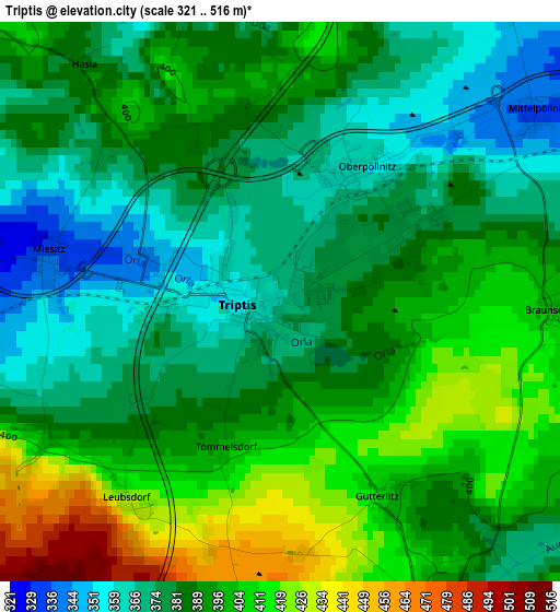
Below is the Elevation map of Triptis, which displays elevation range with different colors. Scale of the first map is from 321 to 516 m (1053 to 1693 ft) with average elevation of 388.7 meters (=1275 ft) [note 1]
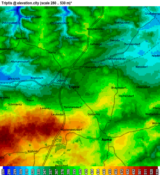
These maps also provides idea of topography and contour of this city, they are displayed at different zoom levels. More info about maps, scale and edge coordinates you can find below images.
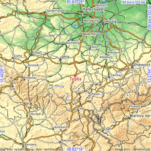
| \ | Map #1 | Map #2 | Topo.Map |
| Scale [m] | 321..516 m | 280..530 m | × |
| Scale [ft] | 1053..1693 ft | 919..1739 ft | × |
| Average | 388.7 m = 1275 ft | 387.7 m = 1272 ft | × |
| Width | 6.18 km = 3.8 mi | 12.37 km = 7.7 mi | 197.9 km = 123 mi |
| Height | 6.19 km = 3.8 mi | 12.37 km = 7.7 mi | 197.9 km = 123 mi |
| ↑Max Latitude | 50.763475° | 50.791263° | 51.61725° |
| Latitude at center | 50.73567° | 50.73567° | 50.73567° |
| ↓Min Latitude | 50.707849° | 50.680011° | 49.83718° |
| ← Min Longitude | 11.826205° | 11.782259° | 10.4639° |
| Longitude center | 11.87015° | 11.87015° | 11.87015° |
| →Max Longitude | 11.914095° | 11.958041° | 13.2764° |
Nearby cities:
Cities around Triptis sort by population:
• Zeulenroda elevation 411 m
12.2 km,  139°
139°
• Weida 239 m
14.1 km,  72°
72°
• Neustadt an der Orla 301 m
8.7 km,  270°
270°
• Stadtroda 199 m
16.8 km,  323°
323°
• Kraftsdorf 257 m
16.1 km,  14°
14°
• Triebes 354 m
12 km,  118°
118°
• Langenwetzendorf 341 m
17 km,  111°
111°
• Münchenbernsdorf 330 m
10.5 km,  24°
24°
• Auma 395 m
4.4 km,  152°
152°
• Hohenleuben 393 m
13.2 km,  101°
101°
• Oppurg 218 m
15.5 km,  259°
259°
• Sankt Gangloff 330 m
13.4 km, 7°
Multilingual:
 En español:
Triptis elevación 365 m.
 En France:
Triptis élévation 365 m.


Sources and notes:
- [note 1] Map square and city borders are not equal. Map elevation data is calculated only from area inside that square.
- [src 1] Elevation data from geonames database provided with same terms of usage.
- [src 2] The elevation map of Triptis is generated using elevation data from NASA's 3 arcsec (90m) resolution SRTM data.
- [src 3] Base (background) map © OpenStreetMap contributors tiles are generated by Geofabrik and OpenTopoMap.
Copyright & License:
This Triptis Elevation Map is licensed under CC BY-SA. You may reuse any part from this page, if you give a proper credit by linking to this URL:
 More info on terms of use page.