Velpke elevation
Velpke (Lower Saxony), Germany elevation is 81 meters and Velpke elevation in feet is 266 ft above sea level [src 1]. Velpke is a seat of a fourth-order administrative division (feature code) with elevation that is 177 meters (581 ft) smaller than average city elevation in Germany.
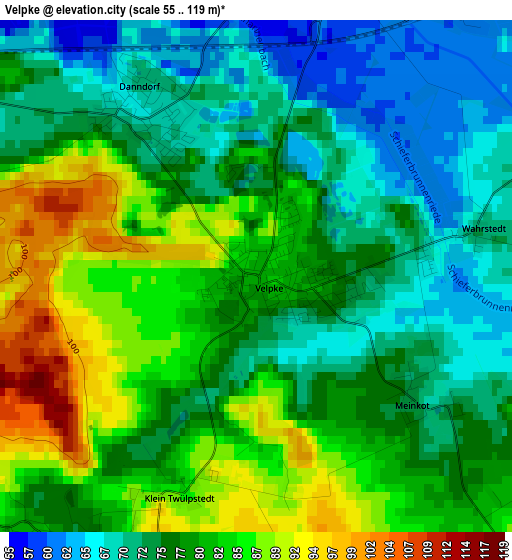
Below is the Elevation map of Velpke, which displays elevation range with different colors. Scale of the first map is from 55 to 119 m (180 to 390 ft) with average elevation of 77.8 meters (=255 ft) [note 1]
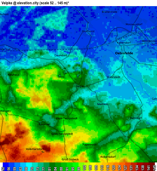
These maps also provides idea of topography and contour of this city, they are displayed at different zoom levels. More info about maps, scale and edge coordinates you can find below images.
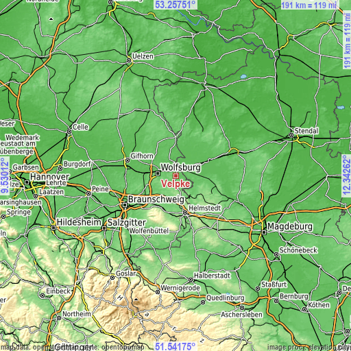
| \ | Map #1 | Map #2 | Topo.Map |
| Scale [m] | 55..119 m | 52..145 m | × |
| Scale [ft] | 180..390 ft | 171..476 ft | × |
| Average | 77.8 m = 255 ft | 79 m = 259 ft | × |
| Width | 5.96 km = 3.7 mi | 11.92 km = 7.4 mi | 190.8 km = 118.6 mi |
| Height | 5.96 km = 3.7 mi | 11.92 km = 7.4 mi | 190.8 km = 118.6 mi |
| ↑Max Latitude | 52.43477° | 52.461554° | 53.25751° |
| Latitude at center | 52.40797° | 52.40797° | 52.40797° |
| ↓Min Latitude | 52.381154° | 52.354321° | 51.54175° |
| ← Min Longitude | 10.892425° | 10.848479° | 9.53012° |
| Longitude center | 10.93637° | 10.93637° | 10.93637° |
| →Max Longitude | 10.980315° | 11.024261° | 12.34262° |
Nearby cities:
Cities around Velpke sort by population:
• Wolfsburg elevation 62 m
10.7 km,  279°
279°
• Westhagen 110 m
13.4 km,  268°
268°
• Detmerode 91 m
13.1 km,  261°
261°
• Oebisfelde 63 m
4.6 km,  50°
50°
• Rühen 68 m
9.3 km,  338°
338°
• Groß Twülpstedt 101 m
4 km,  196°
196°
• Grasleben 101 m
12.5 km,  154°
154°
• Weferlingen 87 m
13.5 km,  142°
142°
• Danndorf 69 m
2.5 km,  319°
319°
• Bahrdorf 76 m
5 km,  119°
119°
• Parsau 62 m
14.4 km,  347°
347°
• Grafhorst 61 m
4.1 km,  8°
8°
Multilingual:
 En español:
Velpke elevación 81 m.
 En France:
Velpke élévation 81 m.


Sources and notes:
- [note 1] Map square and city borders are not equal. Map elevation data is calculated only from area inside that square.
- [src 1] Elevation data from geonames database provided with same terms of usage.
- [src 2] The elevation map of Velpke is generated using elevation data from NASA's 3 arcsec (90m) resolution SRTM data.
- [src 3] Base (background) map © OpenStreetMap contributors tiles are generated by Geofabrik and OpenTopoMap.
Copyright & License:
This Velpke Elevation Map is licensed under CC BY-SA. You may reuse any part from this page, if you give a proper credit by linking to this URL:
 More info on terms of use page.