Rühen elevation
Rühen (Lower Saxony), Germany elevation is 68 meters and Rühen elevation in feet is 223 ft above sea level [src 1]. Rühen is a seat of a fourth-order administrative division (feature code) with elevation that is 190 meters (623 ft) smaller than average city elevation in Germany.
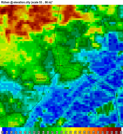
Below is the Elevation map of Rühen, which displays elevation range with different colors. Scale of the first map is from 53 to 86 m (174 to 282 ft) with average elevation of 64.2 meters (=211 ft) [note 1]
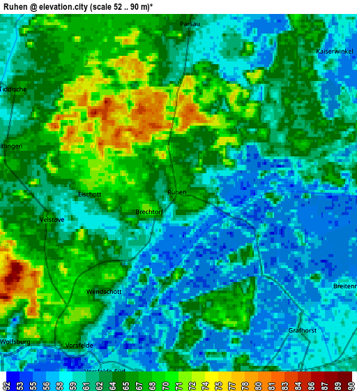
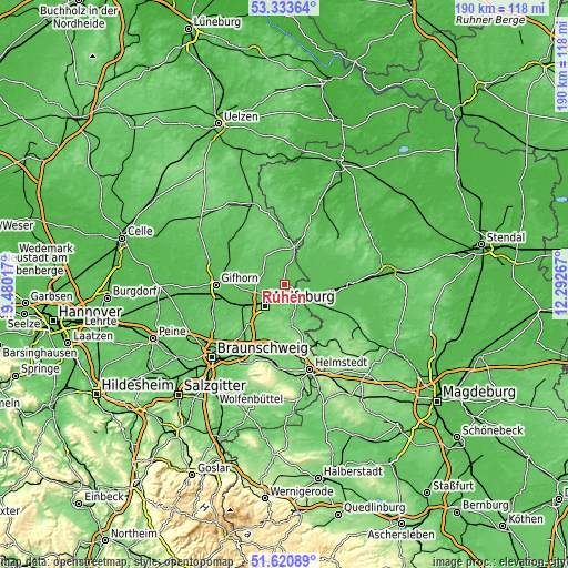
These maps also provides idea of topography and contour of this city, they are displayed at different zoom levels. More info about maps, scale and edge coordinates you can find below images.
| \ | Map #1 | Map #2 | Topo.Map |
| Scale [m] | 53..86 m | 52..90 m | × |
| Scale [ft] | 174..282 ft | 171..295 ft | × |
| Average | 64.2 m = 211 ft | 63.1 m = 207 ft | × |
| Width | 5.95 km = 3.7 mi | 11.9 km = 7.4 mi | 190.4 km = 118.3 mi |
| Height | 5.95 km = 3.7 mi | 11.9 km = 7.4 mi | 190.4 km = 118.3 mi |
| ↑Max Latitude | 52.512353° | 52.539089° | 53.33364° |
| Latitude at center | 52.4856° | 52.4856° | 52.4856° |
| ↓Min Latitude | 52.458831° | 52.432045° | 51.62089° |
| ← Min Longitude | 10.842475° | 10.798529° | 9.48017° |
| Longitude center | 10.88642° | 10.88642° | 10.88642° |
| →Max Longitude | 10.930365° | 10.974311° | 12.29267° |
Nearby cities:
Cities around Rühen sort by population:
• Wolfsburg elevation 62 m
9.8 km,  226°
226°
• Oebisfelde 63 m
8.9 km,  129°
129°
• Velpke 81 m
9.3 km,  158°
158°
• Weyhausen 56 m
11.8 km,  257°
257°
• Danndorf 69 m
7 km,  165°
165°
• Parsau 62 m
5.5 km,  2°
2°
• Jembke 63 m
8.3 km,  281°
281°
• Tülau 75 m
10 km,  356°
356°
• Tiddische 60 m
6.8 km,  300°
300°
• Tappenbeck 64 m
10 km, 260°
• Barwedel 87 m
8.6 km, 298°
• Grafhorst 61 m
6 km,  138°
138°
Multilingual:
 En español:
Rühen elevación 68 m.
 En France:
Rühen élévation 68 m.


Sources and notes:
- [note 1] Map square and city borders are not equal. Map elevation data is calculated only from area inside that square.
- [src 1] Elevation data from geonames database provided with same terms of usage.
- [src 2] The elevation map of Rühen is generated using elevation data from NASA's 3 arcsec (90m) resolution SRTM data.
- [src 3] Base (background) map © OpenStreetMap contributors tiles are generated by Geofabrik and OpenTopoMap.
Copyright & License:
This Rühen Elevation Map is licensed under CC BY-SA. You may reuse any part from this page, if you give a proper credit by linking to this URL:
 More info on terms of use page.