Vlotho elevation
Vlotho (North Rhine-Westphalia, Regierungsbezirk Detmold), Germany elevation is 68 meters and Vlotho elevation in feet is 223 ft above sea level [src 1]. Vlotho is a populated place (feature code) with elevation that is 190 meters (623 ft) smaller than average city elevation in Germany.
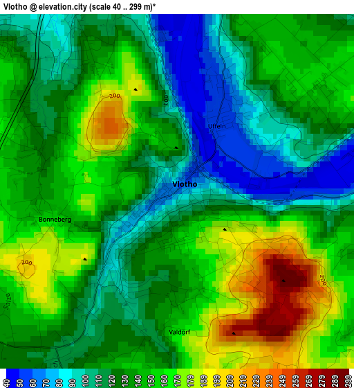
Below is the Elevation map of Vlotho, which displays elevation range with different colors. Scale of the first map is from 40 to 299 m (131 to 981 ft) with average elevation of 136.7 meters (=448 ft) [note 1]
These maps also provides idea of topography and contour of this city, they are displayed at different zoom levels. More info about maps, scale and edge coordinates you can find below images.
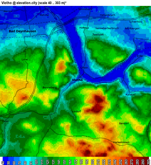
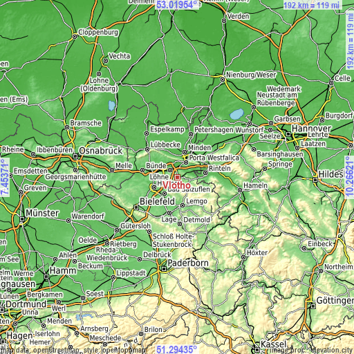
| \ | Map #1 | Map #2 | Topo.Map |
| Scale [m] | 40..299 m | 40..303 m | × |
| Scale [ft] | 131..981 ft | 131..994 ft | × |
| Average | 136.7 m = 448 ft | 128.9 m = 423 ft | × |
| Width | 5.99 km = 3.7 mi | 11.99 km = 7.5 mi | 191.8 km = 119.2 mi |
| Height | 5.99 km = 3.7 mi | 11.99 km = 7.5 mi | 191.8 km = 119.2 mi |
| ↑Max Latitude | 52.192247° | 52.219178° | 53.01954° |
| Latitude at center | 52.1653° | 52.1653° | 52.1653° |
| ↓Min Latitude | 52.138336° | 52.111357° | 51.29435° |
| ← Min Longitude | 8.816015° | 8.772069° | 7.45371° |
| Longitude center | 8.85996° | 8.85996° | 8.85996° |
| →Max Longitude | 8.903905° | 8.947851° | 10.26621° |
Nearby cities:
Cities around Vlotho sort by population:
• Minden elevation 59 m
14.3 km,  15°
15°
• Herford 69 m
13.9 km,  246°
246°
• Bad Salzuflen 82 m
11.8 km,  221°
221°
• Bad Oeynhausen 58 m
6 km,  320°
320°
• Lemgo 100 m
15.5 km,  170°
170°
• Löhne 68 m
11.7 km,  282°
282°
• Porta Westfalica 73 m
8.1 km,  28°
28°
• Rinteln 60 m
15.1 km,  81°
81°
• Hiddenhausen 83 m
16.6 km,  270°
270°
• Bückeburg 68 m
16.7 km,  50°
50°
• Kirchlengern 64 m
15.9 km, 284°
• Obernbeck 57 m
11.4 km,  290°
290°
Multilingual:
 En español:
Vlotho elevación 68 m.
 En France:
Vlotho élévation 68 m.


Sources and notes:
- [note 1] Map square and city borders are not equal. Map elevation data is calculated only from area inside that square.
- [src 1] Elevation data from geonames database provided with same terms of usage.
- [src 2] The elevation map of Vlotho is generated using elevation data from NASA's 3 arcsec (90m) resolution SRTM data.
- [src 3] Base (background) map © OpenStreetMap contributors tiles are generated by Geofabrik and OpenTopoMap.
Copyright & License:
This Vlotho Elevation Map is licensed under CC BY-SA. You may reuse any part from this page, if you give a proper credit by linking to this URL:
 More info on terms of use page.