Minden elevation
Minden (North Rhine-Westphalia, Regierungsbezirk Detmold), Germany elevation is 59 meters and Minden elevation in feet is 194 ft above sea level [src 1]. Minden is a seat of a third-order administrative division (feature code) with elevation that is 199 meters (653 ft) smaller than average city elevation in Germany.
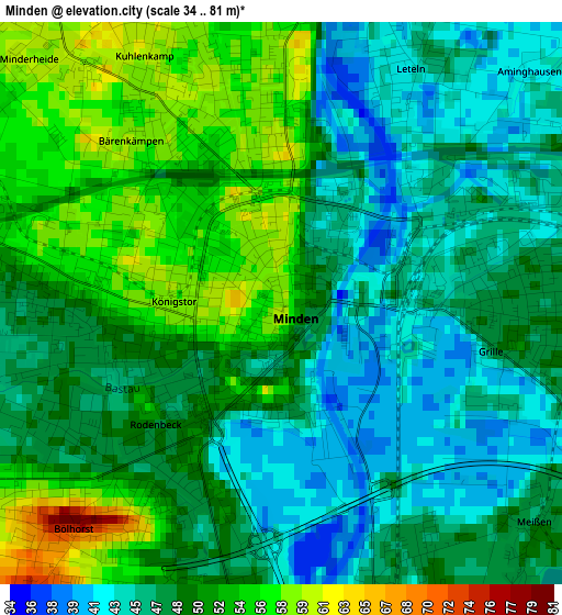
Below is the Elevation map of Minden, which displays elevation range with different colors. Scale of the first map is from 34 to 81 m (112 to 266 ft) with average elevation of 49.2 meters (=161 ft) [note 1]
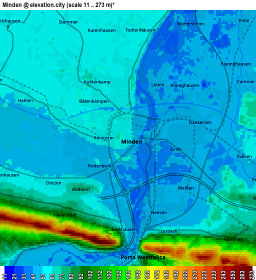
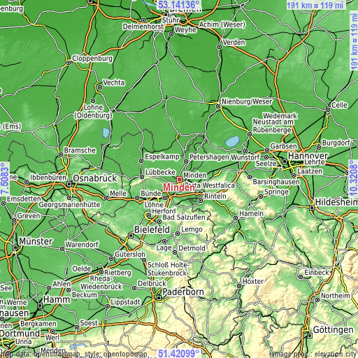
These maps also provides idea of topography and contour of this city, they are displayed at different zoom levels. More info about maps, scale and edge coordinates you can find below images.
| \ | Map #1 | Map #2 | Topo.Map |
| Scale [m] | 34..81 m | 11..273 m | × |
| Scale [ft] | 112..266 ft | 36..896 ft | × |
| Average | 49.2 m = 161 ft | 63.4 m = 208 ft | × |
| Width | 5.98 km = 3.7 mi | 11.96 km = 7.4 mi | 191.3 km = 118.9 mi |
| Height | 5.98 km = 3.7 mi | 11.96 km = 7.4 mi | 191.3 km = 118.9 mi |
| ↑Max Latitude | 52.316402° | 52.343258° | 53.14136° |
| Latitude at center | 52.28953° | 52.28953° | 52.28953° |
| ↓Min Latitude | 52.262642° | 52.235737° | 51.42099° |
| ← Min Longitude | 8.870605° | 8.826659° | 7.5083° |
| Longitude center | 8.91455° | 8.91455° | 8.91455° |
| →Max Longitude | 8.958495° | 9.002441° | 10.3208° |
Nearby cities:
Cities around Minden sort by population:
• Bad Oeynhausen elevation 58 m
11.9 km,  219°
219°
• Porta Westfalica 73 m
6.7 km,  179°
179°
• Petershagen 46 m
10.1 km,  19°
19°
• Bückeburg 68 m
9.7 km,  109°
109°
• Hille 58 m
12.2 km,  293°
293°
• Bad Eilsen 106 m
13.6 km, 112°
• Hespe 60 m
13.9 km,  71°
71°
• Helpsen 58 m
14 km,  80°
80°
• Seggebruch 63 m
12.3 km, 84°
• Heeßen 99 m
13.9 km,  117°
117°
• Ahnsen 75 m
13.3 km, 107°
• Luhden 110 m
14.1 km, 120°
Multilingual:
 En español:
Minden elevación 59 m.
 En France:
Minden élévation 59 m.


Sources and notes:
- [note 1] Map square and city borders are not equal. Map elevation data is calculated only from area inside that square.
- [src 1] Elevation data from geonames database provided with same terms of usage.
- [src 2] The elevation map of Minden is generated using elevation data from NASA's 3 arcsec (90m) resolution SRTM data.
- [src 3] Base (background) map © OpenStreetMap contributors tiles are generated by Geofabrik and OpenTopoMap.
Copyright & License:
This Minden Elevation Map is licensed under CC BY-SA. You may reuse any part from this page, if you give a proper credit by linking to this URL:
 More info on terms of use page.