Waldstetten elevation
Waldstetten (Baden-Württemberg, Regierungsbezirk Stuttgart), Germany elevation is 382 meters and Waldstetten elevation in feet is 1253 ft above sea level [src 1]. Waldstetten is a seat of a fourth-order administrative division (feature code) with elevation that is 124 meters (407 ft) bigger than average city elevation in Germany.
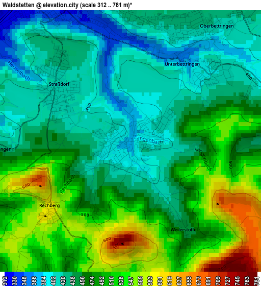
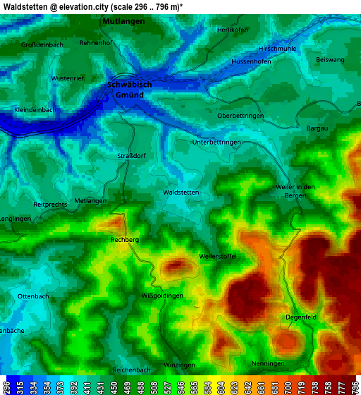
Below is the Elevation map of Waldstetten, which displays elevation range with different colors. Scale of the first map is from 312 to 781 m (1024 to 2562 ft) with average elevation of 468.4 meters (=1537 ft) [note 1]
These maps also provides idea of topography and contour of this city, they are displayed at different zoom levels. More info about maps, scale and edge coordinates you can find below images.
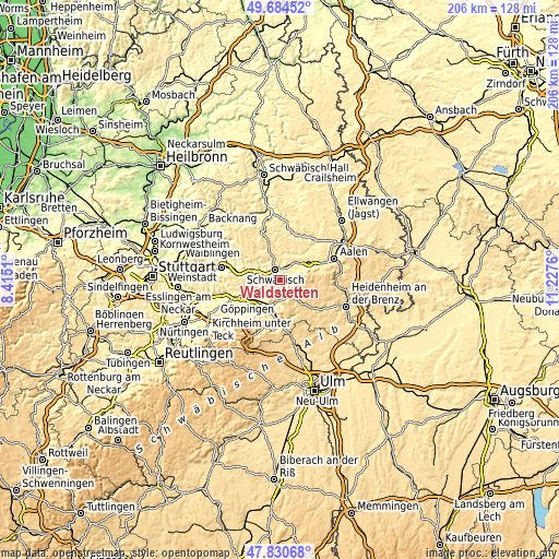
| \ | Map #1 | Map #2 | Topo.Map |
| Scale [m] | 312..781 m | 296..796 m | × |
| Scale [ft] | 1024..2562 ft | 971..2612 ft | × |
| Average | 468.4 m = 1537 ft | 474.5 m = 1557 ft | × |
| Width | 6.44 km = 4 mi | 12.88 km = 8 mi | 206.1 km = 128.1 mi |
| Height | 6.44 km = 4 mi | 12.88 km = 8 mi | 206.1 km = 128.1 mi |
| ↑Max Latitude | 48.795107° | 48.824048° | 49.68452° |
| Latitude at center | 48.76615° | 48.76615° | 48.76615° |
| ↓Min Latitude | 48.737176° | 48.708185° | 47.83068° |
| ← Min Longitude | 9.777405° | 9.733459° | 8.4151° |
| Longitude center | 9.82135° | 9.82135° | 9.82135° |
| →Max Longitude | 9.865295° | 9.909241° | 11.2276° |
Nearby cities:
Cities around Waldstetten sort by population:
• Schwäbisch Gmünd elevation 325 m
4.1 km,  335°
335°
• Lorch 288 m
10.2 km,  290°
290°
• Donzdorf 409 m
9 km,  185°
185°
• Heubach 452 m
8.7 km,  70°
70°
• Mutlangen 452 m
6.9 km,  345°
345°
• Böbingen an der Rems 396 m
9.4 km,  50°
50°
• Wäschenbeuren 415 m
9.8 km,  265°
265°
• Durlangen 489 m
10.2 km, 349°
• Iggingen 465 m
8.4 km,  30°
30°
• Ottenbach 391 m
6.3 km,  238°
238°
• Leinzell 404 m
10.1 km,  23°
23°
• Täferrot 408 m
9.4 km,  7°
7°
Multilingual:
 En español:
Waldstetten elevación 382 m.
 En France:
Waldstetten élévation 382 m.
 Auf Deutsch:
Waldstetten höhe über dem Meeresspiegel ist 382 m.

Sources and notes:
- [note 1] Map square and city borders are not equal. Map elevation data is calculated only from area inside that square.
- [src 1] Elevation data from geonames database provided with same terms of usage.
- [src 2] The elevation map of Waldstetten is generated using elevation data from NASA's 3 arcsec (90m) resolution SRTM data.
- [src 3] Base (background) map © OpenStreetMap contributors tiles are generated by Geofabrik and OpenTopoMap.
Copyright & License:
This Waldstetten Elevation Map is licensed under CC BY-SA. You may reuse any part from this page, if you give a proper credit by linking to this URL:
 More info on terms of use page.