Iggingen elevation
Iggingen (Baden-Württemberg, Regierungsbezirk Stuttgart), Germany elevation is 465 meters and Iggingen elevation in feet is 1526 ft above sea level [src 1]. Iggingen is a seat of a fourth-order administrative division (feature code) with elevation that is 207 meters (679 ft) bigger than average city elevation in Germany.
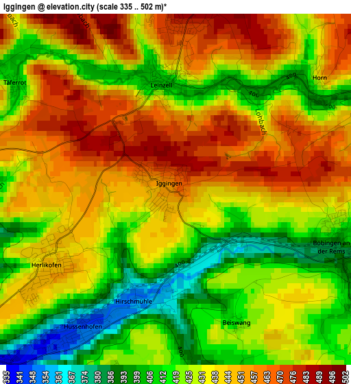
Below is the Elevation map of Iggingen, which displays elevation range with different colors. Scale of the first map is from 335 to 502 m (1099 to 1647 ft) with average elevation of 433.8 meters (=1423 ft) [note 1]
These maps also provides idea of topography and contour of this city, they are displayed at different zoom levels. More info about maps, scale and edge coordinates you can find below images.
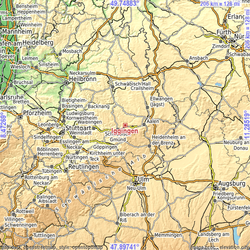
| \ | Map #1 | Topo.Map |
| Scale [m] | 335..502 m | × |
| Scale [ft] | 1099..1647 ft | × |
| Average | 433.8 m = 1423 ft | × |
| Width | 6.43 km = 4 mi | 205.9 km = 127.9 mi |
| Height | 6.43 km = 4 mi | 205.8 km = 127.9 mi |
| ↑Max Latitude | 48.86059° | 49.74883° |
| Latitude at center | 48.83167° | 48.83167° |
| ↓Min Latitude | 48.802734° | 47.89741° |
| ← Min Longitude | 9.834995° | 8.47269° |
| Longitude center | 9.87894° | 9.87894° |
| →Max Longitude | 9.922885° | 11.28519° |
Nearby cities:
Cities around Iggingen sort by population:
• Schwäbisch Gmünd elevation 325 m
6.9 km,  238°
238°
• Heubach 452 m
5.9 km,  137°
137°
• Mutlangen 452 m
6 km,  263°
263°
• Böbingen an der Rems 396 m
3.4 km,  113°
113°
• Mögglingen 412 m
6.2 km,  98°
98°
• Durlangen 489 m
6.6 km,  294°
294°
• Göggingen 491 m
3.3 km,  6°
6°
• Schechingen 484 m
5.4 km,  31°
31°
• Leinzell 404 m
2 km,  356°
356°
• Heuchlingen 388 m
5.3 km,  64°
64°
• Eschach 493 m
6.3 km,  354°
354°
• Täferrot 408 m
3.6 km,  303°
303°
Multilingual:
 En español:
Iggingen elevación 465 m.
 En France:
Iggingen élévation 465 m.
 Auf Deutsch:
Iggingen höhe über dem Meeresspiegel ist 465 m.

Sources and notes:
- [note 1] Map square and city borders are not equal. Map elevation data is calculated only from area inside that square.
- [src 1] Elevation data from geonames database provided with same terms of usage.
- [src 2] The elevation map of Iggingen is generated using elevation data from NASA's 3 arcsec (90m) resolution SRTM data.
- [src 3] Base (background) map © OpenStreetMap contributors tiles are generated by Geofabrik and OpenTopoMap.
Copyright & License:
This Iggingen Elevation Map is licensed under CC BY-SA. You may reuse any part from this page, if you give a proper credit by linking to this URL:
 More info on terms of use page.