Wallhausen elevation
Wallhausen (Saxony-Anhalt), Germany elevation is 144 meters and Wallhausen elevation in feet is 472 ft above sea level [src 1]. Wallhausen is a seat of a fourth-order administrative division (feature code) with elevation that is 114 meters (374 ft) smaller than average city elevation in Germany.
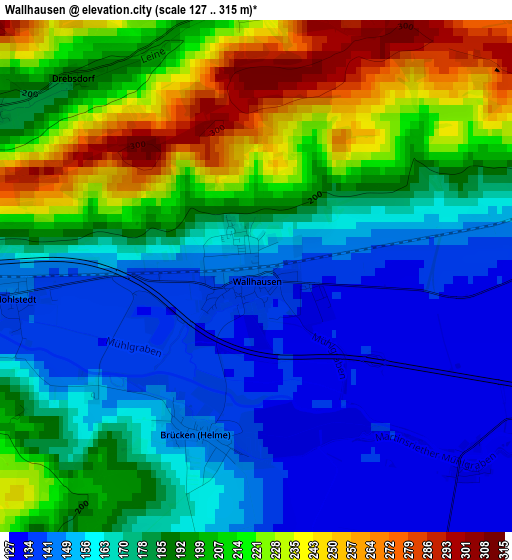
Below is the Elevation map of Wallhausen, which displays elevation range with different colors. Scale of the first map is from 127 to 315 m (417 to 1033 ft) with average elevation of 183.4 meters (=602 ft) [note 1]
These maps also provides idea of topography and contour of this city, they are displayed at different zoom levels. More info about maps, scale and edge coordinates you can find below images.
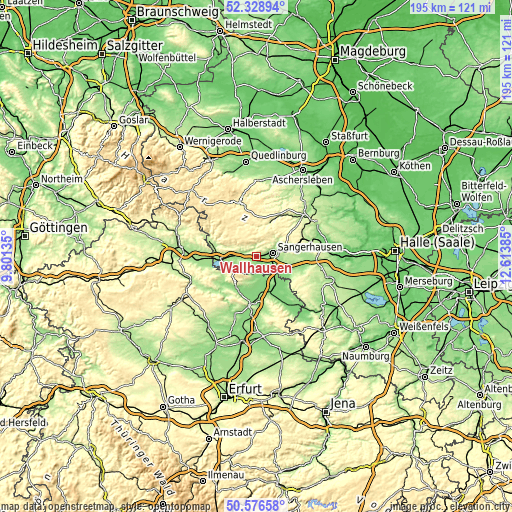
| \ | Map #1 | Topo.Map |
| Scale [m] | 127..315 m | × |
| Scale [ft] | 417..1033 ft | × |
| Average | 183.4 m = 602 ft | × |
| Width | 6.09 km = 3.8 mi | 194.8 km = 121 mi |
| Height | 6.09 km = 3.8 mi | 194.8 km = 121 mi |
| ↑Max Latitude | 51.488542° | 52.32894° |
| Latitude at center | 51.46117° | 51.46117° |
| ↓Min Latitude | 51.433782° | 50.57658° |
| ← Min Longitude | 11.163655° | 9.80135° |
| Longitude center | 11.2076° | 11.2076° |
| →Max Longitude | 11.251545° | 12.61385° |
Nearby cities:
Cities around Wallhausen sort by population:
• Sangerhausen elevation 154 m
6.2 km,  78°
78°
• Bad Frankenhausen 137 m
13.9 km,  212°
212°
• Artern 127 m
12.2 km,  151°
151°
• Kelbra 163 m
11.9 km,  255°
255°
• Roßla 155 m
9.1 km,  271°
271°
• Oberröblingen 130 m
7.4 km,  111°
111°
• Wippra 248 m
13.3 km,  20°
20°
• Riestedt 177 m
11.2 km,  70°
70°
• Edersleben 143 m
7.2 km,  133°
133°
• Voigtstedt 128 m
10.4 km,  137°
137°
• Ringleben 127 m
10.5 km,  176°
176°
• Bennungen 148 m
6.2 km, 269°
Multilingual:
 En español:
Wallhausen elevación 144 m.
 En France:
Wallhausen élévation 144 m.
 Auf Deutsch:
Wallhausen (Helme) höhe über dem Meeresspiegel ist 144 m.
 На русском:
Валльхаузен (Хельме) высота над уровнем моря 144 м
Sources and notes:
- [note 1] Map square and city borders are not equal. Map elevation data is calculated only from area inside that square.
- [src 1] Elevation data from geonames database provided with same terms of usage.
- [src 2] The elevation map of Wallhausen is generated using elevation data from NASA's 3 arcsec (90m) resolution SRTM data.
- [src 3] Base (background) map © OpenStreetMap contributors tiles are generated by Geofabrik and OpenTopoMap.
Copyright & License:
This Wallhausen Elevation Map is licensed under CC BY-SA. You may reuse any part from this page, if you give a proper credit by linking to this URL:
 More info on terms of use page.