Werl elevation
Werl (North Rhine-Westphalia, Regierungsbezirk Arnsberg), Germany elevation is 92 meters and Werl elevation in feet is 302 ft above sea level [src 1]. Werl is a populated place (feature code) with elevation that is 166 meters (545 ft) smaller than average city elevation in Germany.
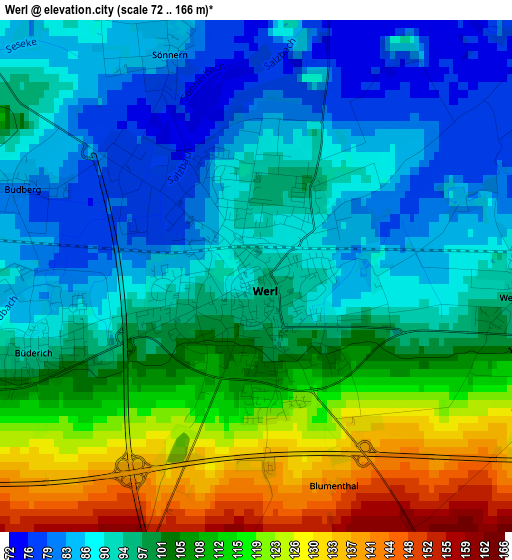
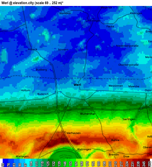
Below is the Elevation map of Werl, which displays elevation range with different colors. Scale of the first map is from 72 to 166 m (236 to 545 ft) with average elevation of 100.4 meters (=329 ft) [note 1]
These maps also provides idea of topography and contour of this city, they are displayed at different zoom levels. More info about maps, scale and edge coordinates you can find below images.
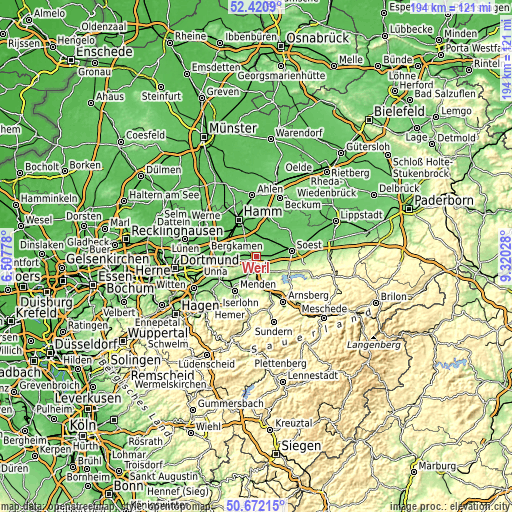
| \ | Map #1 | Map #2 | Topo.Map |
| Scale [m] | 72..166 m | 69..252 m | × |
| Scale [ft] | 236..545 ft | 226..827 ft | × |
| Average | 100.4 m = 329 ft | 119.4 m = 392 ft | × |
| Width | 6.08 km = 3.8 mi | 12.15 km = 7.5 mi | 194.4 km = 120.8 mi |
| Height | 6.08 km = 3.8 mi | 12.15 km = 7.5 mi | 194.4 km = 120.8 mi |
| ↑Max Latitude | 51.582245° | 51.609544° | 52.4209° |
| Latitude at center | 51.55493° | 51.55493° | 51.55493° |
| ↓Min Latitude | 51.527598° | 51.50025° | 50.67215° |
| ← Min Longitude | 7.870085° | 7.826139° | 6.50778° |
| Longitude center | 7.91403° | 7.91403° | 7.91403° |
| →Max Longitude | 7.957975° | 8.001921° | 9.32028° |
Nearby cities:
Cities around Werl sort by population:
• Hamm elevation 66 m
15.4 km,  335°
335°
• Unna 103 m
15.6 km,  263°
263°
• Menden 165 m
15.6 km,  217°
217°
• Bergkamen 67 m
19.8 km,  290°
290°
• Soest 95 m
13.5 km,  80°
80°
• Kamen 65 m
17.8 km,  283°
283°
• Fröndenberg 163 m
13.3 km,  228°
228°
• Bönen 73 m
11.3 km,  296°
296°
• Welver 76 m
7.8 km,  27°
27°
• Wickede 168 m
7.3 km,  207°
207°
• Bad Sassendorf 93 m
17.7 km, 79°
• Möhnesee 253 m
16.4 km,  111°
111°
Multilingual:
 En español:
Werle elevación 92 m.
 En France:
Werl élévation 92 m.


Sources and notes:
- [note 1] Map square and city borders are not equal. Map elevation data is calculated only from area inside that square.
- [src 1] Elevation data from geonames database provided with same terms of usage.
- [src 2] The elevation map of Werl is generated using elevation data from NASA's 3 arcsec (90m) resolution SRTM data.
- [src 3] Base (background) map © OpenStreetMap contributors tiles are generated by Geofabrik and OpenTopoMap.
Copyright & License:
This Werl Elevation Map is licensed under CC BY-SA. You may reuse any part from this page, if you give a proper credit by linking to this URL:
 More info on terms of use page.