Wiesentheid elevation
Wiesentheid (Bavaria, Regierungsbezirk Unterfranken), Germany elevation is 249 meters and Wiesentheid elevation in feet is 817 ft above sea level [src 1]. Wiesentheid is a populated place (feature code) with elevation that is 9 meters (30 ft) smaller than average city elevation in Germany.
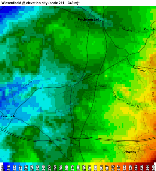
Below is the Elevation map of Wiesentheid, which displays elevation range with different colors. Scale of the first map is from 211 to 349 m (692 to 1145 ft) with average elevation of 262 meters (=860 ft) [note 1]
These maps also provides idea of topography and contour of this city, they are displayed at different zoom levels. More info about maps, scale and edge coordinates you can find below images.
| \ | Map #1 | Map #2 | Topo.Map |
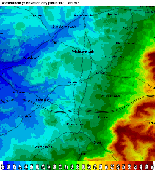
| Scale [m] | 211..349 m | 197..491 m | × |
| Scale [ft] | 692..1145 ft | 646..1611 ft | × |
| Average | 262 m = 860 ft | 282.2 m = 926 ft | × |
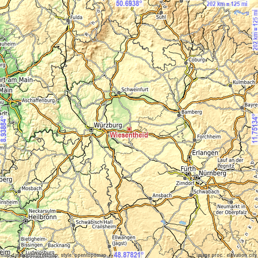
| Width | 6.31 km = 3.9 mi | 12.62 km = 7.8 mi | 201.9 km = 125.5 mi |
| Height | 6.31 km = 3.9 mi | 12.62 km = 7.8 mi | 201.9 km = 125.5 mi |
| ↑Max Latitude | 49.82287° | 49.851213° | 50.6938° |
| Latitude at center | 49.79451° | 49.79451° | 49.79451° |
| ↓Min Latitude | 49.766134° | 49.737741° | 48.87821° |
| ← Min Longitude | 10.301145° | 10.257199° | 8.93884° |
| Longitude center | 10.34509° | 10.34509° | 10.34509° |
| →Max Longitude | 10.389035° | 10.432981° | 11.75134° |
Nearby cities:
Cities around Wiesentheid sort by population:
• Volkach elevation 203 m
11.4 km,  312°
312°
• Gerolzhofen 241 m
11.8 km,  1°
1°
• Iphofen 256 m
11.9 km,  210°
210°
• Prichsenstadt 254 m
2.8 km, 3°
• Geiselwind 348 m
9.3 km,  104°
104°
• Kleinlangheim 228 m
5.1 km,  238°
238°
• Rödelsee 241 m
10.4 km,  224°
224°
• Großlangheim 226 m
8.6 km, 240°
• Sommerach 199 m
10.6 km,  291°
291°
• Oberschwarzach 279 m
8.7 km,  32°
32°
• Oberscheinfeld 323 m
11.5 km,  146°
146°
• Frankenwinheim 230 m
10.6 km,  347°
347°
Multilingual:
 En español:
Wiesentheid elevación 249 m.
 En France:
Wiesentheid élévation 249 m.
 Auf Deutsch:
Wiesentheid höhe über dem Meeresspiegel ist 249 m.

Sources and notes:
- [note 1] Map square and city borders are not equal. Map elevation data is calculated only from area inside that square.
- [src 1] Elevation data from geonames database provided with same terms of usage.
- [src 2] The elevation map of Wiesentheid is generated using elevation data from NASA's 3 arcsec (90m) resolution SRTM data.
- [src 3] Base (background) map © OpenStreetMap contributors tiles are generated by Geofabrik and OpenTopoMap.
Copyright & License:
This Wiesentheid Elevation Map is licensed under CC BY-SA. You may reuse any part from this page, if you give a proper credit by linking to this URL:
 More info on terms of use page.