Bouzov elevation
Bouzov (Olomoucký, Okres Olomouc), Czech Republic elevation is 384 meters and Bouzov elevation in feet is 1260 ft above sea level [src 1]. Bouzov is a populated place (feature code) with elevation that is 39 meters (128 ft) bigger than average city elevation in Czech Republic.
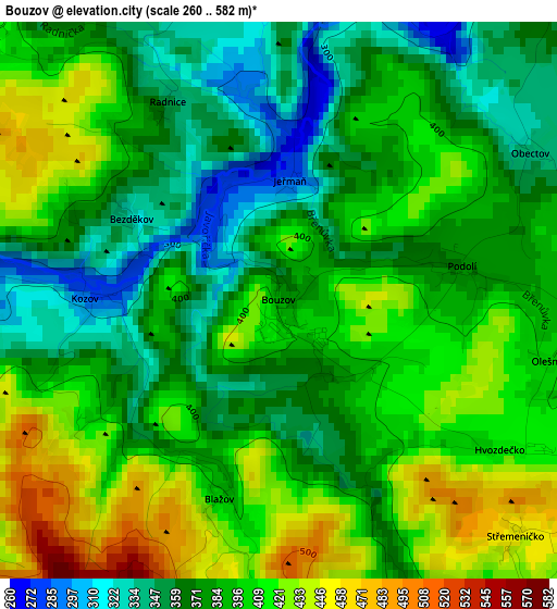
Below is the Elevation map of Bouzov, which displays elevation range with different colors. Scale of the first map is from 260 to 582 m (853 to 1909 ft) with average elevation of 390.2 meters (=1280 ft) [note 1]
These maps also provides idea of topography and contour of this city, they are displayed at different zoom levels. More info about maps, scale and edge coordinates you can find below images.
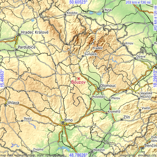
| \ | Map #1 | Topo.Map |
| Scale [m] | 260..582 m | × |
| Scale [ft] | 853..1909 ft | × |
| Average | 390.2 m = 1280 ft | × |
| Width | 6.32 km = 3.9 mi | 202.3 km = 125.7 mi |
| Height | 6.32 km = 3.9 mi | 202.2 km = 125.6 mi |
| ↑Max Latitude | 49.732673° | 50.60523° |
| Latitude at center | 49.70426° | 49.70426° |
| ↓Min Latitude | 49.675831° | 48.78626° |
| ← Min Longitude | 16.848935° | 15.48663° |
| Longitude center | 16.89288° | 16.89288° |
| →Max Longitude | 16.936825° | 18.29913° |
Nearby cities:
Cities around Bouzov sort by population:
• Litovel elevation 239 m
13.2 km,  91°
91°
• Mohelnice 278 m
8.3 km,  13°
13°
• Loštice 260 m
5.2 km,  29°
29°
• Konice 426 m
12.7 km,  181°
181°
• Medlov 252 m
15.3 km,  52°
52°
• Městečko Trnávka 319 m
11.9 km,  272°
272°
• Červenka 233 m
13.4 km,  82°
82°
• Jaroměřice 364 m
13.4 km,  229°
229°
• Úsov 285 m
13.4 km,  38°
38°
• Moravičany 249 m
7.6 km, 39°
• Bílá Lhota 293 m
5.9 km, 84°
• Dubicko 272 m
14.6 km,  20°
20°
Multilingual:
 En español:
Bouzov elevación 384 m.
 En France:
Bouzov élévation 384 m.


Sources and notes:
- [note 1] Map square and city borders are not equal. Map elevation data is calculated only from area inside that square.
- [src 1] Elevation data from geonames database provided with same terms of usage.
- [src 2] The elevation map of Bouzov is generated using elevation data from NASA's 3 arcsec (90m) resolution SRTM data.
- [src 3] Base (background) map © OpenStreetMap contributors tiles are generated by Geofabrik and OpenTopoMap.
Copyright & License:
This Bouzov Elevation Map is licensed under CC BY-SA. You may reuse any part from this page, if you give a proper credit by linking to this URL:
 More info on terms of use page.