Hluk elevation
Hluk (Zlín, Okres Uherské Hradiště), Czech Republic elevation is 225 meters and Hluk elevation in feet is 738 ft above sea level [src 1]. Hluk is a populated place (feature code) with elevation that is 120 meters (394 ft) smaller than average city elevation in Czech Republic.
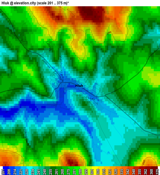
Below is the Elevation map of Hluk, which displays elevation range with different colors. Scale of the first map is from 201 to 375 m (659 to 1230 ft) with average elevation of 264.4 meters (=867 ft) [note 1]
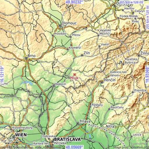
These maps also provides idea of topography and contour of this city, they are displayed at different zoom levels. More info about maps, scale and edge coordinates you can find below images.
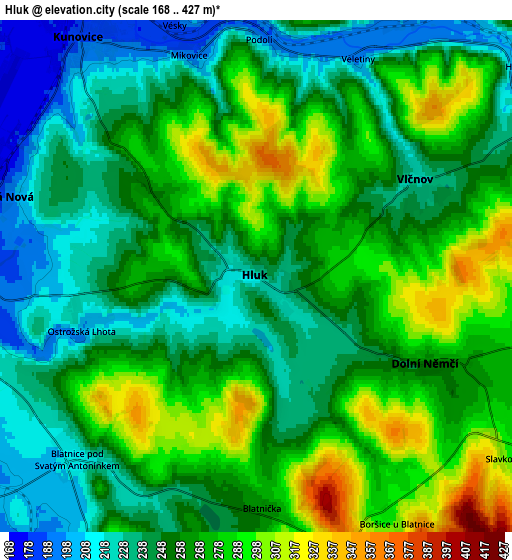
| \ | Map #1 | Map #2 | Topo.Map |
| Scale [m] | 201..375 m | 168..427 m | × |
| Scale [ft] | 659..1230 ft | 551..1401 ft | × |
| Average | 264.4 m = 867 ft | 259.2 m = 850 ft | × |
| Width | 6.41 km = 4 mi | 12.83 km = 8 mi | 205.2 km = 127.5 mi |
| Height | 6.41 km = 4 mi | 12.83 km = 8 mi | 205.2 km = 127.5 mi |
| ↑Max Latitude | 49.016879° | 49.045692° | 49.90232° |
| Latitude at center | 48.98805° | 48.98805° | 48.98805° |
| ↓Min Latitude | 48.959204° | 48.930341° | 48.05669° |
| ← Min Longitude | 17.483495° | 17.439549° | 16.12119° |
| Longitude center | 17.52744° | 17.52744° | 17.52744° |
| →Max Longitude | 17.571385° | 17.615331° | 18.93369° |
Nearby cities:
Cities around Hluk sort by population:
• Uherské Hradiště elevation 182 m
10.3 km,  331°
331°
• Uherský Brod 244 m
9.7 km,  64°
64°
• Kunovice 181 m
7.6 km, 326°
• Uherský Ostroh 178 m
10 km,  268°
268°
• Ostrožská Nová Ves 181 m
6.9 km,  285°
285°
• Nivnice 247 m
8.9 km,  99°
99°
• Vlčnov 223 m
4.7 km, 58°
• Dolní Němčí 257 m
4.8 km,  117°
117°
• Ostrožská Lhota 200 m
4.6 km,  252°
252°
• Lipov 228 m
10.4 km,  207°
207°
• Popovice 262 m
7.2 km,  359°
359°
• Louka 246 m
8.6 km,  198°
198°
Multilingual:
 En español:
Hluk elevación 225 m.
 En France:
Hluk élévation 225 m.


Sources and notes:
- [note 1] Map square and city borders are not equal. Map elevation data is calculated only from area inside that square.
- [src 1] Elevation data from geonames database provided with same terms of usage.
- [src 2] The elevation map of Hluk is generated using elevation data from NASA's 3 arcsec (90m) resolution SRTM data.
- [src 3] Base (background) map © OpenStreetMap contributors tiles are generated by Geofabrik and OpenTopoMap.
Copyright & License:
This Hluk Elevation Map is licensed under CC BY-SA. You may reuse any part from this page, if you give a proper credit by linking to this URL:
 More info on terms of use page.