Uherský Ostroh elevation
Uherský Ostroh (Zlín, Okres Uherské Hradiště), Czech Republic elevation is 178 meters and Uherský Ostroh elevation in feet is 584 ft above sea level [src 1]. Uherský Ostroh is a populated place (feature code) with elevation that is 167 meters (548 ft) smaller than average city elevation in Czech Republic.
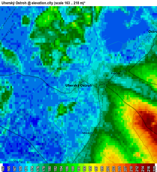
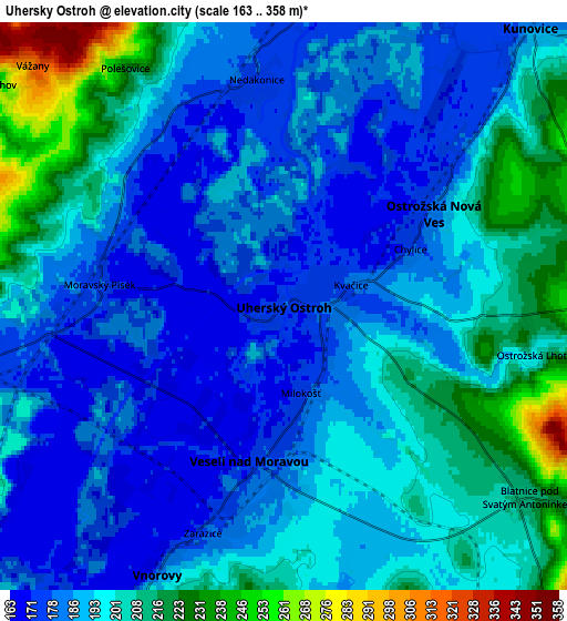
Below is the Elevation map of Uherský Ostroh, which displays elevation range with different colors. Scale of the first map is from 163 to 218 m (535 to 715 ft) with average elevation of 176 meters (=577 ft) [note 1]
These maps also provides idea of topography and contour of this city, they are displayed at different zoom levels. More info about maps, scale and edge coordinates you can find below images.
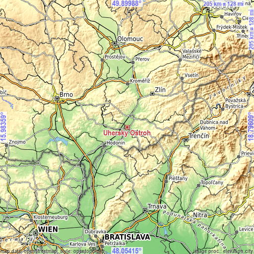
| \ | Map #1 | Map #2 | Topo.Map |
| Scale [m] | 163..218 m | 163..358 m | × |
| Scale [ft] | 535..715 ft | 535..1175 ft | × |
| Average | 176 m = 577 ft | 193.5 m = 635 ft | × |
| Width | 6.41 km = 4 mi | 12.83 km = 8 mi | 205.2 km = 127.5 mi |
| Height | 6.41 km = 4 mi | 12.83 km = 8 mi | 205.2 km = 127.5 mi |
| ↑Max Latitude | 49.014391° | 49.043205° | 49.89988° |
| Latitude at center | 48.98556° | 48.98556° | 48.98556° |
| ↓Min Latitude | 48.956713° | 48.927848° | 48.05415° |
| ← Min Longitude | 17.345895° | 17.301949° | 15.98359° |
| Longitude center | 17.38984° | 17.38984° | 17.38984° |
| →Max Longitude | 17.433785° | 17.477731° | 18.79609° |
Nearby cities:
Cities around Uherský Ostroh sort by population:
• Veselí nad Moravou elevation 170 m
3.7 km,  195°
195°
• Kunovice 181 m
8.8 km,  41°
41°
• Bzenec 188 m
9.1 km,  261°
261°
• Ostrožská Nová Ves 181 m
4 km,  58°
58°
• Vnorovy 186 m
6.7 km,  205°
205°
• Boršice 209 m
9 km,  341°
341°
• Moravský Písek 178 m
4.2 km,  276°
276°
• Polešovice 227 m
6.5 km,  326°
326°
• Ostrožská Lhota 200 m
5.8 km,  101°
101°
• Nedakonice 176 m
5.2 km,  353°
353°
• Hroznová Lhota 200 m
8.9 km,  167°
167°
• Domanín 229 m
7.9 km, 283°
Multilingual:
 En español:
Uherský Ostroh elevación 178 m.
 En France:
Uherský Ostroh élévation 178 m.
 Auf Deutsch:
Uherský Ostroh höhe über dem Meeresspiegel ist 178 m.

Sources and notes:
- [note 1] Map square and city borders are not equal. Map elevation data is calculated only from area inside that square.
- [src 1] Elevation data from geonames database provided with same terms of usage.
- [src 2] The elevation map of Uherský Ostroh is generated using elevation data from NASA's 3 arcsec (90m) resolution SRTM data.
- [src 3] Base (background) map © OpenStreetMap contributors tiles are generated by Geofabrik and OpenTopoMap.
Copyright & License:
This Uherský Ostroh Elevation Map is licensed under CC BY-SA. You may reuse any part from this page, if you give a proper credit by linking to this URL:
 More info on terms of use page.