Uherský Brod elevation
Uherský Brod (Zlín, Okres Uherské Hradiště), Czech Republic elevation is 244 meters and Uherský Brod elevation in feet is 801 ft above sea level [src 1]. Uherský Brod is a populated place (feature code) with elevation that is 101 meters (331 ft) smaller than average city elevation in Czech Republic.
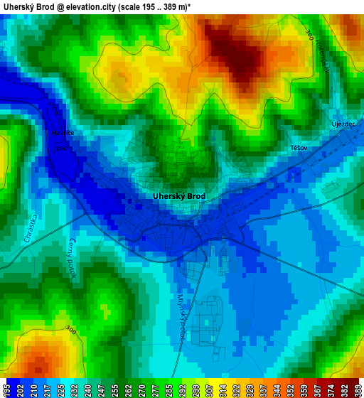
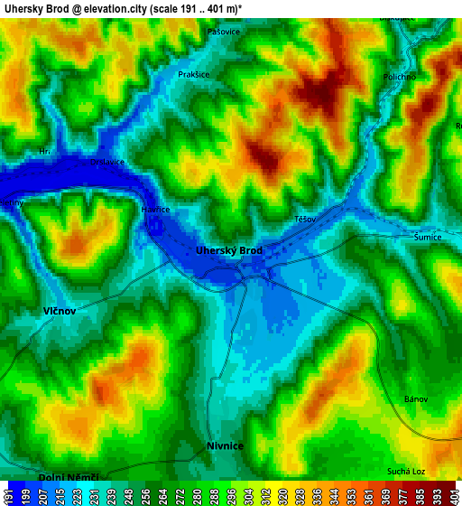
Below is the Elevation map of Uherský Brod, which displays elevation range with different colors. Scale of the first map is from 195 to 389 m (640 to 1276 ft) with average elevation of 254.2 meters (=834 ft) [note 1]
These maps also provides idea of topography and contour of this city, they are displayed at different zoom levels. More info about maps, scale and edge coordinates you can find below images.
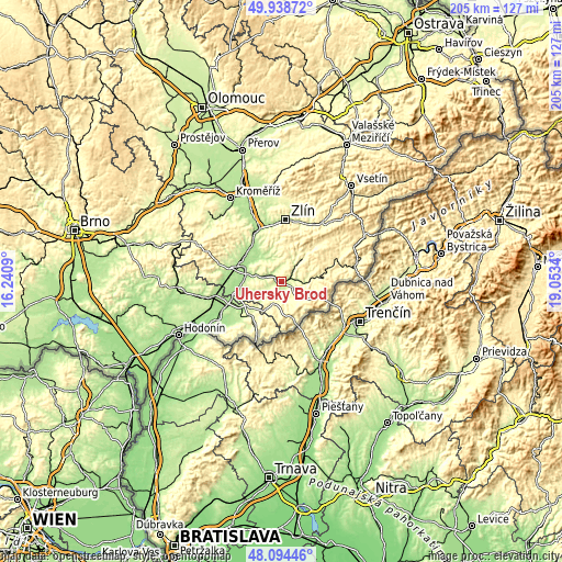
| \ | Map #1 | Map #2 | Topo.Map |
| Scale [m] | 195..389 m | 191..401 m | × |
| Scale [ft] | 640..1276 ft | 627..1316 ft | × |
| Average | 254.2 m = 834 ft | 274.5 m = 901 ft | × |
| Width | 6.41 km = 4 mi | 12.82 km = 8 mi | 205.1 km = 127.4 mi |
| Height | 6.41 km = 4 mi | 12.82 km = 8 mi | 205 km = 127.4 mi |
| ↑Max Latitude | 49.053938° | 49.082729° | 49.93872° |
| Latitude at center | 49.02513° | 49.02513° | 49.02513° |
| ↓Min Latitude | 48.996305° | 48.967464° | 48.09446° |
| ← Min Longitude | 17.603205° | 17.559259° | 16.2409° |
| Longitude center | 17.64715° | 17.64715° | 17.64715° |
| →Max Longitude | 17.691095° | 17.735041° | 19.0534° |
Nearby cities:
Cities around Uherský Brod sort by population:
• Luhačovice elevation 254 m
11.6 km,  44°
44°
• Hluk 225 m
9.7 km,  244°
244°
• Nivnice 247 m
5.6 km,  179°
179°
• Vlčnov 223 m
5.1 km,  250°
250°
• Dolní Němčí 257 m
7.7 km,  215°
215°
• Bánov 292 m
6.6 km,  128°
128°
• Šumice 226 m
5.5 km,  85°
85°
• Bílovice 190 m
10.9 km,  319°
319°
• Mistřice 250 m
10.6 km,  310°
310°
• Popovice 262 m
9.3 km,  289°
289°
• Suchá Loz 297 m
7.8 km,  141°
141°
• Záhorovice 249 m
9.6 km, 91°
Multilingual:
 En español:
Uherský Brod elevación 244 m.
 En France:
Uherský Brod élévation 244 m.
 Auf Deutsch:
Ungarisch Brod höhe über dem Meeresspiegel ist 244 m.

Sources and notes:
- [note 1] Map square and city borders are not equal. Map elevation data is calculated only from area inside that square.
- [src 1] Elevation data from geonames database provided with same terms of usage.
- [src 2] The elevation map of Uherský Brod is generated using elevation data from NASA's 3 arcsec (90m) resolution SRTM data.
- [src 3] Base (background) map © OpenStreetMap contributors tiles are generated by Geofabrik and OpenTopoMap.
Copyright & License:
This Uherský Brod Elevation Map is licensed under CC BY-SA. You may reuse any part from this page, if you give a proper credit by linking to this URL:
 More info on terms of use page.