Horažďovice elevation
Horažďovice (Plzeňský kraj, Okres Klatovy), Czech Republic elevation is 433 meters and Horažďovice elevation in feet is 1421 ft above sea level [src 1]. Horažďovice is a populated place (feature code) with elevation that is 88 meters (289 ft) bigger than average city elevation in Czech Republic.
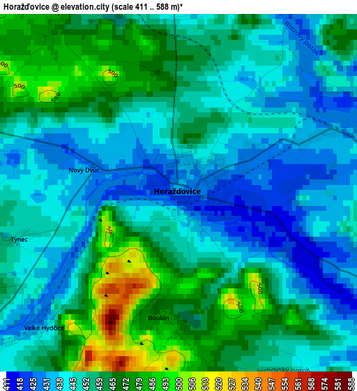
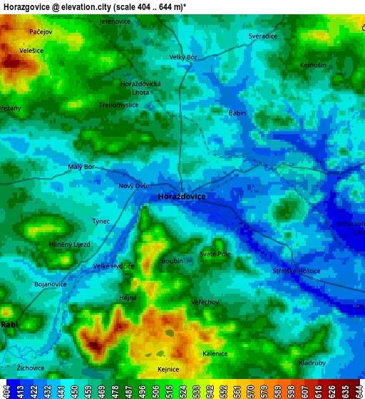
Below is the Elevation map of Horažďovice, which displays elevation range with different colors. Scale of the first map is from 411 to 588 m (1348 to 1929 ft) with average elevation of 454.2 meters (=1490 ft) [note 1]
These maps also provides idea of topography and contour of this city, they are displayed at different zoom levels. More info about maps, scale and edge coordinates you can find below images.
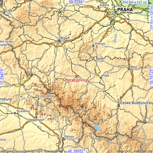
| \ | Map #1 | Map #2 | Topo.Map |
| Scale [m] | 411..588 m | 404..644 m | × |
| Scale [ft] | 1348..1929 ft | 1325..2113 ft | × |
| Average | 454.2 m = 1490 ft | 469.2 m = 1539 ft | × |
| Width | 6.37 km = 4 mi | 12.74 km = 7.9 mi | 203.8 km = 126.6 mi |
| Height | 6.37 km = 4 mi | 12.74 km = 7.9 mi | 203.8 km = 126.6 mi |
| ↑Max Latitude | 49.349326° | 49.377946° | 50.2288° |
| Latitude at center | 49.32069° | 49.32069° | 49.32069° |
| ↓Min Latitude | 49.292037° | 49.263367° | 48.39552° |
| ← Min Longitude | 13.657055° | 13.613109° | 12.29475° |
| Longitude center | 13.701° | 13.701° | 13.701° |
| →Max Longitude | 13.744945° | 13.788891° | 15.10725° |
Nearby cities:
Cities around Horažďovice sort by population:
• Strakonice elevation 403 m
16 km,  114°
114°
• Sušice 477 m
16.5 km,  232°
232°
• Blatná 442 m
17.5 km,  48°
48°
• Nepomuk 451 m
20.3 km,  334°
334°
• Plánice 559 m
18.3 km,  294°
294°
• Kolinec 536 m
19.1 km,  262°
262°
• Vacov 731 m
20.5 km,  174°
174°
• Hrádek 488 m
16.1 km,  245°
245°
• Kasejovice 541 m
16 km,  10°
10°
• Katovice 409 m
10.7 km,  119°
119°
• Sedlice 512 m
18.3 km,  69°
69°
• Radomyšl 457 m
16.6 km,  91°
91°
Multilingual:
 En español:
Horažďovice elevación 433 m.
 En France:
Horažďovice élévation 433 m.
 Auf Deutsch:
Horažďovice höhe über dem Meeresspiegel ist 433 m.

Sources and notes:
- [note 1] Map square and city borders are not equal. Map elevation data is calculated only from area inside that square.
- [src 1] Elevation data from geonames database provided with same terms of usage.
- [src 2] The elevation map of Horažďovice is generated using elevation data from NASA's 3 arcsec (90m) resolution SRTM data.
- [src 3] Base (background) map © OpenStreetMap contributors tiles are generated by Geofabrik and OpenTopoMap.
Copyright & License:
This Horažďovice Elevation Map is licensed under CC BY-SA. You may reuse any part from this page, if you give a proper credit by linking to this URL:
 More info on terms of use page.