Strakonice elevation
Strakonice (Jihočeský kraj, Okres Strakonice), Czech Republic elevation is 403 meters and Strakonice elevation in feet is 1322 ft above sea level [src 1]. Strakonice is a populated place (feature code) with elevation that is 58 meters (190 ft) bigger than average city elevation in Czech Republic.
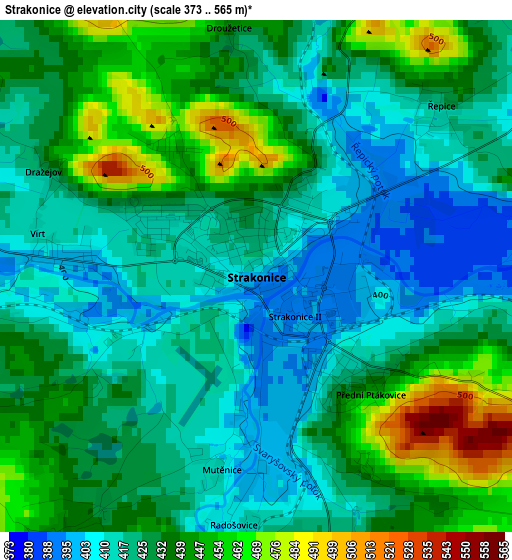
Below is the Elevation map of Strakonice, which displays elevation range with different colors. Scale of the first map is from 373 to 565 m (1224 to 1854 ft) with average elevation of 429.1 meters (=1408 ft) [note 1]
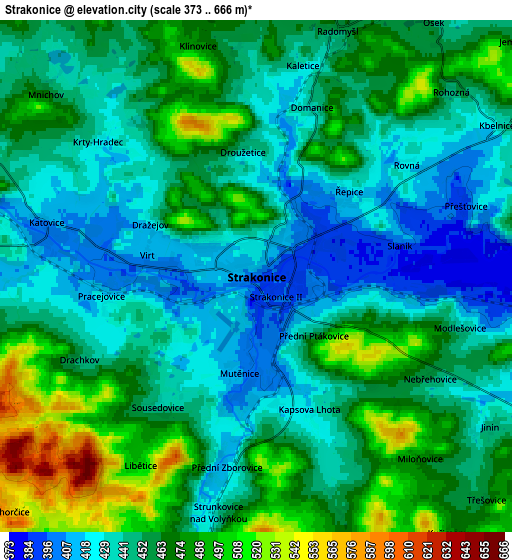
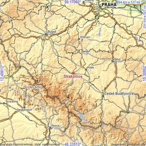
These maps also provides idea of topography and contour of this city, they are displayed at different zoom levels. More info about maps, scale and edge coordinates you can find below images.
| \ | Map #1 | Map #2 | Topo.Map |
| Scale [m] | 373..565 m | 373..666 m | × |
| Scale [ft] | 1224..1854 ft | 1224..2185 ft | × |
| Average | 429.1 m = 1408 ft | 455.2 m = 1493 ft | × |
| Width | 6.38 km = 4 mi | 12.76 km = 7.9 mi | 204.1 km = 126.8 mi |
| Height | 6.38 km = 4 mi | 12.76 km = 7.9 mi | 204.1 km = 126.8 mi |
| ↑Max Latitude | 49.290081° | 49.318735° | 50.17062° |
| Latitude at center | 49.26141° | 49.26141° | 49.26141° |
| ↓Min Latitude | 49.232723° | 49.204018° | 48.33513° |
| ← Min Longitude | 13.858425° | 13.814479° | 12.49612° |
| Longitude center | 13.90237° | 13.90237° | 13.90237° |
| →Max Longitude | 13.946315° | 13.990261° | 15.30862° |
Nearby cities:
Cities around Strakonice sort by population:
• Písek elevation 374 m
18.5 km,  73°
73°
• Blatná 442 m
18.2 km,  355°
355°
• Horažďovice 433 m
16 km,  294°
294°
• Volyně 463 m
10.7 km,  186°
186°
• Vlachovo Březí 552 m
20.4 km,  168°
168°
• Čkyně 527 m
17.1 km,  198°
198°
• Bavorov 441 m
20.1 km,  140°
140°
• Vacov 731 m
18.7 km,  222°
222°
• Katovice 409 m
5.4 km,  284°
284°
• Sedlice 512 m
13.1 km,  11°
11°
• Radomyšl 457 m
6.4 km,  18°
18°
• Mirotice 420 m
21 km,  27°
27°
Multilingual:
 En español:
Strakonice elevación 403 m.
 En France:
Strakonice élévation 403 m.
 Auf Deutsch:
Strakonitz höhe über dem Meeresspiegel ist 403 m.

Sources and notes:
- [note 1] Map square and city borders are not equal. Map elevation data is calculated only from area inside that square.
- [src 1] Elevation data from geonames database provided with same terms of usage.
- [src 2] The elevation map of Strakonice is generated using elevation data from NASA's 3 arcsec (90m) resolution SRTM data.
- [src 3] Base (background) map © OpenStreetMap contributors tiles are generated by Geofabrik and OpenTopoMap.
Copyright & License:
This Strakonice Elevation Map is licensed under CC BY-SA. You may reuse any part from this page, if you give a proper credit by linking to this URL:
 More info on terms of use page.