Mnichovo Hradiště elevation
Mnichovo Hradiště (Central Bohemia, Okres Mladá Boleslav), Czech Republic elevation is 241 meters and Mnichovo Hradiště elevation in feet is 791 ft above sea level [src 1]. Mnichovo Hradiště is a populated place (feature code) with elevation that is 104 meters (341 ft) smaller than average city elevation in Czech Republic.
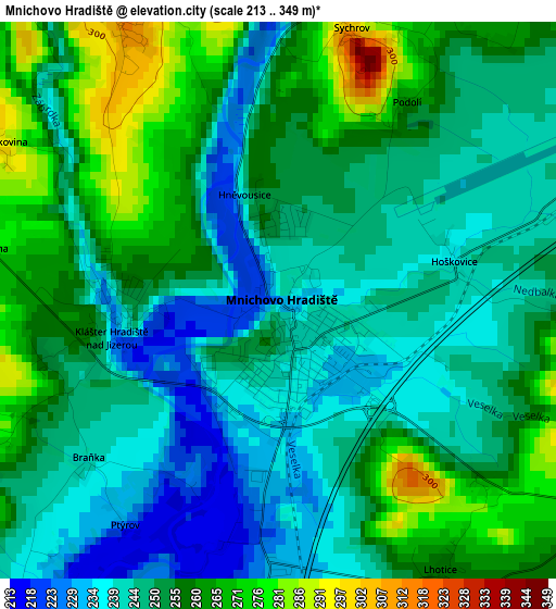
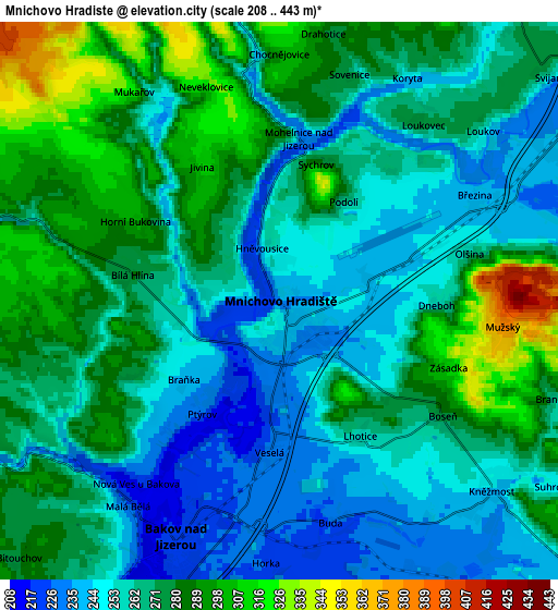
Below is the Elevation map of Mnichovo Hradiště, which displays elevation range with different colors. Scale of the first map is from 213 to 349 m (699 to 1145 ft) with average elevation of 251.5 meters (=825 ft) [note 1]
These maps also provides idea of topography and contour of this city, they are displayed at different zoom levels. More info about maps, scale and edge coordinates you can find below images.
| \ | Map #1 | Map #2 | Topo.Map |
| Scale [m] | 213..349 m | 208..443 m | × |
| Scale [ft] | 699..1145 ft | 682..1453 ft | × |
| Average | 251.5 m = 825 ft | 268.4 m = 881 ft | × |
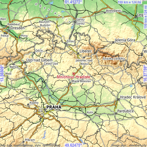
| Width | 6.21 km = 3.9 mi | 12.43 km = 7.7 mi | 198.8 km = 123.5 mi |
| Height | 6.21 km = 3.9 mi | 12.42 km = 7.7 mi | 198.8 km = 123.5 mi |
| ↑Max Latitude | 50.555128° | 50.58304° | 51.41272° |
| Latitude at center | 50.5272° | 50.5272° | 50.5272° |
| ↓Min Latitude | 50.499255° | 50.471294° | 49.62475° |
| ← Min Longitude | 14.927395° | 14.883449° | 13.56509° |
| Longitude center | 14.97134° | 14.97134° | 14.97134° |
| →Max Longitude | 15.015285° | 15.059231° | 16.37759° |
Nearby cities:
Cities around Mnichovo Hradiště sort by population:
• Mladá Boleslav elevation 241 m
13.8 km,  200°
200°
• Turnov 255 m
14.2 km,  63°
63°
• Bělá pod Bezdězem 297 m
12.2 km,  256°
256°
• Bakov nad Jizerou 222 m
5.4 km, 202°
• Kosmonosy 244 m
10.3 km, 196°
• Český Dub 328 m
14.9 km,  6°
6°
• Dolní Bousov 243 m
14.9 km,  131°
131°
• Sobotka 303 m
15.9 km,  114°
114°
• Kněžmost 244 m
6.3 km, 131°
• Příšovice 241 m
9.8 km,  54°
54°
• Žďár 239 m
7.9 km,  76°
76°
• Ohrazenice 288 m
13.4 km, 54°
Multilingual:
 En español:
Mnichovo Hradiště elevación 241 m.
 En France:
Mnichovo Hradiště élévation 241 m.
 Auf Deutsch:
Münchengrätz, Mnichovo Hradiště höhe über dem Meeresspiegel ist 241 m.

Sources and notes:
- [note 1] Map square and city borders are not equal. Map elevation data is calculated only from area inside that square.
- [src 1] Elevation data from geonames database provided with same terms of usage.
- [src 2] The elevation map of Mnichovo Hradiště is generated using elevation data from NASA's 3 arcsec (90m) resolution SRTM data.
- [src 3] Base (background) map © OpenStreetMap contributors tiles are generated by Geofabrik and OpenTopoMap.
Copyright & License:
This Mnichovo Hradiště Elevation Map is licensed under CC BY-SA. You may reuse any part from this page, if you give a proper credit by linking to this URL:
 More info on terms of use page.