Turnov elevation
Turnov (Liberecký kraj, Okres Semily), Czech Republic elevation is 255 meters and Turnov elevation in feet is 837 ft above sea level [src 1]. Turnov is a populated place (feature code) with elevation that is 90 meters (295 ft) smaller than average city elevation in Czech Republic.
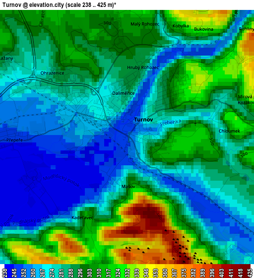
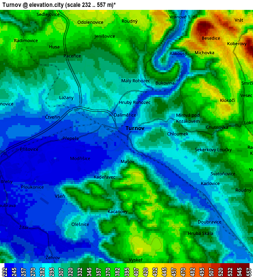
Below is the Elevation map of Turnov, which displays elevation range with different colors. Scale of the first map is from 238 to 425 m (781 to 1394 ft) with average elevation of 290.8 meters (=954 ft) [note 1]
These maps also provides idea of topography and contour of this city, they are displayed at different zoom levels. More info about maps, scale and edge coordinates you can find below images.
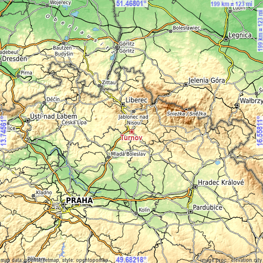
| \ | Map #1 | Map #2 | Topo.Map |
| Scale [m] | 238..425 m | 232..557 m | × |
| Scale [ft] | 781..1394 ft | 761..1827 ft | × |
| Average | 290.8 m = 954 ft | 320.1 m = 1050 ft | × |
| Width | 6.21 km = 3.9 mi | 12.41 km = 7.7 mi | 198.6 km = 123.4 mi |
| Height | 6.21 km = 3.9 mi | 12.41 km = 7.7 mi | 198.6 km = 123.4 mi |
| ↑Max Latitude | 50.611455° | 50.639333° | 51.46801° |
| Latitude at center | 50.58356° | 50.58356° | 50.58356° |
| ↓Min Latitude | 50.555649° | 50.527721° | 49.68218° |
| ← Min Longitude | 15.107915° | 15.063969° | 13.74561° |
| Longitude center | 15.15186° | 15.15186° | 15.15186° |
| →Max Longitude | 15.195805° | 15.239751° | 16.55811° |
Nearby cities:
Cities around Turnov sort by population:
• Semily elevation 321 m
13.1 km,  81°
81°
• Železný Brod 282 m
9.8 km,  47°
47°
• Český Dub 328 m
13.9 km,  307°
307°
• Hodkovice nad Mohelkou 378 m
10.1 km,  334°
334°
• Sobotka 303 m
13 km,  172°
172°
• Pěnčín 560 m
13 km,  27°
27°
• Kněžmost 244 m
13.2 km,  217°
217°
• Příšovice 241 m
4.8 km,  262°
262°
• Rovensko pod Troskami 304 m
9.3 km,  125°
125°
• Žďár 239 m
6.7 km,  228°
228°
• Malá Skála 326 m
7.6 km,  23°
23°
• Ohrazenice 288 m
2.4 km, 310°
Multilingual:
 En español:
Turnov elevación 255 m.
 En France:
Turnov élévation 255 m.


Sources and notes:
- [note 1] Map square and city borders are not equal. Map elevation data is calculated only from area inside that square.
- [src 1] Elevation data from geonames database provided with same terms of usage.
- [src 2] The elevation map of Turnov is generated using elevation data from NASA's 3 arcsec (90m) resolution SRTM data.
- [src 3] Base (background) map © OpenStreetMap contributors tiles are generated by Geofabrik and OpenTopoMap.
Copyright & License:
This Turnov Elevation Map is licensed under CC BY-SA. You may reuse any part from this page, if you give a proper credit by linking to this URL:
 More info on terms of use page.