Osečná elevation
Osečná (Liberecký kraj, Okres Liberec), Czech Republic elevation is 374 meters and Osečná elevation in feet is 1227 ft above sea level [src 1]. Osečná is a populated place (feature code) with elevation that is 29 meters (95 ft) bigger than average city elevation in Czech Republic.
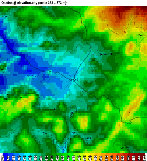
Below is the Elevation map of Osečná, which displays elevation range with different colors. Scale of the first map is from 338 to 573 m (1109 to 1880 ft) with average elevation of 421.9 meters (=1384 ft) [note 1]
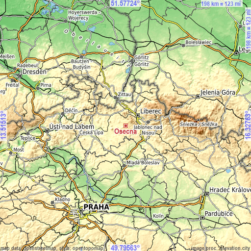
These maps also provides idea of topography and contour of this city, they are displayed at different zoom levels. More info about maps, scale and edge coordinates you can find below images.
| \ | Map #1 | Topo.Map |
| Scale [m] | 338..573 m | × |
| Scale [ft] | 1109..1880 ft | × |
| Average | 421.9 m = 1384 ft | × |
| Width | 6.19 km = 3.8 mi | 198.1 km = 123.1 mi |
| Height | 6.19 km = 3.8 mi | 198.1 km = 123.1 mi |
| ↑Max Latitude | 50.722719° | 51.57724° |
| Latitude at center | 50.69489° | 50.69489° |
| ↓Min Latitude | 50.667045° | 49.79563° |
| ← Min Longitude | 14.877435° | 13.51513° |
| Longitude center | 14.92138° | 14.92138° |
| →Max Longitude | 14.965325° | 16.32763° |
Nearby cities:
Cities around Osečná sort by population:
• Liberec elevation 359 m
12.4 km,  49°
49°
• Jablonec nad Nisou 518 m
17.9 km,  79°
79°
• Mimoň 281 m
14.4 km,  253°
253°
• Chrastava 297 m
14 km,  13°
13°
• Stráž pod Ralskem 315 m
8.5 km,  275°
275°
• Jablonné v Podještědí 323 m
13.8 km,  304°
304°
• Český Dub 328 m
6.5 km,  125°
125°
• Hodkovice nad Mohelkou 378 m
12.3 km,  105°
105°
• Stráž nad Nisou 362 m
13 km,  34°
34°
• Brniště 300 m
15.8 km, 283°
• Příšovice 241 m
17.3 km,  138°
138°
• Mníšek 387 m
17.9 km, 31°
Multilingual:
 En español:
Osečná elevación 374 m.
 En France:
Osečná élévation 374 m.


Sources and notes:
- [note 1] Map square and city borders are not equal. Map elevation data is calculated only from area inside that square.
- [src 1] Elevation data from geonames database provided with same terms of usage.
- [src 2] The elevation map of Osečná is generated using elevation data from NASA's 3 arcsec (90m) resolution SRTM data.
- [src 3] Base (background) map © OpenStreetMap contributors tiles are generated by Geofabrik and OpenTopoMap.
Copyright & License:
This Osečná Elevation Map is licensed under CC BY-SA. You may reuse any part from this page, if you give a proper credit by linking to this URL:
 More info on terms of use page.