Skuteč elevation
Skuteč (Pardubický, Okres Chrudim), Czech Republic elevation is 412 meters and Skuteč elevation in feet is 1352 ft above sea level [src 1]. Skuteč is a populated place (feature code) with elevation that is 67 meters (220 ft) bigger than average city elevation in Czech Republic.
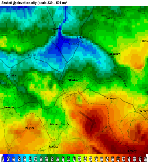
Below is the Elevation map of Skuteč, which displays elevation range with different colors. Scale of the first map is from 339 to 501 m (1112 to 1644 ft) with average elevation of 416.4 meters (=1366 ft) [note 1]
These maps also provides idea of topography and contour of this city, they are displayed at different zoom levels. More info about maps, scale and edge coordinates you can find below images.
| \ | Map #1 | Map #2 | Topo.Map |
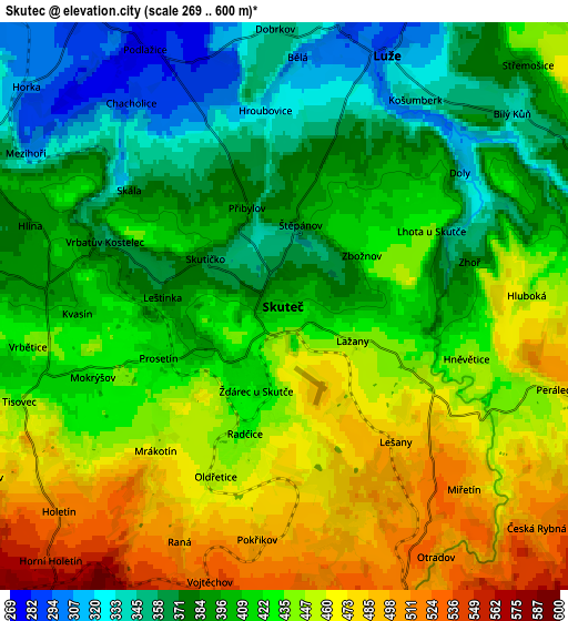
| Scale [m] | 339..501 m | 269..600 m | × |
| Scale [ft] | 1112..1644 ft | 883..1969 ft | × |
| Average | 416.4 m = 1366 ft | 418.3 m = 1372 ft | × |
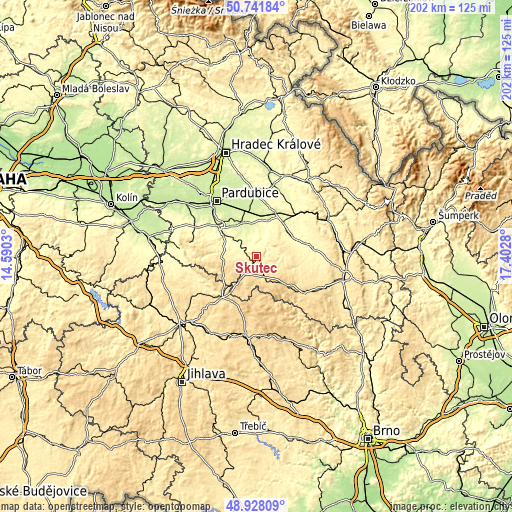
| Width | 6.3 km = 3.9 mi | 12.6 km = 7.8 mi | 201.7 km = 125.3 mi |
| Height | 6.3 km = 3.9 mi | 12.6 km = 7.8 mi | 201.7 km = 125.3 mi |
| ↑Max Latitude | 49.871801° | 49.900116° | 50.74184° |
| Latitude at center | 49.84347° | 49.84347° | 49.84347° |
| ↓Min Latitude | 49.815122° | 49.786758° | 48.92809° |
| ← Min Longitude | 15.952605° | 15.908659° | 14.5903° |
| Longitude center | 15.99655° | 15.99655° | 15.99655° |
| →Max Longitude | 16.040495° | 16.084441° | 17.4028° |
Nearby cities:
Cities around Skuteč sort by population:
• Hlinsko elevation 561 m
11.1 km,  215°
215°
• Slatiňany 267 m
15.7 km,  303°
303°
• Chrast 288 m
7.9 km,  325°
325°
• Luže 306 m
6 km,  22°
22°
• Proseč 519 m
9.5 km,  115°
115°
• Hrochův Týnec 243 m
14.3 km, 334°
• Svratka 637 m
15 km,  170°
170°
• Nasavrky 487 m
13.8 km,  270°
270°
• Krouna 537 m
8.2 km,  164°
164°
• Rosice 261 m
9.3 km,  339°
339°
• Chroustovice 258 m
12.5 km,  358°
358°
• Miřetice 394 m
8 km, 268°
Multilingual:
 En español:
Skuteč elevación 412 m.
 En France:
Skuteč élévation 412 m.


Sources and notes:
- [note 1] Map square and city borders are not equal. Map elevation data is calculated only from area inside that square.
- [src 1] Elevation data from geonames database provided with same terms of usage.
- [src 2] The elevation map of Skuteč is generated using elevation data from NASA's 3 arcsec (90m) resolution SRTM data.
- [src 3] Base (background) map © OpenStreetMap contributors tiles are generated by Geofabrik and OpenTopoMap.
Copyright & License:
This Skuteč Elevation Map is licensed under CC BY-SA. You may reuse any part from this page, if you give a proper credit by linking to this URL:
 More info on terms of use page.