Úvaly elevation
Úvaly (Central Bohemia, Okres Praha-východ), Czech Republic elevation is 249 meters and Úvaly elevation in feet is 817 ft above sea level [src 1]. Úvaly is a populated place (feature code) with elevation that is 96 meters (315 ft) smaller than average city elevation in Czech Republic.
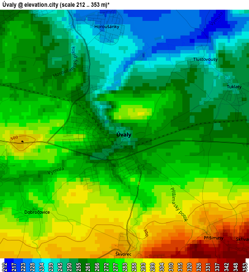
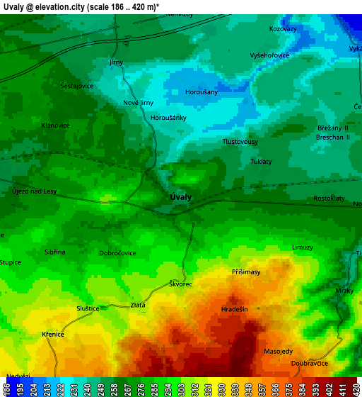
Below is the Elevation map of Úvaly, which displays elevation range with different colors. Scale of the first map is from 212 to 353 m (696 to 1158 ft) with average elevation of 270.2 meters (=886 ft) [note 1]
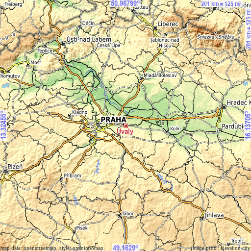
These maps also provides idea of topography and contour of this city, they are displayed at different zoom levels. More info about maps, scale and edge coordinates you can find below images.
| \ | Map #1 | Map #2 | Topo.Map |
| Scale [m] | 212..353 m | 186..420 m | × |
| Scale [ft] | 696..1158 ft | 610..1378 ft | × |
| Average | 270.2 m = 886 ft | 280.5 m = 920 ft | × |
| Width | 6.27 km = 3.9 mi | 12.54 km = 7.8 mi | 200.7 km = 124.7 mi |
| Height | 6.27 km = 3.9 mi | 12.54 km = 7.8 mi | 200.7 km = 124.7 mi |
| ↑Max Latitude | 50.102136° | 50.130315° | 50.96799° |
| Latitude at center | 50.07394° | 50.07394° | 50.07394° |
| ↓Min Latitude | 50.045728° | 50.017499° | 49.1629° |
| ← Min Longitude | 14.686855° | 14.642909° | 13.32455° |
| Longitude center | 14.7308° | 14.7308° | 14.7308° |
| →Max Longitude | 14.774745° | 14.818691° | 16.13705° |
Nearby cities:
Cities around Úvaly sort by population:
• Černý Most elevation 252 m
11.3 km,  287°
287°
• Horní Počernice 286 m
9.6 km,  296°
296°
• Říčany 343 m
10.7 km,  210°
210°
• Čelákovice 181 m
9.7 km,  8°
8°
• Český Brod 223 m
9.3 km,  89°
89°
• Dolní Počernice 234 m
11.4 km,  277°
277°
• Zeleneč 257 m
8.3 km,  323°
323°
• Šestajovice 261 m
5.3 km, 316°
• Jirny 249 m
5.2 km,  334°
334°
• Mukařov 432 m
9.2 km,  175°
175°
• Přerov nad Labem 180 m
11.7 km,  34°
34°
• Nehvizdy 242 m
6.3 km,  359°
359°
Multilingual:
 En español:
Úvaly elevación 249 m.
 En France:
Úvaly élévation 249 m.


Sources and notes:
- [note 1] Map square and city borders are not equal. Map elevation data is calculated only from area inside that square.
- [src 1] Elevation data from geonames database provided with same terms of usage.
- [src 2] The elevation map of Úvaly is generated using elevation data from NASA's 3 arcsec (90m) resolution SRTM data.
- [src 3] Base (background) map © OpenStreetMap contributors tiles are generated by Geofabrik and OpenTopoMap.
Copyright & License:
This Úvaly Elevation Map is licensed under CC BY-SA. You may reuse any part from this page, if you give a proper credit by linking to this URL:
 More info on terms of use page.