Horní Počernice elevation
Horní Počernice (Hlavní město Praha, Praha 20), Czech Republic elevation is 286 meters and Horní Počernice elevation in feet is 938 ft above sea level [src 1]. Horní Počernice is a section of populated place (feature code) with elevation that is 59 meters (194 ft) smaller than average city elevation in Czech Republic.
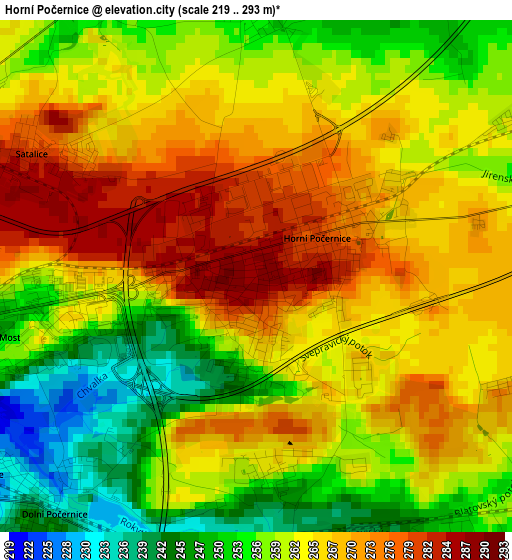
Below is the Elevation map of Horní Počernice, which displays elevation range with different colors. Scale of the first map is from 219 to 293 m (719 to 961 ft) with average elevation of 262.4 meters (=861 ft) [note 1]
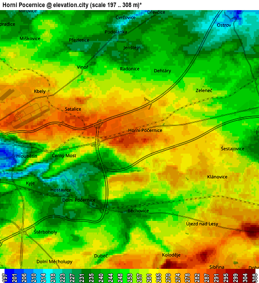
These maps also provides idea of topography and contour of this city, they are displayed at different zoom levels. More info about maps, scale and edge coordinates you can find below images.
| \ | Map #1 | Map #2 | Topo.Map |
| Scale [m] | 219..293 m | 197..308 m | × |
| Scale [ft] | 719..961 ft | 646..1010 ft | × |
| Average | 262.4 m = 861 ft | 254.6 m = 835 ft | × |
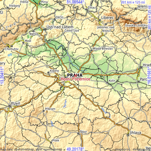
| Width | 6.27 km = 3.9 mi | 12.53 km = 7.8 mi | 200.5 km = 124.6 mi |
| Height | 6.27 km = 3.9 mi | 12.53 km = 7.8 mi | 200.5 km = 124.6 mi |
| ↑Max Latitude | 50.140273° | 50.16843° | 51.00544° |
| Latitude at center | 50.1121° | 50.1121° | 50.1121° |
| ↓Min Latitude | 50.08391° | 50.055704° | 49.20178° |
| ← Min Longitude | 14.566415° | 14.522469° | 13.20411° |
| Longitude center | 14.61036° | 14.61036° | 14.61036° |
| →Max Longitude | 14.654305° | 14.698251° | 16.01661° |
Nearby cities:
Cities around Horní Počernice sort by population:
• Černý Most elevation 252 m
2.3 km,  249°
249°
• Letňany 276 m
7.1 km,  289°
289°
• Prosek 249 m
7.4 km,  272°
272°
• Střížkov 296 m
8.5 km,  281°
281°
• Vysočany 209 m
6.7 km, 267°
• Kbely 272 m
4.9 km,  298°
298°
• Dolní Počernice 234 m
3.9 km,  225°
225°
• Satalice 280 m
3.1 km, 297°
• Hostavice 229 m
4.3 km,  240°
240°
• Zeleneč 257 m
4.3 km,  56°
56°
• Šestajovice 261 m
5 km,  94°
94°
• Jirny 249 m
6.3 km, 86°
Multilingual:
 En español:
Horní Počernice elevación 286 m.
 En France:
Horní Počernice élévation 286 m.
 Auf Deutsch:
Horní Počernice höhe über dem Meeresspiegel ist 286 m.

Sources and notes:
- [note 1] Map square and city borders are not equal. Map elevation data is calculated only from area inside that square.
- [src 1] Elevation data from geonames database provided with same terms of usage.
- [src 2] The elevation map of Horní Počernice is generated using elevation data from NASA's 3 arcsec (90m) resolution SRTM data.
- [src 3] Base (background) map © OpenStreetMap contributors tiles are generated by Geofabrik and OpenTopoMap.
Copyright & License:
This Horní Počernice Elevation Map is licensed under CC BY-SA. You may reuse any part from this page, if you give a proper credit by linking to this URL:
 More info on terms of use page.