Quesada elevation
Quesada (Alajuela, San Carlos), Costa Rica elevation is 651 meters and Quesada elevation in feet is 2136 ft above sea level [src 1]. Quesada is a populated place (feature code) with elevation that is 89 meters (292 ft) smaller than average city elevation in Costa Rica.
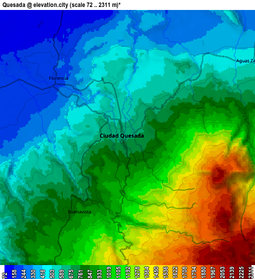
Below is the Elevation map of Quesada, which displays elevation range with different colors. Scale of the first map is from 236 to 1663 m (774 to 5456 ft) with average elevation of 749.2 meters (=2458 ft) [note 1]
These maps also provides idea of topography and contour of this city, they are displayed at different zoom levels. More info about maps, scale and edge coordinates you can find below images.

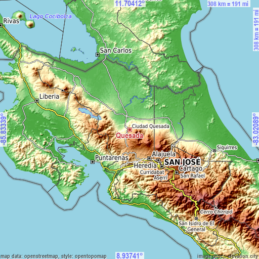
| \ | Map #1 | Map #2 | Topo.Map |
| Scale [m] | 236..1663 m | 72..2311 m | × |
| Scale [ft] | 774..5456 ft | 236..7582 ft | × |
| Average | 749.2 m = 2458 ft | 795.1 m = 2609 ft | × |
| Width | 9.61 km = 6 mi | 19.23 km = 11.9 mi | 307.6 km = 191.1 mi |
| Height | 9.61 km = 6 mi | 19.23 km = 11.9 mi | 307.7 km = 191.2 mi |
| ↑Max Latitude | 10.367041° | 10.410266° | 11.70412° |
| Latitude at center | 10.32381° | 10.32381° | 10.32381° |
| ↓Min Latitude | 10.280573° | 10.23733° | 8.93741° |
| ← Min Longitude | -84.471085° | -84.515031° | -85.83339° |
| Longitude center | -84.42714° | -84.42714° | -84.42714° |
| →Max Longitude | -84.383195° | -84.339249° | -83.02089° |
Nearby cities:
Cities around Quesada sort by population:
• Naranjo elevation 1044 m
25.6 km,  167°
167°
• San Ramón 1061 m
26.6 km,  190°
190°
• Río Segundo 1275 m
18.6 km,  119°
119°
• San Juan 1090 m
27.4 km,  153°
153°
• San Rafael 1074 m
29.3 km, 189°
• Zarcero 1752 m
15.9 km, 165°
• La Fortuna 256 m
28.9 km,  304°
304°
• Pocosol 370 m
21.3 km,  282°
282°
• Pital 161 m
21.9 km,  49°
49°
• Esquipulas 1011 m
29.7 km,  179°
179°
• La Virgen 188 m
33.3 km,  74°
74°
• Sarchí 973 m
27.5 km,  161°
161°
Multilingual:
 En español:
Quesada elevación 651 m.
 En France:
Quesada élévation 651 m.


Sources and notes:
- [note 1] Map square and city borders are not equal. Map elevation data is calculated only from area inside that square.
- [src 1] Elevation data from geonames database provided with same terms of usage.
- [src 2] The elevation map of Quesada is generated using elevation data from NASA's 3 arcsec (90m) resolution SRTM data.
- [src 3] Base (background) map © OpenStreetMap contributors tiles are generated by Geofabrik and OpenTopoMap.
Copyright & License:
This Quesada Elevation Map is licensed under CC BY-SA. You may reuse any part from this page, if you give a proper credit by linking to this URL:
 More info on terms of use page.