Nechí elevation
Nechí (Antioquia), Colombia elevation is 31 meters and Nechí elevation in feet is 102 ft above sea level [src 1]. Nechí is a seat of a second-order administrative division (feature code) with elevation that is 1118 meters (3668 ft) smaller than average city elevation in Colombia.
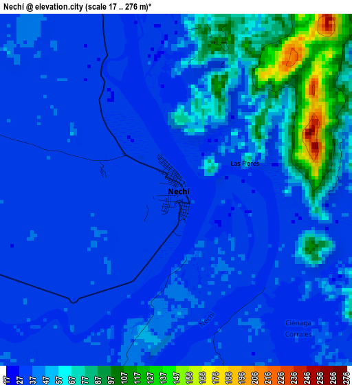
Below is the Elevation map of Nechí, which displays elevation range with different colors. Scale of the first map is from 17 to 276 m (56 to 906 ft) with average elevation of 46.2 meters (=152 ft) [note 1]
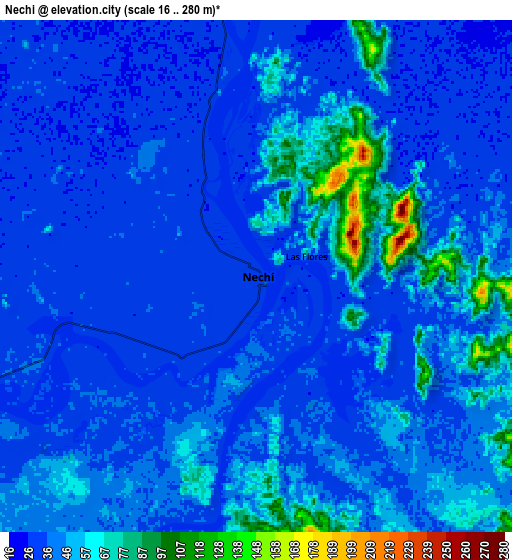
These maps also provides idea of topography and contour of this city, they are displayed at different zoom levels. More info about maps, scale and edge coordinates you can find below images.
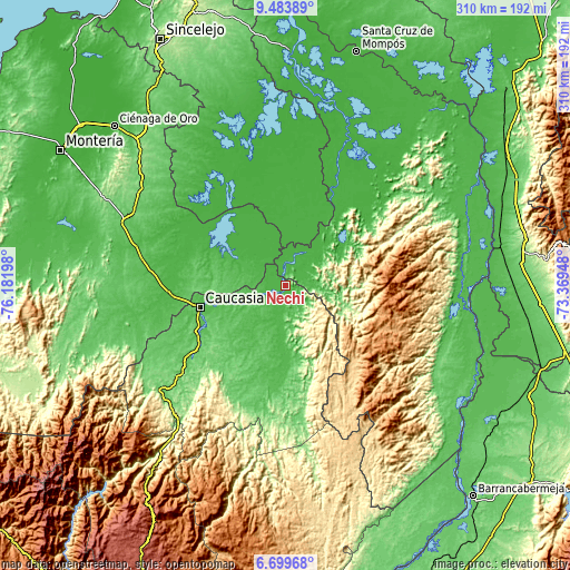
| \ | Map #1 | Map #2 | Topo.Map |
| Scale [m] | 17..276 m | 16..280 m | × |
| Scale [ft] | 56..906 ft | 52..919 ft | × |
| Average | 46.2 m = 152 ft | 42.7 m = 140 ft | × |
| Width | 9.68 km = 6 mi | 19.35 km = 12 mi | 309.6 km = 192.4 mi |
| Height | 9.68 km = 6 mi | 19.35 km = 12 mi | 309.6 km = 192.4 mi |
| ↑Max Latitude | 8.137695° | 8.181196° | 9.48389° |
| Latitude at center | 8.09419° | 8.09419° | 8.09419° |
| ↓Min Latitude | 8.05068° | 8.007166° | 6.69968° |
| ← Min Longitude | -74.819675° | -74.863621° | -76.18198° |
| Longitude center | -74.77573° | -74.77573° | -74.77573° |
| →Max Longitude | -74.731785° | -74.687839° | -73.36948° |
Nearby cities:
Cities around Nechí sort by population:
• Caucasia elevation 50 m
47.5 km,  255°
255°
• El Bagre 51 m
54.7 km,  183°
183°
• San Carlos 59 m
33.6 km, 179°
• Ayapel 25 m
46.9 km,  301°
301°
• Zaragoza 66 m
68 km,  188°
188°
• Majagual 29 m
52.2 km,  17°
17°
• Pueblo Nuevo 32 m
25.9 km,  309°
309°
• Achí 23 m
58.1 km, 24°
• Montecristo 84 m
40.2 km,  55°
55°
• La Apartada 66 m
62 km,  265°
265°
• Guaranda 23 m
49.2 km,  32°
32°
• San Jacinto del Cauca 29 m
18.3 km, 19°
Multilingual:
 En español:
Nechí elevación 31 m.
 En France:
Nechí élévation 31 m.


Sources and notes:
- [note 1] Map square and city borders are not equal. Map elevation data is calculated only from area inside that square.
- [src 1] Elevation data from geonames database provided with same terms of usage.
- [src 2] The elevation map of Nechí is generated using elevation data from NASA's 3 arcsec (90m) resolution SRTM data.
- [src 3] Base (background) map © OpenStreetMap contributors tiles are generated by Geofabrik and OpenTopoMap.
Copyright & License:
This Nechí Elevation Map is licensed under CC BY-SA. You may reuse any part from this page, if you give a proper credit by linking to this URL:
 More info on terms of use page.