San Carlos elevation
San Carlos (Antioquia, El Bagre), Colombia elevation is 59 meters and San Carlos elevation in feet is 194 ft above sea level [src 1]. San Carlos is a populated place (feature code) with elevation that is 1090 meters (3576 ft) smaller than average city elevation in Colombia.
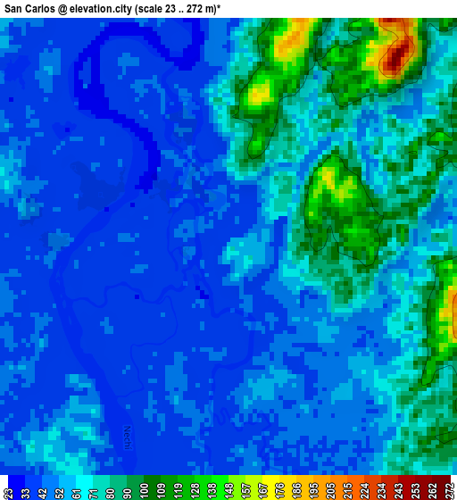
Below is the Elevation map of San Carlos, which displays elevation range with different colors. Scale of the first map is from 23 to 272 m (75 to 892 ft) with average elevation of 59.4 meters (=195 ft) [note 1]
These maps also provides idea of topography and contour of this city, they are displayed at different zoom levels. More info about maps, scale and edge coordinates you can find below images.
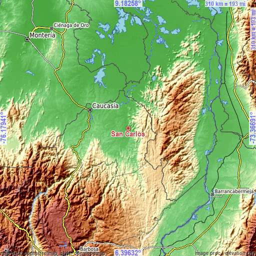
| \ | Map #1 | Map #2 | Topo.Map |
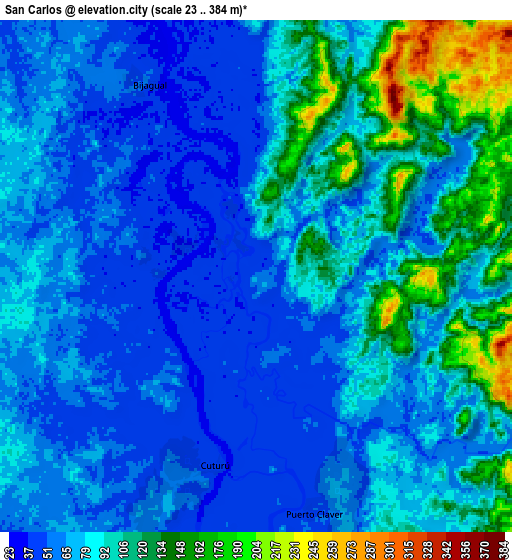
| Scale [m] | 23..272 m | 23..384 m | × |
| Scale [ft] | 75..892 ft | 75..1260 ft | × |
| Average | 59.4 m = 195 ft | 82.3 m = 270 ft | × |
| Width | 9.68 km = 6 mi | 19.36 km = 12 mi | 309.8 km = 192.5 mi |
| Height | 9.68 km = 6 mi | 19.36 km = 12 mi | 309.8 km = 192.5 mi |
| ↑Max Latitude | 7.835307° | 7.87884° | 9.18258° |
| Latitude at center | 7.79177° | 7.79177° | 7.79177° |
| ↓Min Latitude | 7.748228° | 7.704682° | 6.39632° |
| ← Min Longitude | -74.817105° | -74.861051° | -76.17941° |
| Longitude center | -74.77316° | -74.77316° | -74.77316° |
| →Max Longitude | -74.729215° | -74.685269° | -73.36691° |
Nearby cities:
Cities around San Carlos sort by population:
• Montelíbano elevation 46 m
74.2 km,  286°
286°
• Caucasia 50 m
51.1 km,  295°
295°
• El Bagre 51 m
21.3 km,  190°
190°
• Ayapel 25 m
70.7 km,  325°
325°
• Zaragoza 66 m
35.2 km,  197°
197°
• Pueblo Nuevo 32 m
54 km,  337°
337°
• Nechí 31 m
33.6 km,  359°
359°
• Montecristo 84 m
65.2 km,  30°
30°
• Cáceres 95 m
67.6 km,  249°
249°
• Tarazá 92 m
72.9 km, 251°
• La Apartada 66 m
68.4 km, 294°
• San Jacinto del Cauca 29 m
51.2 km,  6°
6°
Multilingual:
 En español:
San Carlos elevación 59 m.
 En France:
San Carlos élévation 59 m.
 Auf Deutsch:
San Carlos höhe über dem Meeresspiegel ist 59 m.

Sources and notes:
- [note 1] Map square and city borders are not equal. Map elevation data is calculated only from area inside that square.
- [src 1] Elevation data from geonames database provided with same terms of usage.
- [src 2] The elevation map of San Carlos is generated using elevation data from NASA's 3 arcsec (90m) resolution SRTM data.
- [src 3] Base (background) map © OpenStreetMap contributors tiles are generated by Geofabrik and OpenTopoMap.
Copyright & License:
This San Carlos Elevation Map is licensed under CC BY-SA. You may reuse any part from this page, if you give a proper credit by linking to this URL:
 More info on terms of use page.