Yangchun elevation
Yangchun (Guangdong), China elevation is 22 meters and Yangchun elevation in feet is 72 ft above sea level [src 1]. Yangchun is a populated place (feature code) with elevation that is 536 meters (1759 ft) smaller than average city elevation in China.
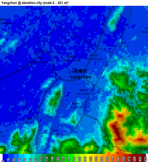
Below is the Elevation map of Yangchun, which displays elevation range with different colors. Scale of the first map is from 0 to 421 m (0 to 1381 ft) with average elevation of 57.8 meters (=190 ft) [note 1]
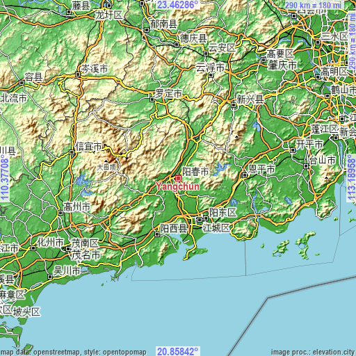
These maps also provides idea of topography and contour of this city, they are displayed at different zoom levels. More info about maps, scale and edge coordinates you can find below images.
| \ | Map #1 | Map #2 | Topo.Map |
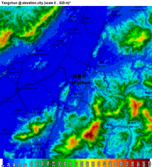
| Scale [m] | 0..421 m | 0..629 m | × |
| Scale [ft] | 0..1381 ft | 0..2064 ft | × |
| Average | 57.8 m = 190 ft | 103 m = 338 ft | × |
| Width | 9.05 km = 5.6 mi | 18.1 km = 11.2 mi | 289.6 km = 179.9 mi |
| Height | 9.05 km = 5.6 mi | 18.1 km = 11.2 mi | 289.6 km = 179.9 mi |
| ↑Max Latitude | 22.207361° | 22.248041° | 23.46286° |
| Latitude at center | 22.16667° | 22.16667° | 22.16667° |
| ↓Min Latitude | 22.125967° | 22.085252° | 20.85842° |
| ← Min Longitude | 111.739385° | 111.695439° | 110.37708° |
| Longitude center | 111.78333° | 111.78333° | 111.78333° |
| →Max Longitude | 111.827275° | 111.871221° | 113.18958° |
Nearby cities:
Cities around Yangchun sort by population:
• Yunfu elevation 76 m
88.7 km,  17°
17°
• Yangjiang 15 m
39.2 km,  151°
151°
• Gaozhou 57 m
99.8 km,  255°
255°
• Encheng 25 m
53.7 km,  87°
87°
• Xinyi 89 m
89 km,  284°
284°
• Tangping 19 m
21.7 km,  133°
133°
• Changsha 6 m
95.8 km,  75°
75°
• Dongzhen 90 m
90.1 km,  285°
285°
• Xincheng 33 m
74.8 km,  37°
37°
• Luocheng 50 m
70.6 km,  341°
341°
• Zhize 20 m
48.9 km,  200°
200°
• Dongcheng 20 m
39.4 km,  143°
143°
Multilingual:
 En español:
Yangchun elevación 22 m.
 En France:
Yangchun élévation 22 m.


Sources and notes:
- [note 1] Map square and city borders are not equal. Map elevation data is calculated only from area inside that square.
- [src 1] Elevation data from geonames database provided with same terms of usage.
- [src 2] The elevation map of Yangchun is generated using elevation data from NASA's 3 arcsec (90m) resolution SRTM data.
- [src 3] Base (background) map © OpenStreetMap contributors tiles are generated by Geofabrik and OpenTopoMap.
Copyright & License:
This Yangchun Elevation Map is licensed under CC BY-SA. You may reuse any part from this page, if you give a proper credit by linking to this URL:
 More info on terms of use page.