Shahecheng elevation
Shahecheng (Hebei), China elevation is 73 meters and Shahecheng elevation in feet is 240 ft above sea level [src 1]. Shahecheng is a populated place (feature code) with elevation that is 485 meters (1591 ft) smaller than average city elevation in China.
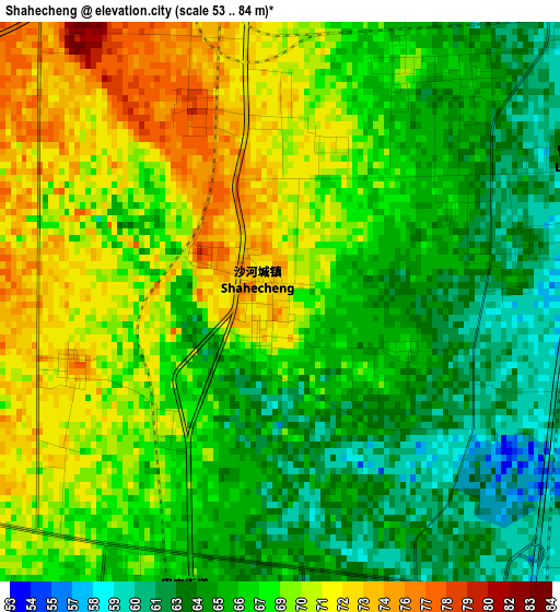
Below is the Elevation map of Shahecheng, which displays elevation range with different colors. Scale of the first map is from 53 to 84 m (174 to 276 ft) with average elevation of 67.4 meters (=221 ft) [note 1]
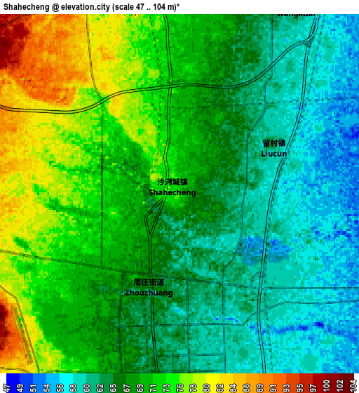
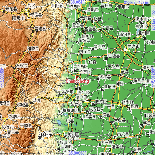
These maps also provides idea of topography and contour of this city, they are displayed at different zoom levels. More info about maps, scale and edge coordinates you can find below images.
| \ | Map #1 | Map #2 | Topo.Map |
| Scale [m] | 53..84 m | 47..104 m | × |
| Scale [ft] | 174..276 ft | 154..341 ft | × |
| Average | 67.4 m = 221 ft | 67.8 m = 222 ft | × |
| Width | 7.81 km = 4.9 mi | 15.62 km = 9.7 mi | 249.9 km = 155.3 mi |
| Height | 7.81 km = 4.9 mi | 15.62 km = 9.7 mi | 249.9 km = 155.3 mi |
| ↑Max Latitude | 36.973447° | 37.008547° | 38.054° |
| Latitude at center | 36.93833° | 36.93833° | 36.93833° |
| ↓Min Latitude | 36.903197° | 36.868048° | 35.80608° |
| ← Min Longitude | 114.461885° | 114.417939° | 113.09958° |
| Longitude center | 114.50583° | 114.50583° | 114.50583° |
| →Max Longitude | 114.549775° | 114.593721° | 115.91208° |
Nearby cities:
Cities around Shahecheng sort by population:
• Handan elevation 66 m
37.7 km,  185°
185°
• Anyang 70 m
94.3 km, 186°
• Xingtai 76 m
13.9 km,  355°
355°
• Linshui 138 m
63.1 km,  205°
205°
• Hecun 247 m
57.1 km,  217°
217°
• Nangong 29 m
90 km,  58°
58°
• Pengcheng 147 m
63.9 km, 207°
• Yixing 1379 m
96.5 km,  297°
297°
• Daming 48 m
92.2 km,  141°
141°
• Guantao 43 m
82.1 km,  122°
122°
• Mingzhou 39 m
66.8 km,  86°
86°
• Xinmatou 41 m
60.6 km,  102°
102°
Multilingual:
 En español:
Shahecheng elevación 73 m.
 En France:
Shahecheng élévation 73 m.
 Auf Deutsch:
Shahecheng höhe über dem Meeresspiegel ist 73 m.

Sources and notes:
- [note 1] Map square and city borders are not equal. Map elevation data is calculated only from area inside that square.
- [src 1] Elevation data from geonames database provided with same terms of usage.
- [src 2] The elevation map of Shahecheng is generated using elevation data from NASA's 3 arcsec (90m) resolution SRTM data.
- [src 3] Base (background) map © OpenStreetMap contributors tiles are generated by Geofabrik and OpenTopoMap.
Copyright & License:
This Shahecheng Elevation Map is licensed under CC BY-SA. You may reuse any part from this page, if you give a proper credit by linking to this URL:
 More info on terms of use page.