Xunyi Chengguanzhen elevation
Xunyi Chengguanzhen (Shaanxi), China elevation is 1163 meters and Xunyi Chengguanzhen elevation in feet is 3816 ft above sea level [src 1]. Xunyi Chengguanzhen is a seat of a third-order administrative division (feature code) with elevation that is 605 meters (1985 ft) bigger than average city elevation in China.
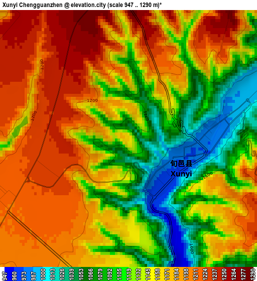
Below is the Elevation map of Xunyi Chengguanzhen, which displays elevation range with different colors. Scale of the first map is from 947 to 1290 m (3107 to 4232 ft) with average elevation of 1150.7 meters (=3775 ft) [note 1]
These maps also provides idea of topography and contour of this city, they are displayed at different zoom levels. More info about maps, scale and edge coordinates you can find below images.
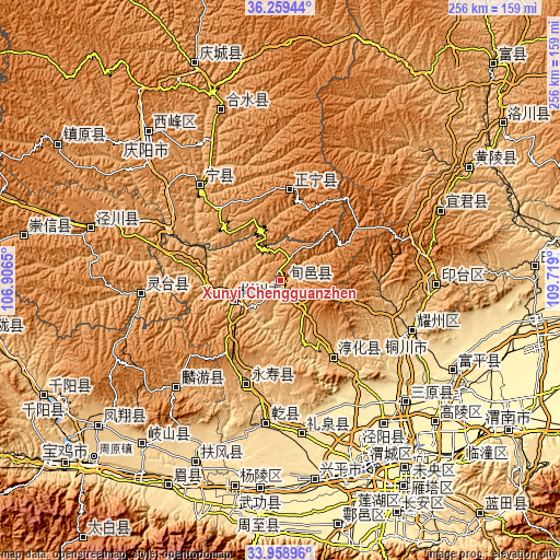
| \ | Map #1 | Topo.Map |
| Scale [m] | 947..1290 m | × |
| Scale [ft] | 3107..4232 ft | × |
| Average | 1150.7 m = 3775 ft | × |
| Width | 7.99 km = 5 mi | 255.8 km = 158.9 mi |
| Height | 7.99 km = 5 mi | 255.8 km = 158.9 mi |
| ↑Max Latitude | 35.153258° | 36.25944° |
| Latitude at center | 35.11732° | 35.11732° |
| ↓Min Latitude | 35.081366° | 33.95896° |
| ← Min Longitude | 108.268805° | 106.9065° |
| Longitude center | 108.31275° | 108.31275° |
| →Max Longitude | 108.356695° | 109.719° |
Nearby cities:
Cities around Xunyi Chengguanzhen sort by population:
• Tongchuanshi elevation 834 m
70.4 km,  93°
93°
• Jinggan 409 m
80.8 km,  143°
143°
• Sanyuan Chengguanzhen 425 m
79.2 km,  134°
134°
• Liquan Chengguanzhen 560 m
71.5 km,  171°
171°
• Jiuchenggong 1038 m
68.4 km,  224°
224°
• Yaozhou 627 m
64.3 km,  111°
111°
• Tongchuan 711 m
63 km, 112°
• Xinning 1018 m
55.1 km,  319°
319°
• Jianjun 982 m
49.9 km,  198°
198°
• Zhaoren 1196 m
48.4 km,  281°
281°
• Chunhua 850 m
42.7 km,  145°
145°
• Shanhe 1358 m
41.1 km,  6°
6°
Multilingual:
 En español:
Xunyi Chengguanzhen elevación 1163 m.
 En France:
Xunyi Chengguanzhen élévation 1163 m.
 Auf Deutsch:
Xunyi Chengguanzhen höhe über dem Meeresspiegel ist 1163 m.
 На русском:
Xunyi Chengguanzhen высота над уровнем моря 1163 м
Sources and notes:
- [note 1] Map square and city borders are not equal. Map elevation data is calculated only from area inside that square.
- [src 1] Elevation data from geonames database provided with same terms of usage.
- [src 2] The elevation map of Xunyi Chengguanzhen is generated using elevation data from NASA's 3 arcsec (90m) resolution SRTM data.
- [src 3] Base (background) map © OpenStreetMap contributors tiles are generated by Geofabrik and OpenTopoMap.
Copyright & License:
This Xunyi Chengguanzhen Elevation Map is licensed under CC BY-SA. You may reuse any part from this page, if you give a proper credit by linking to this URL:
 More info on terms of use page.