Zhongfang elevation
Zhongfang (Hunan), China elevation is 208 meters and Zhongfang elevation in feet is 682 ft above sea level [src 1]. Zhongfang is a seat of a third-order administrative division (feature code) with elevation that is 350 meters (1148 ft) smaller than average city elevation in China.
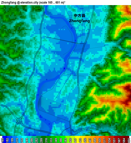
Below is the Elevation map of Zhongfang, which displays elevation range with different colors. Scale of the first map is from 165 to 601 m (541 to 1972 ft) with average elevation of 275.6 meters (=904 ft) [note 1]
These maps also provides idea of topography and contour of this city, they are displayed at different zoom levels. More info about maps, scale and edge coordinates you can find below images.
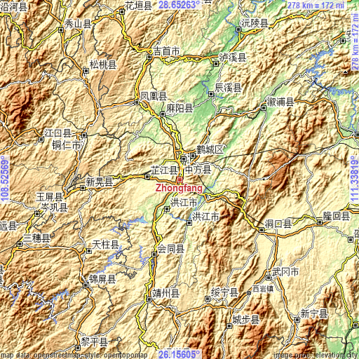
| \ | Map #1 | Topo.Map |
| Scale [m] | 165..601 m | × |
| Scale [ft] | 541..1972 ft | × |
| Average | 275.6 m = 904 ft | × |
| Width | 8.68 km = 5.4 mi | 277.6 km = 172.5 mi |
| Height | 8.68 km = 5.4 mi | 277.6 km = 172.5 mi |
| ↑Max Latitude | 27.450394° | 28.65263° |
| Latitude at center | 27.41139° | 27.41139° |
| ↓Min Latitude | 27.372372° | 26.15605° |
| ← Min Longitude | 109.887995° | 108.52569° |
| Longitude center | 109.93194° | 109.93194° |
| →Max Longitude | 109.975885° | 111.33819° |
Nearby cities:
Cities around Zhongfang sort by population:
• Huaihua elevation 236 m
18.3 km,  22°
22°
• Hongjiang 197 m
34.1 km,  169°
169°
• Anjiang 196 m
19.7 km,  121°
121°
• Qiancheng 214 m
30.1 km,  213°
213°
• Luyang 261 m
28.8 km,  34°
34°
• Huaqiao 270 m
38.9 km, 32°
• Luojiu 259 m
16.8 km,  313°
313°
• Jiangshi 197 m
37.3 km, 210°
• Jiangkouxu 174 m
36.9 km,  328°
328°
• Nanmuping 359 m
27.4 km,  245°
245°
• Shuangxi 238 m
21.7 km,  200°
200°
• Zhijiang 267 m
27.4 km,  280°
280°
Multilingual:
 En español:
Zhongfang elevación 208 m.
 En France:
Zhongfang élévation 208 m.
 Auf Deutsch:
Zhongfang höhe über dem Meeresspiegel ist 208 m.

Sources and notes:
- [note 1] Map square and city borders are not equal. Map elevation data is calculated only from area inside that square.
- [src 1] Elevation data from geonames database provided with same terms of usage.
- [src 2] The elevation map of Zhongfang is generated using elevation data from NASA's 3 arcsec (90m) resolution SRTM data.
- [src 3] Base (background) map © OpenStreetMap contributors tiles are generated by Geofabrik and OpenTopoMap.
Copyright & License:
This Zhongfang Elevation Map is licensed under CC BY-SA. You may reuse any part from this page, if you give a proper credit by linking to this URL:
 More info on terms of use page.