Luyang elevation
Luyang (Hunan), China elevation is 261 meters and Luyang elevation in feet is 856 ft above sea level [src 1]. Luyang is a populated place (feature code) with elevation that is 297 meters (974 ft) smaller than average city elevation in China.
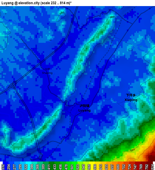
Below is the Elevation map of Luyang, which displays elevation range with different colors. Scale of the first map is from 232 to 814 m (761 to 2671 ft) with average elevation of 294.8 meters (=967 ft) [note 1]
These maps also provides idea of topography and contour of this city, they are displayed at different zoom levels. More info about maps, scale and edge coordinates you can find below images.
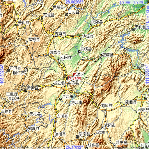
| \ | Map #1 | Topo.Map |
| Scale [m] | 232..814 m | × |
| Scale [ft] | 761..2671 ft | × |
| Average | 294.8 m = 967 ft | × |
| Width | 8.66 km = 5.4 mi | 277.1 km = 172.2 mi |
| Height | 8.66 km = 5.4 mi | 277.1 km = 172.2 mi |
| ↑Max Latitude | 27.662819° | 28.86268° |
| Latitude at center | 27.62389° | 27.62389° |
| ↓Min Latitude | 27.584947° | 26.37092° |
| ← Min Longitude | 110.054945° | 108.69264° |
| Longitude center | 110.09889° | 110.09889° |
| →Max Longitude | 110.142835° | 111.50514° |
Nearby cities:
Cities around Luyang sort by population:
• Huaihua elevation 236 m
11.5 km,  234°
234°
• Anjiang 196 m
33.9 km,  179°
179°
• Longtou’an 150 m
23.9 km,  77°
77°
• Anping 138 m
27 km,  3°
3°
• Tongwan 174 m
18.2 km,  105°
105°
• Huaqiao 270 m
10.3 km,  24°
24°
• Luojiu 259 m
31 km,  247°
247°
• Huomachong 178 m
31.6 km, 24°
• Huangxikou 134 m
30.1 km,  69°
69°
• Zhongfang 208 m
28.8 km,  214°
214°
• Xiaolongmen 187 m
20.7 km, 17°
• Xianrenwan 151 m
27 km,  57°
57°
Multilingual:
 En español:
Luyang elevación 261 m.
 En France:
Luyang élévation 261 m.


Sources and notes:
- [note 1] Map square and city borders are not equal. Map elevation data is calculated only from area inside that square.
- [src 1] Elevation data from geonames database provided with same terms of usage.
- [src 2] The elevation map of Luyang is generated using elevation data from NASA's 3 arcsec (90m) resolution SRTM data.
- [src 3] Base (background) map © OpenStreetMap contributors tiles are generated by Geofabrik and OpenTopoMap.
Copyright & License:
This Luyang Elevation Map is licensed under CC BY-SA. You may reuse any part from this page, if you give a proper credit by linking to this URL:
 More info on terms of use page.