Bouna elevation
Bouna (Zanzan), Ivory Coast elevation is 318 meters and Bouna elevation in feet is 1043 ft above sea level [src 1]. Bouna is a seat of a second-order administrative division (feature code) with elevation that is 89 meters (292 ft) bigger than average city elevation in Ivory Coast.
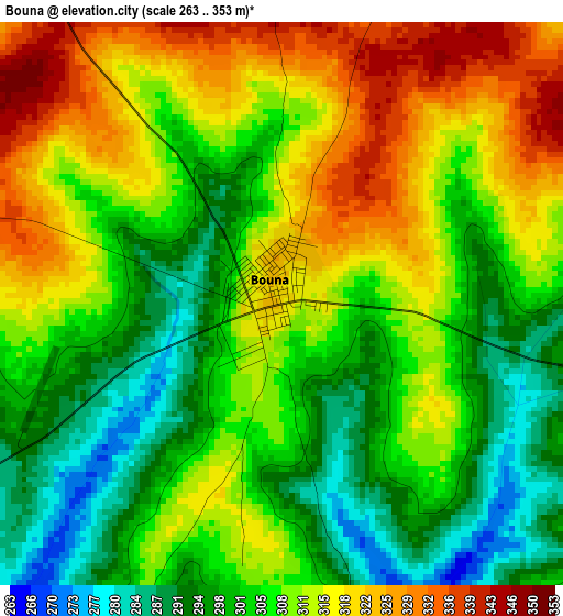
Below is the Elevation map of Bouna, which displays elevation range with different colors. Scale of the first map is from 263 to 353 m (863 to 1158 ft) with average elevation of 307.6 meters (=1009 ft) [note 1]
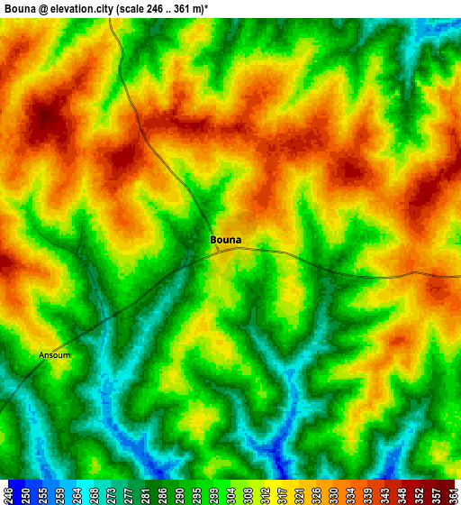
These maps also provides idea of topography and contour of this city, they are displayed at different zoom levels. More info about maps, scale and edge coordinates you can find below images.
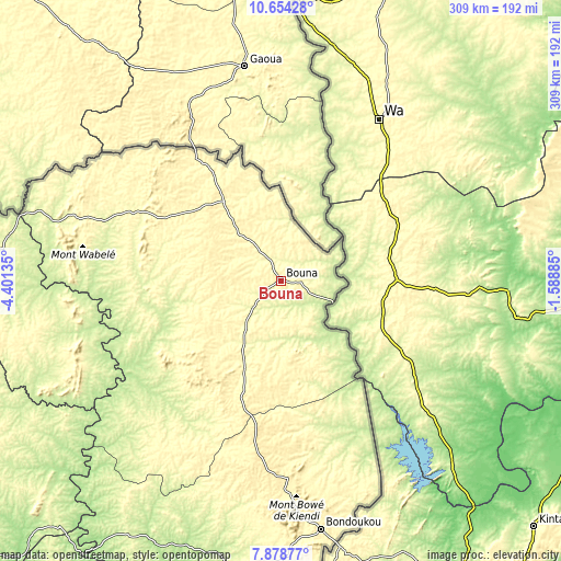
| \ | Map #1 | Map #2 | Topo.Map |
| Scale [m] | 263..353 m | 246..361 m | × |
| Scale [ft] | 863..1158 ft | 807..1184 ft | × |
| Average | 307.6 m = 1009 ft | 305.7 m = 1003 ft | × |
| Width | 9.64 km = 6 mi | 19.29 km = 12 mi | 308.6 km = 191.8 mi |
| Height | 9.64 km = 6 mi | 19.29 km = 12 mi | 308.6 km = 191.8 mi |
| ↑Max Latitude | 9.312639° | 9.356002° | 10.65428° |
| Latitude at center | 9.26927° | 9.26927° | 9.26927° |
| ↓Min Latitude | 9.225896° | 9.182516° | 7.87877° |
| ← Min Longitude | -3.039045° | -3.082991° | -4.40135° |
| Longitude center | -2.9951° | -2.9951° | -2.9951° |
| →Max Longitude | -2.951155° | -2.907209° | -1.58885° |
Nearby cities:
Cities around Bouna sort by population:
• Ferkessédougou elevation 334 m
243.9 km,  278°
278°
• Bondoukou 350 m
138.3 km,  171°
171°
• Agnibilékrou 236 m
238.8 km,  185°
185°
• Tanda 274 m
164.1 km, 186°
• Dabakala 254 m
187 km,  237°
237°
• Prikro 213 m
211.3 km,  211°
211°
• Koun-Fao 196 m
200.1 km, 188°
• Transua 195 m
191.2 km,  180°
180°
• Kong 327 m
177.7 km,  265°
265°
• Sandégué 201 m
159.8 km,  203°
203°
• Nassian 353 m
104.8 km, 209°
• Téhini 310 m
81.8 km,  297°
297°
Multilingual:
 En español:
Bouna elevación 318 m.
 En France:
Bouna élévation 318 m.


Sources and notes:
- [note 1] Map square and city borders are not equal. Map elevation data is calculated only from area inside that square.
- [src 1] Elevation data from geonames database provided with same terms of usage.
- [src 2] The elevation map of Bouna is generated using elevation data from NASA's 3 arcsec (90m) resolution SRTM data.
- [src 3] Base (background) map © OpenStreetMap contributors tiles are generated by Geofabrik and OpenTopoMap.
Copyright & License:
This Bouna Elevation Map is licensed under CC BY-SA. You may reuse any part from this page, if you give a proper credit by linking to this URL:
 More info on terms of use page.