Ferkessédougou elevation
Ferkessédougou (Savanes), Ivory Coast elevation is 334 meters and Ferkessédougou elevation in feet is 1096 ft above sea level [src 1]. Ferkessédougou is a seat of a second-order administrative division (feature code) with elevation that is 105 meters (344 ft) bigger than average city elevation in Ivory Coast.
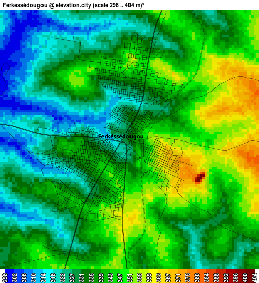
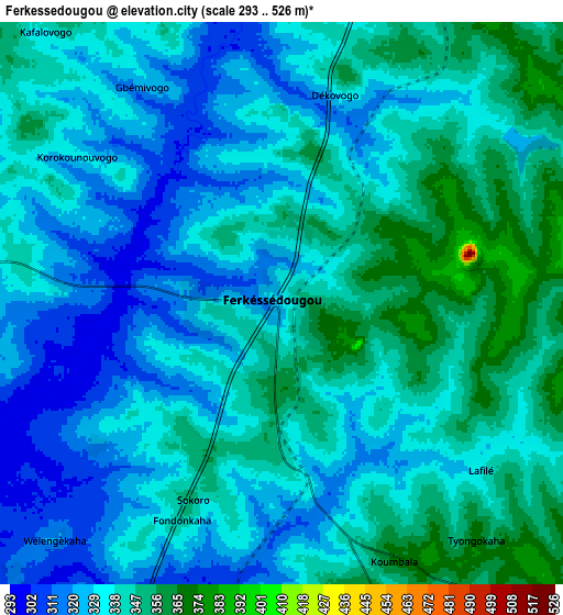
Below is the Elevation map of Ferkessédougou, which displays elevation range with different colors. Scale of the first map is from 298 to 404 m (978 to 1325 ft) with average elevation of 336.6 meters (=1104 ft) [note 1]
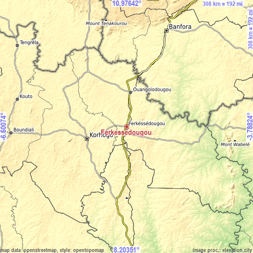
These maps also provides idea of topography and contour of this city, they are displayed at different zoom levels. More info about maps, scale and edge coordinates you can find below images.
| \ | Map #1 | Map #2 | Topo.Map |
| Scale [m] | 298..404 m | 293..526 m | × |
| Scale [ft] | 978..1325 ft | 961..1726 ft | × |
| Average | 336.6 m = 1104 ft | 335.3 m = 1100 ft | × |
| Width | 9.64 km = 6 mi | 19.27 km = 12 mi | 308.3 km = 191.6 mi |
| Height | 9.64 km = 6 mi | 19.27 km = 12 mi | 308.3 km = 191.6 mi |
| ↑Max Latitude | 9.636128° | 9.679451° | 10.97642° |
| Latitude at center | 9.5928° | 9.5928° | 9.5928° |
| ↓Min Latitude | 9.549466° | 9.506127° | 8.20351° |
| ← Min Longitude | -5.238435° | -5.282381° | -6.60074° |
| Longitude center | -5.19449° | -5.19449° | -5.19449° |
| →Max Longitude | -5.150545° | -5.106599° | -3.78824° |
Nearby cities:
Cities around Ferkessédougou sort by population:
• Korhogo elevation 360 m
50 km,  252°
252°
• Katiola 326 m
162.2 km,  176°
176°
• Boundiali 411 m
141.9 km,  266°
266°
• Dabakala 254 m
160.5 km,  148°
148°
• Kouto 377 m
137.2 km,  283°
283°
• Dianra 369 m
137 km,  238°
238°
• Niakaramandougou 385 m
104.5 km,  185°
185°
• M’Bengué 362 m
89.8 km,  300°
300°
• Dikodougou 409 m
86.2 km,  227°
227°
• Kong 327 m
80.9 km,  127°
127°
• Ouangolodougou 328 m
42.1 km,  6°
6°
• Sinématiali 333 m
20.9 km, 267°
Multilingual:
 En español:
Ferkessédougou elevación 334 m.
 En France:
Ferkessédougou élévation 334 m.
 Auf Deutsch:
Ferkessédougou höhe über dem Meeresspiegel ist 334 m.

Sources and notes:
- [note 1] Map square and city borders are not equal. Map elevation data is calculated only from area inside that square.
- [src 1] Elevation data from geonames database provided with same terms of usage.
- [src 2] The elevation map of Ferkessédougou is generated using elevation data from NASA's 3 arcsec (90m) resolution SRTM data.
- [src 3] Base (background) map © OpenStreetMap contributors tiles are generated by Geofabrik and OpenTopoMap.
Copyright & License:
This Ferkessédougou Elevation Map is licensed under CC BY-SA. You may reuse any part from this page, if you give a proper credit by linking to this URL:
 More info on terms of use page.