Ecublens elevation
Ecublens (Fribourg, Glâne District), Switzerland elevation is 591 meters and Ecublens elevation in feet is 1939 ft above sea level [src 1]. Ecublens is a populated place (feature code) with elevation that is 43 meters (141 ft) bigger than average city elevation in Switzerland.
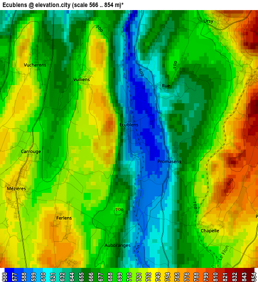
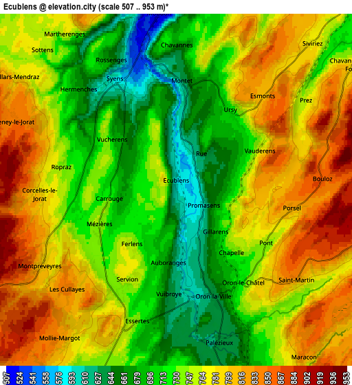
Below is the Elevation map of Ecublens, which displays elevation range with different colors. Scale of the first map is from 566 to 854 m (1857 to 2802 ft) with average elevation of 694 meters (=2277 ft) [note 1]
These maps also provides idea of topography and contour of this city, they are displayed at different zoom levels. More info about maps, scale and edge coordinates you can find below images.
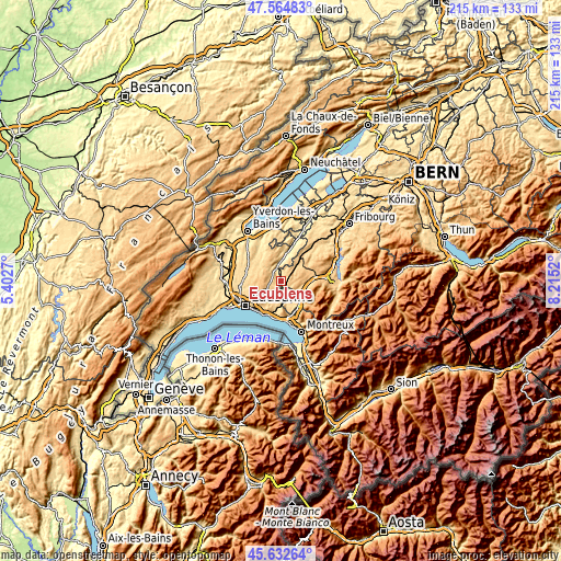
| \ | Map #1 | Map #2 | Topo.Map |
| Scale [m] | 566..854 m | 507..953 m | × |
| Scale [ft] | 1857..2802 ft | 1663..3127 ft | × |
| Average | 694 m = 2277 ft | 750.8 m = 2463 ft | × |
| Width | 6.71 km = 4.2 mi | 13.43 km = 8.3 mi | 214.8 km = 133.5 mi |
| Height | 6.71 km = 4.2 mi | 13.43 km = 8.3 mi | 214.8 km = 133.5 mi |
| ↑Max Latitude | 46.637532° | 46.667697° | 47.56483° |
| Latitude at center | 46.60735° | 46.60735° | 46.60735° |
| ↓Min Latitude | 46.577151° | 46.546936° | 45.63264° |
| ← Min Longitude | 6.765005° | 6.721059° | 5.4027° |
| Longitude center | 6.80895° | 6.80895° | 6.80895° |
| →Max Longitude | 6.852895° | 6.896841° | 8.2152° |
Nearby cities:
Cities around Ecublens sort by population:
• Châtel-Saint-Denis elevation 809 m
11.4 km,  141°
141°
• Moudon 514 m
6.8 km,  352°
352°
• Savigny 799 m
9.6 km,  217°
217°
• Froideville 811 m
9.8 km,  266°
266°
• Palézieux 684 m
7.7 km,  161°
161°
• Oron-la-Ville 629 m
4.2 km, 162°
• Rue 662 m
1.7 km,  37°
37°
• Bottens 730 m
11.3 km, 274°
• Sottens 754 m
7.4 km,  316°
316°
• Vuisternens-devant-Romont 801 m
10.5 km,  61°
61°
• Corcelles-le-Jorat 734 m
5.1 km, 268°
• Servion 727 m
4.7 km,  210°
210°
Multilingual:
 En español:
Ecublens elevación 591 m.
 En France:
Écublens élévation 591 m.
 Auf Deutsch:
Ecublens FR höhe über dem Meeresspiegel ist 591 m.

Sources and notes:
- [note 1] Map square and city borders are not equal. Map elevation data is calculated only from area inside that square.
- [src 1] Elevation data from geonames database provided with same terms of usage.
- [src 2] The elevation map of Ecublens is generated using elevation data from NASA's 3 arcsec (90m) resolution SRTM data.
- [src 3] Base (background) map © OpenStreetMap contributors tiles are generated by Geofabrik and OpenTopoMap.
Copyright & License:
This Ecublens Elevation Map is licensed under CC BY-SA. You may reuse any part from this page, if you give a proper credit by linking to this URL:
 More info on terms of use page.